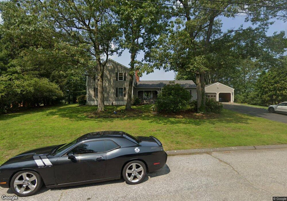
672 Cedar Grove Orange, CT 06477
Estimated Value: $731,000 - $916,000
3
Beds
3
Baths
3,330
Sq Ft
$253/Sq Ft
Est. Value
About This Home
This home is located at 672 Cedar Grove, Orange, CT 06477 and is currently estimated at $841,500, approximately $252 per square foot. 672 Cedar Grove is a home located in New Haven County with nearby schools including Mary L. Tracy School, Turkey Hill School, and Amity Middle School: Orange.
Ownership History
Date
Name
Owned For
Owner Type
Purchase Details
Closed on
Jul 16, 2021
Sold by
Donadeo Michael P
Bought by
Donadeo Michael P and Donadeo Susan
Current Estimated Value
Purchase Details
Closed on
Mar 4, 2020
Sold by
Vanyo Ft and Vanyo
Bought by
Mulhall Ryan
Home Financials for this Owner
Home Financials are based on the most recent Mortgage that was taken out on this home.
Original Mortgage
$164,803
Interest Rate
3.4%
Mortgage Type
New Conventional
Create a Home Valuation Report for This Property
The Home Valuation Report is an in-depth analysis detailing your home's value as well as a comparison with similar homes in the area
Home Values in the Area
Average Home Value in this Area
Purchase History
| Date | Buyer | Sale Price | Title Company |
|---|---|---|---|
| Donadeo Michael P | -- | None Available | |
| Donadeo Michael P | -- | None Available | |
| Mulhall Ryan | $169,900 | None Available |
Source: Public Records
Mortgage History
| Date | Status | Borrower | Loan Amount |
|---|---|---|---|
| Previous Owner | Mulhall Ryan | $164,803 |
Source: Public Records
Tax History
| Year | Tax Paid | Tax Assessment Tax Assessment Total Assessment is a certain percentage of the fair market value that is determined by local assessors to be the total taxable value of land and additions on the property. | Land | Improvement |
|---|---|---|---|---|
| 2025 | $16,040 | $551,200 | $225,800 | $325,400 |
| 2024 | $17,087 | $551,200 | $225,800 | $325,400 |
| 2023 | $13,202 | $408,600 | $164,900 | $243,700 |
| 2022 | $13,365 | $408,600 | $164,900 | $243,700 |
| 2021 | $13,586 | $408,600 | $164,900 | $243,700 |
| 2020 | $13,378 | $408,600 | $164,900 | $243,700 |
| 2019 | $13,316 | $408,600 | $164,900 | $243,700 |
| 2018 | $13,075 | $408,600 | $164,900 | $243,700 |
| 2017 | $13,249 | $398,100 | $186,700 | $211,400 |
| 2016 | $12,819 | $398,100 | $186,700 | $211,400 |
| 2015 | $12,500 | $398,100 | $186,700 | $211,400 |
| 2014 | $12,142 | $398,100 | $186,700 | $211,400 |
Source: Public Records
Map
Nearby Homes
- 74 Victory St
- 500 River Rd Unit 3
- 20 3rd Ave
- 11A Derby-Milford Rd
- 249 Coram Rd
- 847 Glenbrook Rd
- 4 Rivendell Dr
- 223 River Rd
- 88 Rocky Rest Rd
- 133 Rocky Rest Rd
- 112 River Rd
- 830 Bayberry Ln
- 26 Bunker Hill Cir
- 489 Derby Milford Rd
- 1 Windward Way Unit 1
- 2 Windward Way Unit 2
- 941 Garden Rd
- 444 Asbury Ridge
- 22 Jenyfer Ct
- 11 Westminster Ave
- 684 Cedar Grove
- 671 Cedar Grove
- 652 Cedar Grove
- 663 Broadview Rd
- 636 Cedar Grove
- 655 Cedar Grove
- 670 Broadview Rd
- 639 Cedar Grove
- 651 Broadview Rd
- 628 Cedar Grove
- 623 Cedar Grove
- 660 Broadview Rd
- 601 Aspen Ln
- 622 Cedar Grove
- 639 Broadview Rd
- 650 Broadview Rd
- 607 Aspen Ln
- 616 Cedar Grove
- 627 Broadview Rd
- 666 Wheelers Farm Rd
Your Personal Tour Guide
Ask me questions while you tour the home.