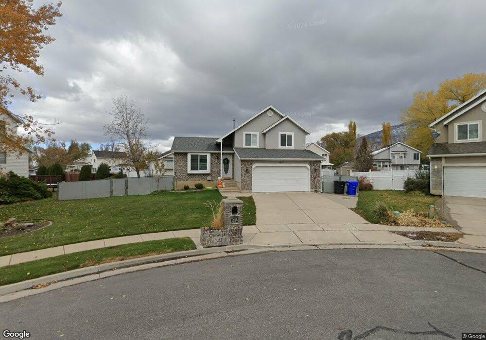
672 Kit Carson Cir Centerville, UT 84014
Estimated Value: $500,000 - $681,000
3
Beds
3
Baths
1,847
Sq Ft
$312/Sq Ft
Est. Value
About This Home
This home is located at 672 Kit Carson Cir, Centerville, UT 84014 and is currently estimated at $575,694, approximately $311 per square foot. 672 Kit Carson Cir is a home located in Davis County with nearby schools including Stewart Elementary School, Centerville Jr High, and Viewmont High School.
Ownership History
Date
Name
Owned For
Owner Type
Purchase Details
Closed on
May 22, 2019
Sold by
Bjorklund Kaylene Sarah
Bought by
Palmer Alyson and Palmer Richard T
Current Estimated Value
Home Financials for this Owner
Home Financials are based on the most recent Mortgage that was taken out on this home.
Original Mortgage
$263,000
Outstanding Balance
$230,761
Interest Rate
4.1%
Mortgage Type
New Conventional
Estimated Equity
$344,933
Purchase Details
Closed on
Oct 18, 2016
Sold by
Rory E Debbie A Neale
Bought by
Bjorklund Kaylene
Home Financials for this Owner
Home Financials are based on the most recent Mortgage that was taken out on this home.
Original Mortgage
$258,236
Interest Rate
3.47%
Purchase Details
Closed on
Aug 29, 2003
Sold by
Neale Debbie A and Neale Rory E
Bought by
Neale Rory E and Neale Debbie A
Home Financials for this Owner
Home Financials are based on the most recent Mortgage that was taken out on this home.
Original Mortgage
$137,600
Interest Rate
5.87%
Mortgage Type
Purchase Money Mortgage
Purchase Details
Closed on
Jul 26, 2001
Sold by
Leetham Debbie A
Bought by
Neale Rory E and Neale Debbie A
Home Financials for this Owner
Home Financials are based on the most recent Mortgage that was taken out on this home.
Original Mortgage
$135,355
Interest Rate
7.15%
Purchase Details
Closed on
Apr 9, 2001
Sold by
Leetham Debbie Ann
Bought by
Leetham Debbie A
Home Financials for this Owner
Home Financials are based on the most recent Mortgage that was taken out on this home.
Original Mortgage
$135,355
Interest Rate
7.09%
Purchase Details
Closed on
Dec 7, 1995
Sold by
Gmw Development Inc
Bought by
Leetham Michael Jay and Leetham Debbie Ann
Create a Home Valuation Report for This Property
The Home Valuation Report is an in-depth analysis detailing your home's value as well as a comparison with similar homes in the area
Purchase History
| Date | Buyer | Sale Price | Title Company |
|---|---|---|---|
| Palmer Alyson | -- | Stewart Title Ins | |
| Bjorklund Kaylene | -- | -- | |
| Neale Rory E | -- | Backman Stewart Title Servic | |
| Neale Rory E | -- | Bonneville Title Company Inc | |
| Leetham Debbie A | -- | Associated Title Company | |
| Leetham Michael Jay | -- | Bonneville Title Company Inc |
Source: Public Records
Mortgage History
| Date | Status | Borrower | Loan Amount |
|---|---|---|---|
| Open | Palmer Alyson | $263,000 | |
| Previous Owner | Bjorklund Kaylene | $258,236 | |
| Previous Owner | Bjorklund Kaylene | -- | |
| Previous Owner | Neale Rory E | $137,600 | |
| Previous Owner | Neale Rory E | $135,355 | |
| Previous Owner | Leetham Debbie A | $135,355 | |
| Closed | Neale Rory E | $34,400 |
Source: Public Records
Tax History
| Year | Tax Paid | Tax Assessment Tax Assessment Total Assessment is a certain percentage of the fair market value that is determined by local assessors to be the total taxable value of land and additions on the property. | Land | Improvement |
|---|---|---|---|---|
| 2025 | $3,211 | $285,450 | $168,155 | $117,295 |
| 2024 | $3,032 | $275,550 | $150,350 | $125,200 |
| 2023 | $2,869 | $474,000 | $247,661 | $226,339 |
| 2022 | $2,997 | $274,450 | $124,843 | $149,607 |
| 2021 | $2,653 | $377,000 | $189,303 | $187,697 |
| 2020 | $2,470 | $338,000 | $185,552 | $152,448 |
| 2019 | $2,226 | $309,000 | $188,234 | $120,766 |
| 2018 | $2,055 | $283,000 | $174,789 | $108,211 |
| 2016 | $1,739 | $134,310 | $55,351 | $78,959 |
| 2015 | $1,678 | $122,815 | $55,351 | $67,464 |
| 2014 | $1,671 | $125,974 | $55,351 | $70,623 |
| 2013 | -- | $118,080 | $51,728 | $66,352 |
Source: Public Records
Map
Nearby Homes
- 664 Kit Carson Cir
- 642 Kit Carson Cir
- 1666 N 725 W
- 642 W 1650 N
- 704 Kit Carson Cir
- 663 Lewis And Clark Dr
- 663 W Lewis And Clark Dr
- 627 Lewis And Clark Dr
- 634 Kit Carson Cir
- 669 Kit Carson Cir
- 1669 Pony Express Way
- 1669 N 575 W
- 705 Kit Carson Cir
- 643 Kit Carson Cir
- 1665 Pony Express Way
- 1663 N 725 W
- 1673 Pony Express Way
- 727 Lewis And Clark Cir
- 1657 N 725 W
- 727 Lewis And Clark Dr
Your Personal Tour Guide
Ask me questions while you tour the home.