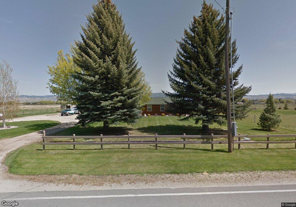
672 Old Corvallis Rd Corvallis, MT 59828
Estimated Value: $613,179 - $746,000
3
Beds
3
Baths
1,890
Sq Ft
$357/Sq Ft
Est. Value
About This Home
This home is located at 672 Old Corvallis Rd, Corvallis, MT 59828 and is currently estimated at $674,393, approximately $356 per square foot. 672 Old Corvallis Rd is a home located in Ravalli County with nearby schools including Hamilton High School.
Ownership History
Date
Name
Owned For
Owner Type
Purchase Details
Closed on
Jan 7, 2021
Sold by
Wing Johnny R and Wing Brittney L
Bought by
Wing Brittney L
Current Estimated Value
Home Financials for this Owner
Home Financials are based on the most recent Mortgage that was taken out on this home.
Original Mortgage
$281,952
Outstanding Balance
$251,154
Interest Rate
2.6%
Mortgage Type
New Conventional
Estimated Equity
$423,239
Purchase Details
Closed on
Jan 9, 2015
Sold by
Miller Daryl F
Bought by
Wing Johnny R and Wing Brittney L
Home Financials for this Owner
Home Financials are based on the most recent Mortgage that was taken out on this home.
Original Mortgage
$308,750
Interest Rate
3.92%
Mortgage Type
New Conventional
Purchase Details
Closed on
Oct 19, 2005
Bought by
Wing Johnny R and Wing Brittney L
Create a Home Valuation Report for This Property
The Home Valuation Report is an in-depth analysis detailing your home's value as well as a comparison with similar homes in the area
Home Values in the Area
Average Home Value in this Area
Purchase History
| Date | Buyer | Sale Price | Title Company |
|---|---|---|---|
| Wing Brittney L | -- | None Listed On Document | |
| Wing Johnny R | $385,937 | -- | |
| Wing Johnny R | -- | -- |
Source: Public Records
Mortgage History
| Date | Status | Borrower | Loan Amount |
|---|---|---|---|
| Open | Wing Brittney L | $281,952 | |
| Previous Owner | Wing Johnny R | $308,750 |
Source: Public Records
Tax History
| Year | Tax Paid | Tax Assessment Tax Assessment Total Assessment is a certain percentage of the fair market value that is determined by local assessors to be the total taxable value of land and additions on the property. | Land | Improvement |
|---|---|---|---|---|
| 2025 | $1,598 | $499,400 | $0 | $0 |
| 2024 | $2,230 | $432,700 | $0 | $0 |
| 2023 | $2,221 | $432,700 | $0 | $0 |
| 2022 | $1,934 | $310,900 | $0 | $0 |
| 2021 | $2,080 | $310,900 | $0 | $0 |
| 2020 | $1,956 | $281,400 | $0 | $0 |
| 2019 | $1,923 | $281,400 | $0 | $0 |
| 2018 | $1,806 | $247,900 | $0 | $0 |
| 2017 | $1,612 | $247,900 | $0 | $0 |
| 2016 | $1,811 | $269,480 | $0 | $0 |
| 2015 | $1,789 | $269,480 | $0 | $0 |
| 2014 | $1,667 | $147,552 | $0 | $0 |
Source: Public Records
Map
Nearby Homes
- 671 Old Corvallis Rd
- 660 Old Corvallis Rd
- 645 Old Corvallis Rd
- 690 Old Corvallis Rd
- 691 Old Corvallis Rd
- 644 Old Corvallis Rd
- 624 Old Corvallis Rd
- 633 Old Corvallis Rd
- 718 Old Corvallis Rd
- 635 Dusty Trail
- 625 Old Corvallis Rd
- 128 Black Ln
- 731 Old Corvallis Rd
- 632 Dusty Trail
- 652 Dusty Trail
- 611 Old Corvallis Rd
- 129 Black Ln
- 745 Old Corvallis Rd
- 662 Dusty Trail
- 600 Old Corvallis Rd
Your Personal Tour Guide
Ask me questions while you tour the home.