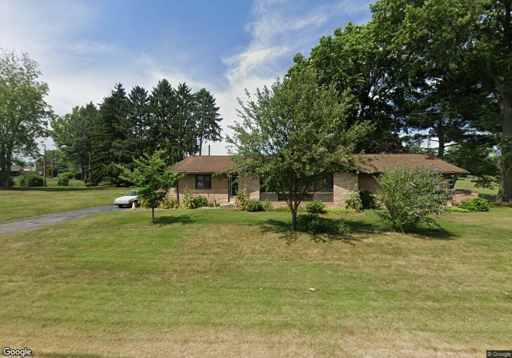
6721 Lower MacUngie Rd Allentown, PA 18106
Lower Macungie Township East NeighborhoodEstimated Value: $397,000 - $486,000
3
Beds
2
Baths
1,872
Sq Ft
$243/Sq Ft
Est. Value
About This Home
This home is located at 6721 Lower MacUngie Rd, Allentown, PA 18106 and is currently estimated at $454,343, approximately $242 per square foot. 6721 Lower MacUngie Rd is a home located in Lehigh County with nearby schools including Wescosville Elementary School, Lower Macungie Middle School, and Emmaus High School.
Ownership History
Date
Name
Owned For
Owner Type
Purchase Details
Closed on
Dec 7, 2021
Sold by
Dibbs Mitchell and Dibbs Robert M
Bought by
Dibbs Brian R
Current Estimated Value
Purchase Details
Closed on
Dec 4, 1998
Sold by
Dibbs Mitchell and Dibbs Vera
Bought by
Dibbs Vera L and Vera L Dibbs Revocable Trust Agreement
Purchase Details
Closed on
Oct 17, 1977
Bought by
Dibbs Mitchell and Dibbs Vera
Create a Home Valuation Report for This Property
The Home Valuation Report is an in-depth analysis detailing your home's value as well as a comparison with similar homes in the area
Home Values in the Area
Average Home Value in this Area
Purchase History
| Date | Buyer | Sale Price | Title Company |
|---|---|---|---|
| Dibbs Brian R | -- | None Available | |
| Dibbs Vera L | -- | -- | |
| Dibbs Mitchell | $65,000 | -- |
Source: Public Records
Tax History Compared to Growth
Tax History
| Year | Tax Paid | Tax Assessment Tax Assessment Total Assessment is a certain percentage of the fair market value that is determined by local assessors to be the total taxable value of land and additions on the property. | Land | Improvement |
|---|---|---|---|---|
| 2025 | $6,227 | $243,900 | $55,700 | $188,200 |
| 2024 | $6,024 | $243,900 | $55,700 | $188,200 |
| 2023 | $5,904 | $243,900 | $55,700 | $188,200 |
| 2022 | $5,764 | $243,900 | $188,200 | $55,700 |
| 2021 | $5,642 | $243,900 | $55,700 | $188,200 |
| 2020 | $5,588 | $243,900 | $55,700 | $188,200 |
| 2019 | $5,493 | $243,900 | $55,700 | $188,200 |
| 2018 | $5,421 | $243,900 | $55,700 | $188,200 |
| 2017 | $5,326 | $243,900 | $55,700 | $188,200 |
| 2016 | -- | $243,900 | $55,700 | $188,200 |
| 2015 | -- | $243,900 | $55,700 | $188,200 |
| 2014 | -- | $243,900 | $55,700 | $188,200 |
Source: Public Records
Map
Nearby Homes
- 6645 Stein Way Unit 6639-6661
- 6779 Hickory Rd
- 1360 Walnut Ln
- 6179 Fairway Ln
- 1897 Alexander Dr Unit I6
- 7468 Continental Cir
- 6522 Trafalgar Dr
- 7301 Cedar Rd
- 7588 Trexler Cir
- 6007 Timberknoll Dr
- 5736 Greens Dr
- 1674 Red Oak Ln
- 7678 Catalpa Dr
- 7501 Spring Creek Rd
- 5673 Wedge Ln
- 2154 Gorton Rd
- 2225 Four Seasons Blvd Unit 116A0
- 2252 Eldemere Cir
- 5619 Stonecroft Ln
- 6126 Palomino Dr
- 0 Lot # 2 9 Or 11shiloh Rd Unit 296545
- 6744 Holly Rd
- 0 Swarthmore Model-To Be Built Unit 341198
- 0 Prescott Grande - To Be Built Unit 341196
- 0 Prescott Model-To Be Built Unit 341193
- 6664 Holly Rd
- 6709 Holly Rd
- 6687 Holly Rd
- 6737 Holly Rd
- 6663 Holly Rd
- 6767 Holly Rd
- 6644 Holly Rd
- 1255 Danner Rd
- 6710 Ivy Ln
- 6643 Holly Rd
- 6686 Ivy Ln
- 6734 Ivy Ln
- 6662 Ivy Ln
- 6754 Ivy Ln
- 6701 Mink Rd