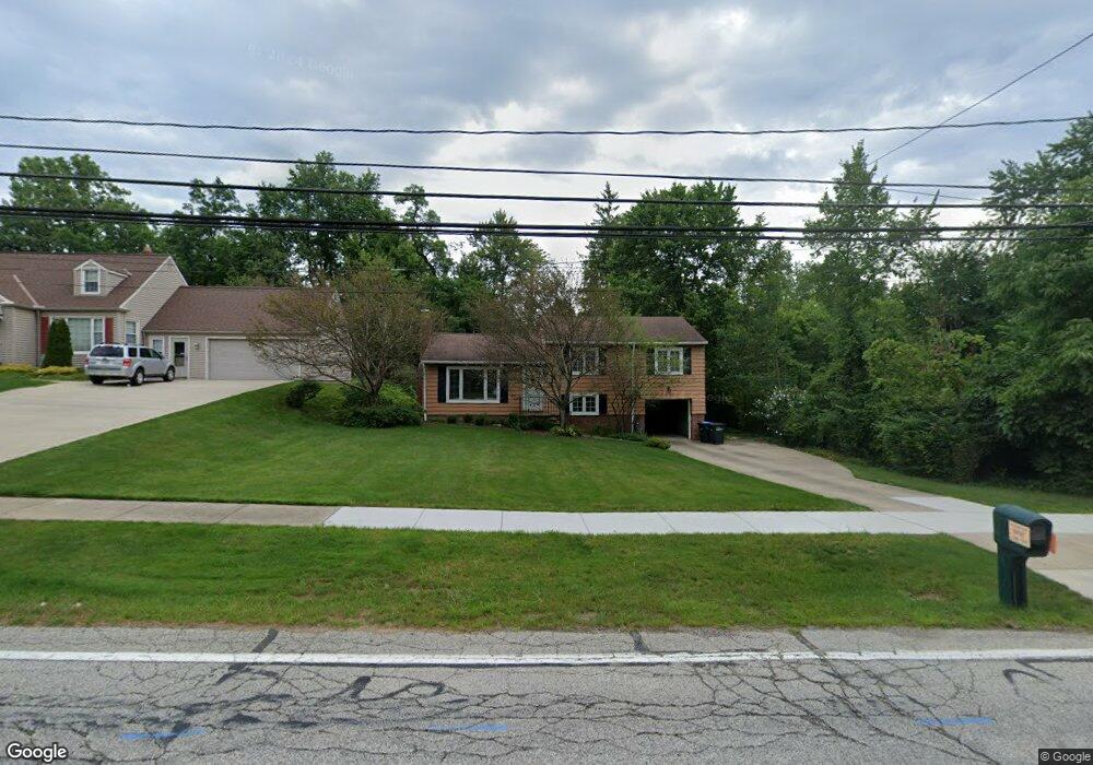
6725 Brookside Rd Independence, OH 44131
Estimated Value: $255,035 - $339,000
3
Beds
1
Bath
1,840
Sq Ft
$160/Sq Ft
Est. Value
About This Home
This home is located at 6725 Brookside Rd, Independence, OH 44131 and is currently estimated at $294,009, approximately $159 per square foot. 6725 Brookside Rd is a home located in Cuyahoga County with nearby schools including Independence Primary School, Independence Middle School, and Independence High School.
Ownership History
Date
Name
Owned For
Owner Type
Purchase Details
Closed on
Jul 18, 2022
Sold by
Eby Margaret A and Eby Robert G
Bought by
Decapua Lori
Current Estimated Value
Home Financials for this Owner
Home Financials are based on the most recent Mortgage that was taken out on this home.
Original Mortgage
$150,500
Outstanding Balance
$142,325
Interest Rate
5.23%
Mortgage Type
Balloon
Estimated Equity
$151,684
Purchase Details
Closed on
Mar 14, 2018
Sold by
Eby Margaret Ann
Bought by
Eby Robert G and Eby Maragret A
Purchase Details
Closed on
Nov 5, 1998
Sold by
Eby Robert G and Eby Margaret Ann
Bought by
Eby Margarey Ann and Margaret Ann Eby Revocable Trust
Purchase Details
Closed on
Apr 1, 1985
Sold by
Eby Robert G and Eby Margaret A
Bought by
Eby Robert G and Margaret Ann
Purchase Details
Closed on
Jan 1, 1975
Bought by
Eby Robert G and Eby Margaret A
Create a Home Valuation Report for This Property
The Home Valuation Report is an in-depth analysis detailing your home's value as well as a comparison with similar homes in the area
Home Values in the Area
Average Home Value in this Area
Purchase History
| Date | Buyer | Sale Price | Title Company |
|---|---|---|---|
| Decapua Lori | $215,000 | American Title Solutions | |
| Eby Robert G | -- | None Available | |
| Eby Margarey Ann | -- | -- | |
| Eby Robert G | -- | -- | |
| Eby Robert G | -- | -- |
Source: Public Records
Mortgage History
| Date | Status | Borrower | Loan Amount |
|---|---|---|---|
| Open | Decapua Lori | $150,500 |
Source: Public Records
Tax History
| Year | Tax Paid | Tax Assessment Tax Assessment Total Assessment is a certain percentage of the fair market value that is determined by local assessors to be the total taxable value of land and additions on the property. | Land | Improvement |
|---|---|---|---|---|
| 2025 | $3,692 | $78,085 | $14,385 | $63,700 |
| 2024 | $3,825 | $78,085 | $14,385 | $63,700 |
| 2023 | $3,991 | $74,100 | $14,670 | $59,430 |
| 2022 | $3,421 | $74,100 | $14,670 | $59,430 |
| 2021 | $3,371 | $74,100 | $14,670 | $59,430 |
| 2020 | $3,256 | $67,970 | $13,440 | $54,530 |
| 2019 | $3,143 | $194,200 | $38,400 | $155,800 |
| 2018 | $3,171 | $67,970 | $13,440 | $54,530 |
| 2017 | $2,927 | $61,430 | $11,310 | $50,120 |
| 2016 | $2,897 | $61,430 | $11,310 | $50,120 |
| 2015 | $2,645 | $61,430 | $11,310 | $50,120 |
| 2014 | $2,645 | $56,880 | $10,470 | $46,410 |
Source: Public Records
Map
Nearby Homes
- 7003 Brecksville Rd
- SL 23 Kingscote Park
- 6312 E Pleasant Valley Rd
- 7572 Scenicview Dr
- 6119 E Sprague Rd
- 6626 Hawthorne Dr
- 6208 Dora Blvd
- 4730 Eastview Dr
- 4469 Shelly Dr
- 8084 Wright Rd
- 6878 W Fitzwater Rd Unit 41
- 7817 Daniel Dr
- VL TBB Laura Lee Ln
- 6930 Carriage Hill Dr Unit 101
- 6910 Carriage Hill Dr Unit 101
- VL Laura Lee Ln
- 7571 Pleasant Run Dr
- 2441 Vezber Dr
- 7647 Mccreary Rd
- 0 Brecksville Rd
- 6717 Brookside Rd
- 6713 Brookside Rd
- 7451 Oval Dr
- 6813 Brookside Rd
- 7459 Oval Dr
- 6819 Brookside Rd
- 7447 Oval Dr
- 6720 Brookside Rd
- 6715 Brookside Rd
- 6724 Brookside Rd
- 6716 Brookside Rd
- 6710 Brookside Rd
- 6816 Brookside Rd
- 6903 Brookside Rd
- 6621 Brookside Rd
- 7448 Oval Dr
- 6700 Brookside Rd
- 7452 Oval Dr
- 7456 Oval Dr
Your Personal Tour Guide
Ask me questions while you tour the home.