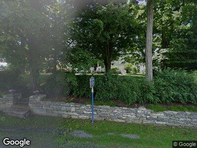
6725 State Route 10 Sharon Springs, NY 13459
Schoharie County NeighborhoodEstimated Value: $493,000 - $1,881,000
5
Beds
5
Baths
4,200
Sq Ft
$296/Sq Ft
Est. Value
About This Home
This home is located at 6725 State Route 10, Sharon Springs, NY 13459 and is currently estimated at $1,241,520, approximately $295 per square foot. 6725 State Route 10 is a home located in Schoharie County with nearby schools including Sharon Springs School District.
Ownership History
Date
Name
Owned For
Owner Type
Purchase Details
Closed on
May 25, 2018
Sold by
Ridge Stephen B and Kimber-Purcell Joshua
Bought by
Beekman 1802 Farm Llc
Current Estimated Value
Purchase Details
Closed on
Feb 21, 2007
Sold by
Trust Selch Frederick R
Bought by
Ridge Stephen Brent
Home Financials for this Owner
Home Financials are based on the most recent Mortgage that was taken out on this home.
Original Mortgage
$600,000
Interest Rate
6%
Mortgage Type
Purchase Money Mortgage
Purchase Details
Closed on
Dec 15, 2002
Sold by
Selch Frederick R Family Trust
Bought by
Selch Frederick R Family Trust
Purchase Details
Closed on
Dec 24, 2001
Sold by
Selch Frederick R
Bought by
Selch Frederick R Family
Create a Home Valuation Report for This Property
The Home Valuation Report is an in-depth analysis detailing your home's value as well as a comparison with similar homes in the area
Home Values in the Area
Average Home Value in this Area
Purchase History
| Date | Buyer | Sale Price | Title Company |
|---|---|---|---|
| Beekman 1802 Farm Llc | -- | -- | |
| Ridge Stephen Brent | $950,000 | Jeffrey Taub | |
| Selch Frederick R Family Trust | -- | Ronald Rockower | |
| Selch Frederick R Family | -- | -- |
Source: Public Records
Mortgage History
| Date | Status | Borrower | Loan Amount |
|---|---|---|---|
| Previous Owner | Ridge Stephen Brent | $600,000 |
Source: Public Records
Tax History Compared to Growth
Tax History
| Year | Tax Paid | Tax Assessment Tax Assessment Total Assessment is a certain percentage of the fair market value that is determined by local assessors to be the total taxable value of land and additions on the property. | Land | Improvement |
|---|---|---|---|---|
| 2024 | $25,421 | $600,000 | $65,200 | $534,800 |
| 2023 | $28,939 | $670,400 | $65,200 | $605,200 |
| 2022 | $29,274 | $670,400 | $65,200 | $605,200 |
| 2021 | $29,299 | $670,400 | $65,200 | $605,200 |
| 2020 | $27,943 | $650,000 | $65,200 | $584,800 |
| 2019 | $27,204 | $650,000 | $65,200 | $584,800 |
| 2018 | $27,204 | $650,000 | $65,200 | $584,800 |
| 2017 | $27,508 | $650,000 | $65,200 | $584,800 |
Source: Public Records
Map
Nearby Homes
- 687 Slate Hill Rd
- 6510 State Route 10
- 131 Park Ave
- 138 Lantern Dr
- 542 Highway Route 20
- 1149 Slate Hill Rd
- 515 Highway Route 20
- 116 Union St
- 114 Washington St
- 103 Franklin Bellinger Rd
- 290 Borst Rd
- 571 Chestnut St
- 463 Cemetery Rd
- 1562 Highway Route 20
- 637 Chestnut St
- 840 Clove Rd
- 489 Ten Eyck Rd
- 190 Wes Brown Rd
- 343 Button St
- 5516 State Route 10
- 6725 State Route 10
- 6736 State Rt 10
- 6747 State Route 10
- 521 Slate Hill Rd
- 493 Slate Hill Rd
- 6736 State Route 10
- 483 Slate Hill Rd
- 6660 State Route 10
- 473 Slate Hill Rd
- 6650 State Route 10
- 459 Slate Hill Rd
- 6650 New York 10
- 564 Slate Hill Rd
- 460 Slate Hill Rd
- 587 Slate Hill Rd
- 6818 New York 10
- 6818 State Route 10
- 6818 State Route 10
- 584 Slate Hill Rd
- 593 Slate Hill Rd
