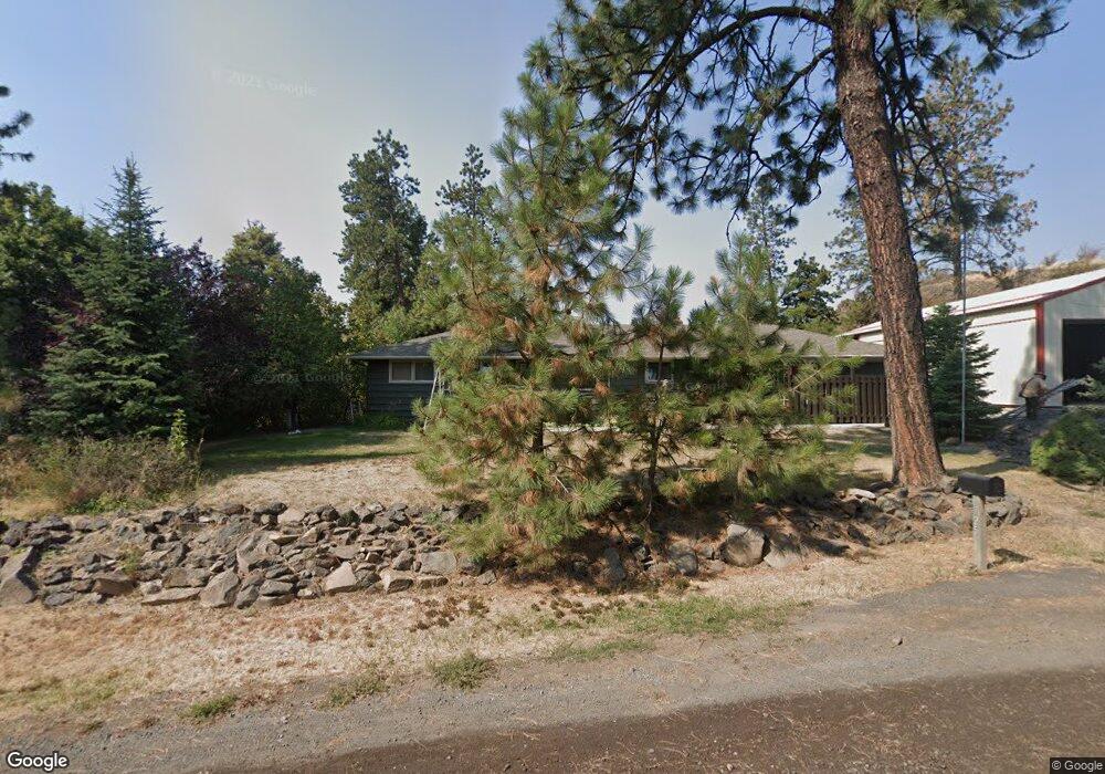
6725 W Deno Rd Spokane, WA 99224
West Spokane NeighborhoodEstimated Value: $498,000 - $966,000
3
Beds
2
Baths
1,657
Sq Ft
$399/Sq Ft
Est. Value
About This Home
This home is located at 6725 W Deno Rd, Spokane, WA 99224 and is currently estimated at $660,399, approximately $398 per square foot. 6725 W Deno Rd is a home located in Spokane County with nearby schools including Hutton Elementary School, Sacajawea Middle School, and Lewis & Clark High School.
Ownership History
Date
Name
Owned For
Owner Type
Purchase Details
Closed on
Mar 27, 2017
Sold by
Mcallister Michael L and Mcallister Jaclynne M
Bought by
Ballard William A and Ballard Heidi A
Current Estimated Value
Home Financials for this Owner
Home Financials are based on the most recent Mortgage that was taken out on this home.
Original Mortgage
$383,062
Outstanding Balance
$318,416
Interest Rate
4.17%
Mortgage Type
VA
Estimated Equity
$341,983
Purchase Details
Closed on
Mar 22, 2005
Sold by
Owen Eileen Marie
Bought by
Mcallister Michael L and Mcallister Jaclynne M
Home Financials for this Owner
Home Financials are based on the most recent Mortgage that was taken out on this home.
Original Mortgage
$166,500
Interest Rate
4.42%
Mortgage Type
Purchase Money Mortgage
Create a Home Valuation Report for This Property
The Home Valuation Report is an in-depth analysis detailing your home's value as well as a comparison with similar homes in the area
Home Values in the Area
Average Home Value in this Area
Purchase History
| Date | Buyer | Sale Price | Title Company |
|---|---|---|---|
| Ballard William A | $387,000 | First American Title | |
| Mcallister Michael L | $185,000 | Transnation Title |
Source: Public Records
Mortgage History
| Date | Status | Borrower | Loan Amount |
|---|---|---|---|
| Open | Ballard William A | $383,062 | |
| Previous Owner | Mcallister Michael L | $166,500 |
Source: Public Records
Tax History Compared to Growth
Tax History
| Year | Tax Paid | Tax Assessment Tax Assessment Total Assessment is a certain percentage of the fair market value that is determined by local assessors to be the total taxable value of land and additions on the property. | Land | Improvement |
|---|---|---|---|---|
| 2025 | $6,113 | $597,950 | $245,050 | $352,900 |
| 2024 | $6,113 | $610,950 | $245,050 | $365,900 |
| 2023 | $5,532 | $610,050 | $199,050 | $411,000 |
| 2022 | $5,006 | $587,550 | $199,050 | $388,500 |
| 2021 | $4,117 | $346,020 | $87,720 | $258,300 |
| 2020 | $4,138 | $337,920 | $83,620 | $254,300 |
| 2019 | $3,674 | $308,720 | $73,620 | $235,100 |
| 2018 | $3,831 | $275,020 | $61,720 | $213,300 |
| 2017 | $3,512 | $258,520 | $61,720 | $196,800 |
| 2016 | $3,504 | $242,020 | $57,220 | $184,800 |
| 2015 | $3,311 | $235,120 | $57,220 | $177,900 |
| 2014 | -- | $236,120 | $58,220 | $177,900 |
| 2013 | -- | $0 | $0 | $0 |
Source: Public Records
Map
Nearby Homes
- 61XX W Deno Rd
- 7xxx W Deno Rd
- 7527 W Greenwood Rd
- 8200 W Mission Rd
- 728 S Basalt St
- 6501 W Jedi Ln
- 8250 W Mission Rd
- 0 Unassigned Address St Unit SAR202523258
- 6405 W Trails Rd
- 7525 W Trails Rd Unit **not house, just pr
- Xxx W Trails Rd
- 1101 S Pillar Rock Dr
- 8630 W Campus Dr
- 3803 W Greenwood Rd Unit A23
- 3803 W Greenwood Rd Unit 17-C
- 9107 W Pirates Ct
- 1119 S Soda Rd
- 1412 N River Ridge Blvd
- 1105 S Oswald St
- 3412 W 3rd Ave
- 6401 W Deno Rd
- 6206 W Deno Rd
- 6104 W Deno Rd
- 6113 W Deno Rd
- 6204 W Greenwood Rd
- 813 N Grove Rd
- 00XX W Deno Rd Unit Lot 3
- X20 W Deno Rd
- X10 W Deno Rd
- XXX W Deno Rd
- 405 N Grove Rd
- 6805 W Deno Rd
- 6316 W Greenwood Rd
- 6418 W Greenwood Rd
- 6 xxx W Deno
- 0 W Greenwood Rd Unit 28014210
- 0 W Greenwood Rd Unit 29019981
- 0 W Greenwood Rd Unit 29019982
- 0 W Greenwood Rd Unit 29019983
- 0 W Greenwood Rd Unit 29019980