673 Central Ave Needham Heights, MA 02494
Estimated Value: $1,881,000 - $2,051,000
4
Beds
3
Baths
4,000
Sq Ft
$486/Sq Ft
Est. Value
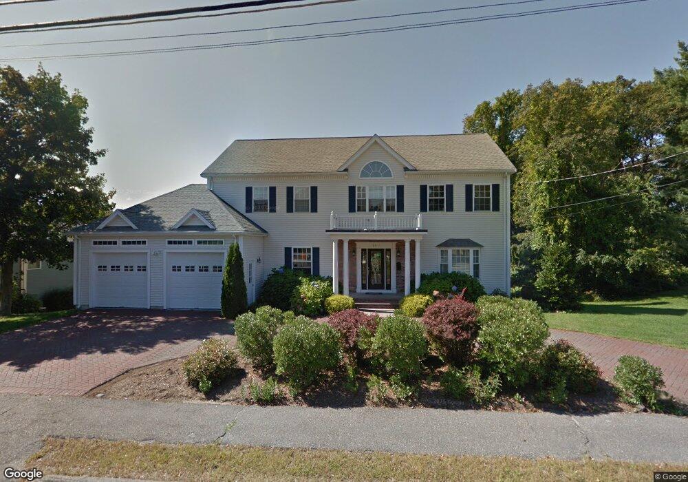
About This Home
This home is located at 673 Central Ave, Needham Heights, MA 02494 and is currently estimated at $1,943,722, approximately $485 per square foot. 673 Central Ave is a home located in Norfolk County with nearby schools including Sunita L. Williams Elementary School, High Rock Middle School, and Pollard Middle School.
Ownership History
Date
Name
Owned For
Owner Type
Purchase Details
Closed on
Jun 29, 2001
Sold by
Freemark Corp
Bought by
Fuller James A
Current Estimated Value
Purchase Details
Closed on
Mar 16, 1992
Sold by
Borrelli Paul D
Bought by
Stanley Robert G and Stanley Deanne A
Purchase Details
Closed on
Oct 26, 1989
Sold by
Borrelli Francesca
Bought by
Borrelli Paul D
Create a Home Valuation Report for This Property
The Home Valuation Report is an in-depth analysis detailing your home's value as well as a comparison with similar homes in the area
Home Values in the Area
Average Home Value in this Area
Purchase History
| Date | Buyer | Sale Price | Title Company |
|---|---|---|---|
| Fuller James A | $765,000 | -- | |
| Stanley Robert G | $139,000 | -- | |
| Borrelli Paul D | $60,000 | -- |
Source: Public Records
Tax History Compared to Growth
Tax History
| Year | Tax Paid | Tax Assessment Tax Assessment Total Assessment is a certain percentage of the fair market value that is determined by local assessors to be the total taxable value of land and additions on the property. | Land | Improvement |
|---|---|---|---|---|
| 2025 | $15,245 | $1,438,200 | $695,900 | $742,300 |
| 2024 | $15,590 | $1,245,200 | $404,100 | $841,100 |
| 2023 | $15,280 | $1,171,800 | $404,100 | $767,700 |
| 2022 | $14,604 | $1,092,300 | $365,100 | $727,200 |
| 2021 | $14,233 | $1,092,300 | $365,100 | $727,200 |
| 2020 | $13,504 | $1,081,200 | $365,100 | $716,100 |
| 2019 | $12,796 | $1,032,800 | $333,000 | $699,800 |
| 2018 | $12,270 | $1,032,800 | $333,000 | $699,800 |
| 2017 | $11,200 | $942,000 | $333,000 | $609,000 |
| 2016 | $10,960 | $949,700 | $333,000 | $616,700 |
| 2015 | $10,722 | $949,700 | $333,000 | $616,700 |
| 2014 | $10,289 | $883,900 | $303,700 | $580,200 |
Source: Public Records
Map
Nearby Homes
- 35 Andrea Cir
- 263 Hunnewell St
- 71 Brookside Rd
- 98 Hunnewell St
- 379 Hunnewell St Unit 379
- 381 Hunnewell St Unit 381
- 403 Hunnewell St Unit 403
- 443 Central Ave
- 400 Hunnewell St Unit 103
- 132 Hillside Ave
- 7 Avery St
- 14 Hunnewell St
- 78 Hunnewell St
- 345 Central Ave
- 609 Hunnewell St
- 28 Mercer Rd
- 310 Oakland St
- 1473 Great Plain Ave
- 77 High St
- 11 Fuller Brook Ave
- 683 Central Ave
- 665 Central Ave
- 674 Central Ave
- 682 Central Ave
- 693 Central Ave
- 659 Central Ave
- 692 Central Ave Unit 1
- 692 Central Ave
- 20 Glover Rd
- 664 Central Ave
- 651 Central Ave
- 652 Central Ave
- 652 Central Ave Unit 1
- 652 Central Ave Unit 2
- 3 Sunset Rd
- 696 Central Ave
- 11 Glover Rd
- 30 Glover Rd
- 645 Central Ave
- 10 Cynthia Rd