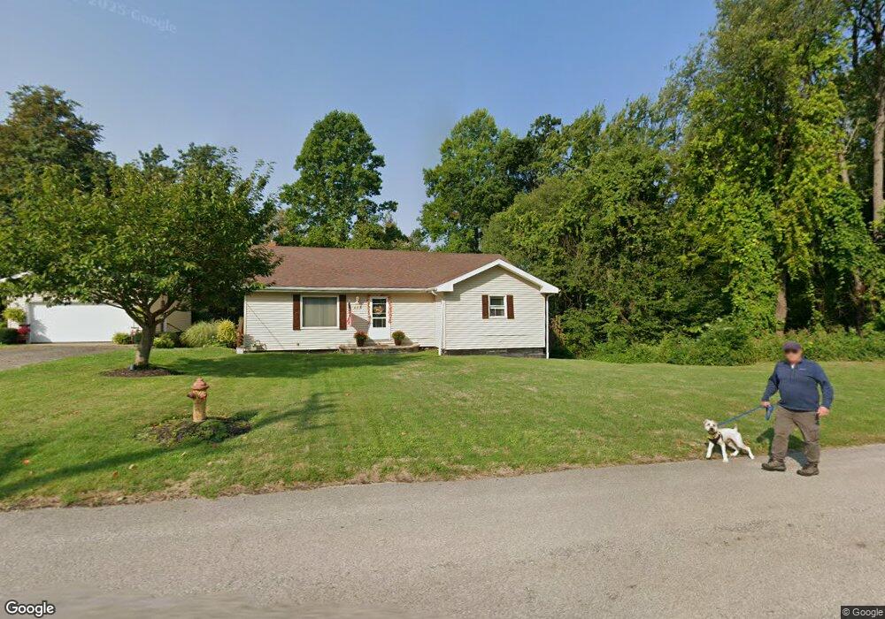
673 Lake Erie St Conneaut, OH 44030
Estimated Value: $108,000 - $269,000
3
Beds
1
Bath
1,504
Sq Ft
$117/Sq Ft
Est. Value
About This Home
This home is located at 673 Lake Erie St, Conneaut, OH 44030 and is currently estimated at $175,546, approximately $116 per square foot. 673 Lake Erie St is a home located in Ashtabula County with nearby schools including Lakeshore Primary Elementary School, Gateway Elementary School, and Conneaut Middle School.
Ownership History
Date
Name
Owned For
Owner Type
Purchase Details
Closed on
Nov 12, 2009
Sold by
Gebe Stephen M and Gebe Pamala
Bought by
Soller Anne M
Current Estimated Value
Home Financials for this Owner
Home Financials are based on the most recent Mortgage that was taken out on this home.
Original Mortgage
$102,000
Outstanding Balance
$66,466
Interest Rate
4.96%
Mortgage Type
New Conventional
Estimated Equity
$109,080
Purchase Details
Closed on
Apr 15, 2008
Sold by
Cebasek Thomas J and Cebasek Julius T
Bought by
Gebe Stephen M
Create a Home Valuation Report for This Property
The Home Valuation Report is an in-depth analysis detailing your home's value as well as a comparison with similar homes in the area
Home Values in the Area
Average Home Value in this Area
Purchase History
| Date | Buyer | Sale Price | Title Company |
|---|---|---|---|
| Soller Anne M | $100,000 | Multiple | |
| Gebe Stephen M | $38,101 | Chicago Title |
Source: Public Records
Mortgage History
| Date | Status | Borrower | Loan Amount |
|---|---|---|---|
| Open | Soller Anne M | $102,000 |
Source: Public Records
Tax History Compared to Growth
Tax History
| Year | Tax Paid | Tax Assessment Tax Assessment Total Assessment is a certain percentage of the fair market value that is determined by local assessors to be the total taxable value of land and additions on the property. | Land | Improvement |
|---|---|---|---|---|
| 2024 | $2,671 | $36,510 | $4,410 | $32,100 |
| 2023 | $1,727 | $36,510 | $4,410 | $32,100 |
| 2022 | $1,460 | $27,170 | $3,400 | $23,770 |
| 2021 | $1,485 | $27,170 | $3,400 | $23,770 |
| 2020 | $1,484 | $27,170 | $3,400 | $23,770 |
| 2019 | $1,473 | $26,470 | $2,490 | $23,980 |
| 2018 | $1,406 | $26,470 | $2,490 | $23,980 |
| 2017 | $1,279 | $26,470 | $2,490 | $23,980 |
| 2016 | $1,143 | $23,420 | $2,210 | $21,210 |
| 2015 | $1,154 | $23,420 | $2,210 | $21,210 |
| 2014 | $1,022 | $23,420 | $2,210 | $21,210 |
| 2013 | $342 | $7,990 | $2,630 | $5,360 |
Source: Public Records
Map
Nearby Homes
- 474 Sherman St
- 716 Chestnut St
- 0 Chestnut St Unit 5120761
- 1036 Golfview Dr
- 405 Bliss Ave
- 429 Depot St
- 533 Mill St
- 644 Mill St
- 459 Mill St
- 554 Sandusky St
- 536 Madison St
- 681 Madison St
- 859 Sandusky St
- 527 State St
- 589 Main St
- 408 Broad State Rd 7 St
- 247 Whitney St
- 427 Harbor St
- 413 Harbor St
- 455 Main St
- 657 Lake Erie St
- V/L 1 Lake Erie St
- 0 Lake Erie St
- 682 Millard Ave
- VL 2 Lake Erie St
- 682 Lake Erie St
- 670 Lake Erie St
- 678 Millard Ave
- VL Millard Ave
- VL Millard Ave
- 0 Millard Ave
- 649 Lake Erie St
- 592 Clinton Ave
- 698 Millard Ave
- 644 Millard Ave
- 700 Lake Erie St
- 652 Lake Erie St
- 681 Millard Ave
- 727 Lake Erie St
- 502 Clinton Ave