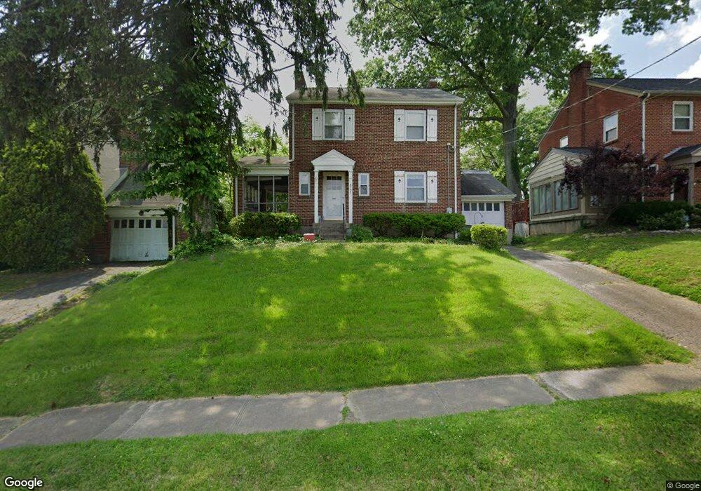
6735 Sampson Ln Cincinnati, OH 45236
Estimated Value: $220,000 - $271,000
3
Beds
1
Bath
1,248
Sq Ft
$201/Sq Ft
Est. Value
About This Home
This home is located at 6735 Sampson Ln, Cincinnati, OH 45236 and is currently estimated at $251,075, approximately $201 per square foot. 6735 Sampson Ln is a home located in Hamilton County with nearby schools including Silverton Paideia Elementary School, Shroder High School, and Clark Montessori High School.
Ownership History
Date
Name
Owned For
Owner Type
Purchase Details
Closed on
Aug 29, 2001
Sold by
Mary Mohr Dawana and Mary Robert David
Bought by
Friend Deborah A
Current Estimated Value
Home Financials for this Owner
Home Financials are based on the most recent Mortgage that was taken out on this home.
Original Mortgage
$90,000
Outstanding Balance
$35,197
Interest Rate
7.03%
Estimated Equity
$215,878
Purchase Details
Closed on
Jan 5, 2001
Sold by
Mohr Dawana Mary
Bought by
Mohr David Robert
Purchase Details
Closed on
Nov 15, 1994
Sold by
Leucht Henrietta A
Bought by
Mohr Dawana Mary and Mohr David Robert
Home Financials for this Owner
Home Financials are based on the most recent Mortgage that was taken out on this home.
Original Mortgage
$40,000
Interest Rate
8.91%
Mortgage Type
Seller Take Back
Create a Home Valuation Report for This Property
The Home Valuation Report is an in-depth analysis detailing your home's value as well as a comparison with similar homes in the area
Home Values in the Area
Average Home Value in this Area
Purchase History
| Date | Buyer | Sale Price | Title Company |
|---|---|---|---|
| Friend Deborah A | $100,000 | -- | |
| Mohr David Robert | -- | -- | |
| Mohr Dawana Mary | -- | -- |
Source: Public Records
Mortgage History
| Date | Status | Borrower | Loan Amount |
|---|---|---|---|
| Open | Friend Deborah A | $90,000 | |
| Previous Owner | Mohr Dawana Mary | $40,000 |
Source: Public Records
Tax History Compared to Growth
Tax History
| Year | Tax Paid | Tax Assessment Tax Assessment Total Assessment is a certain percentage of the fair market value that is determined by local assessors to be the total taxable value of land and additions on the property. | Land | Improvement |
|---|---|---|---|---|
| 2024 | $3,177 | $55,703 | $12,170 | $43,533 |
| 2023 | $3,249 | $55,703 | $12,170 | $43,533 |
| 2022 | $2,558 | $37,104 | $9,156 | $27,948 |
| 2021 | $2,491 | $37,104 | $9,156 | $27,948 |
| 2020 | $2,530 | $37,104 | $9,156 | $27,948 |
| 2019 | $2,755 | $36,376 | $8,978 | $27,398 |
| 2018 | $2,760 | $36,376 | $8,978 | $27,398 |
| 2017 | $2,636 | $36,376 | $8,978 | $27,398 |
| 2016 | $2,509 | $34,003 | $8,082 | $25,921 |
| 2015 | $2,270 | $34,003 | $8,082 | $25,921 |
| 2014 | $2,284 | $34,003 | $8,082 | $25,921 |
| 2013 | $2,579 | $37,780 | $8,978 | $28,802 |
Source: Public Records
Map
Nearby Homes
- 6808 Sampson Ln
- 6733 Stoll Ln
- 6820 Alpine Ave
- 6829 Alpine Ave
- 6535 Highland Ave
- 3849 Oak Crest Ave
- 3942 Standish Ave
- 6914 Montgomery Rd
- 3824 Standish Ave
- 4248 South Ave
- 6414 Red Bank Rd
- 6240 Red Bank Rd
- 3962 S Fordham Place
- 6773 Siebern Ave
- 4025 Deer Park Ave
- 3969 S Fordham Place
- 6508 Coleridge Ave
- 6502 Coleridge Ave
- 4385 Grinnell Dr
- 7024 Ohio Ave
- 6739 Sampson Ln
- 6731 Sampson Ln
- 6743 Sampson Ln
- 6727 Sampson Ln
- 6747 Sampson Ln
- 6723 Sampson Ln
- 6730 Plainfield Rd
- 6728 Plainfield Rd
- 6732 Plainfield Rd
- 6726 Plainfield Rd
- 6734 Plainfield Rd
- 6749 Sampson Ln
- 6734 Sampson Ln
- 6724 Plainfield Rd
- 6719 Sampson Ln
- 6738 Sampson Ln
- 6730 Sampson Ln
- 6736 Plainfield Rd
- 6742 Sampson Ln
- 6720 Plainfield Rd