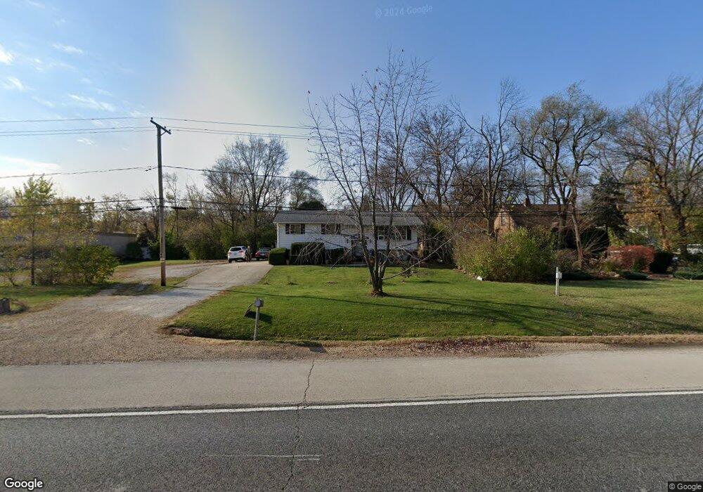
6738 Route 83 Darien, IL 60561
Estimated Value: $409,000 - $493,000
Studio
1
Bath
1,460
Sq Ft
$298/Sq Ft
Est. Value
About This Home
This home is located at 6738 Route 83, Darien, IL 60561 and is currently estimated at $435,581, approximately $298 per square foot. 6738 Route 83 is a home located in DuPage County with nearby schools including Mark Delay School, Lace Elementary School, and Eisenhower Jr High School.
Ownership History
Date
Name
Owned For
Owner Type
Purchase Details
Closed on
Jul 25, 2016
Sold by
Chicago Title Land Trust Company
Bought by
Randolph Saso Declaration Of Trust
Current Estimated Value
Purchase Details
Closed on
Dec 1, 1995
Sold by
Saso Martin P and Saso Mary C
Bought by
American National Bk & Tr Co Of Chicago
Home Financials for this Owner
Home Financials are based on the most recent Mortgage that was taken out on this home.
Original Mortgage
$123,000
Interest Rate
7.56%
Purchase Details
Closed on
Nov 8, 1995
Sold by
American National Bk & Tr Co Of Chicago
Bought by
Saso Martin P and Saso Mary C
Home Financials for this Owner
Home Financials are based on the most recent Mortgage that was taken out on this home.
Original Mortgage
$123,000
Interest Rate
7.56%
Create a Home Valuation Report for This Property
The Home Valuation Report is an in-depth analysis detailing your home's value as well as a comparison with similar homes in the area
Home Values in the Area
Average Home Value in this Area
Purchase History
| Date | Buyer | Sale Price | Title Company |
|---|---|---|---|
| Randolph Saso Declaration Of Trust | -- | Chicago Title Land Trust Co | |
| American National Bk & Tr Co Of Chicago | -- | -- | |
| Saso Martin P | -- | -- |
Source: Public Records
Mortgage History
| Date | Status | Borrower | Loan Amount |
|---|---|---|---|
| Previous Owner | Saso Martin P | $123,000 |
Source: Public Records
Tax History
| Year | Tax Paid | Tax Assessment Tax Assessment Total Assessment is a certain percentage of the fair market value that is determined by local assessors to be the total taxable value of land and additions on the property. | Land | Improvement |
|---|---|---|---|---|
| 2024 | $8,148 | $134,463 | $42,903 | $91,560 |
| 2023 | $7,846 | $123,610 | $39,440 | $84,170 |
| 2022 | $7,397 | $116,490 | $37,170 | $79,320 |
| 2021 | $7,116 | $115,170 | $36,750 | $78,420 |
| 2020 | $7,020 | $112,890 | $36,020 | $76,870 |
| 2019 | $6,785 | $108,320 | $34,560 | $73,760 |
| 2018 | $6,310 | $101,930 | $34,420 | $67,510 |
| 2017 | $6,247 | $98,080 | $33,120 | $64,960 |
| 2016 | $5,737 | $93,610 | $31,610 | $62,000 |
| 2015 | $5,630 | $88,070 | $29,740 | $58,330 |
| 2014 | $5,419 | $84,520 | $28,920 | $55,600 |
| 2013 | $5,265 | $84,120 | $28,780 | $55,340 |
Source: Public Records
Map
Nearby Homes
- 740 67th Place
- 101 Lake Hinsdale Dr Unit 205
- 6740 Illinois 83
- 301 Lake Hinsdale Dr Unit 108
- 301 Lake Hinsdale Dr Unit 311
- 301 Lake Hinsdale Dr Unit 404
- 646 68th St
- 701 Lake Hinsdale Dr Unit 306
- 77 Lake Hinsdale Dr Unit 207
- 601 Lake Hinsdale Dr Unit 101
- 601 Lake Hinsdale Dr Unit 112
- 601 Lake Hinsdale Dr Unit 301
- 19 Portwine Rd
- 6925 Clarendon Hills Rd
- 6503 Clarendon Hills Rd
- 7285 Willow Way Ln Unit 3B
- 724 Maplewood Ct Unit B
- 7235 Willow Way Ln Unit B
- 6730 S Madison St
- 447 Stratford Ln
Your Personal Tour Guide
Ask me questions while you tour the home.