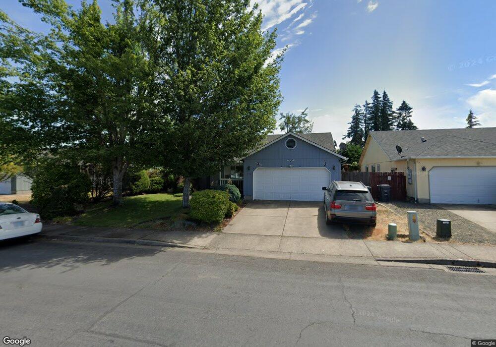
674 N 1st St Creswell, OR 97426
Estimated Value: $388,000 - $408,397
3
Beds
2
Baths
1,520
Sq Ft
$264/Sq Ft
Est. Value
About This Home
This home is located at 674 N 1st St, Creswell, OR 97426 and is currently estimated at $400,849, approximately $263 per square foot. 674 N 1st St is a home located in Lane County with nearby schools including Creslane Elementary School, Creswell Middle School, and Creswell High School.
Ownership History
Date
Name
Owned For
Owner Type
Purchase Details
Closed on
Feb 17, 2009
Sold by
Viveiros Georgiana G and Russell Paula Frances
Bought by
Viveiros Properties Llc
Current Estimated Value
Purchase Details
Closed on
Jul 8, 2004
Sold by
Utter Patrick E and Utter Anna
Bought by
Viveiros Georgiana G and Russell Paula Frances
Purchase Details
Closed on
Mar 6, 2001
Sold by
Hayden Enterprises Inc
Bought by
Utter Patrick E and Utter Anna
Home Financials for this Owner
Home Financials are based on the most recent Mortgage that was taken out on this home.
Original Mortgage
$124,429
Interest Rate
7.12%
Mortgage Type
VA
Create a Home Valuation Report for This Property
The Home Valuation Report is an in-depth analysis detailing your home's value as well as a comparison with similar homes in the area
Home Values in the Area
Average Home Value in this Area
Purchase History
| Date | Buyer | Sale Price | Title Company |
|---|---|---|---|
| Viveiros Properties Llc | -- | None Available | |
| Viveiros Georgiana G | -- | Cascade Title Co | |
| Utter Patrick E | $121,990 | Cascade Title Co |
Source: Public Records
Mortgage History
| Date | Status | Borrower | Loan Amount |
|---|---|---|---|
| Previous Owner | Utter Patrick E | $124,429 |
Source: Public Records
Tax History Compared to Growth
Tax History
| Year | Tax Paid | Tax Assessment Tax Assessment Total Assessment is a certain percentage of the fair market value that is determined by local assessors to be the total taxable value of land and additions on the property. | Land | Improvement |
|---|---|---|---|---|
| 2025 | $3,737 | $227,690 | -- | -- |
| 2024 | $2,795 | $221,059 | -- | -- |
| 2023 | $2,795 | $214,621 | $0 | $0 |
| 2022 | $3,011 | $208,370 | $0 | $0 |
| 2021 | $2,909 | $202,301 | $0 | $0 |
| 2020 | $2,868 | $196,409 | $0 | $0 |
| 2019 | $2,804 | $190,689 | $0 | $0 |
| 2018 | $2,765 | $179,743 | $0 | $0 |
| 2017 | $2,682 | $179,743 | $0 | $0 |
| 2016 | $2,747 | $174,508 | $0 | $0 |
| 2015 | $2,643 | $169,425 | $0 | $0 |
| 2014 | $2,604 | $164,490 | $0 | $0 |
Source: Public Records
Map
Nearby Homes
- 692 N 1st St
- 156 N 1st St
- 689 Blue Jay Loop
- 368 Hillegas Ave
- 83354 N Pacific Hwy
- 700 N Mill St Unit 109
- 700 N Mill St
- 460 Meadow Ln
- 33465 Irish Ln
- 589 Mary Neal Ln
- 491 Ironwood Loop
- 685 St Andrews Loop
- 521 S 7th St
- 375 Sunday Dr
- 336 Sunday Dr
- 316 Sunday Dr
- 0 Holbrook Ln Unit 339588620
- 1 Queens Ave Unit 1
- 645 Boulder Loop
- 370 Magnolia Dr
- 658 N 1st St
- 665 Blue Jay Loop
- 636 N 1st St
- 714 N 1st St
- 647 Blue Jay Loop
- 113 Morse Ave
- 711 Blue Jay Loop
- 633 Blue Jay Loop
- 116 Morse Ave
- 752 N 1st St
- 610 N 1st St
- 583 N 1st St
- 727 Blue Jay Loop
- 721 N 1st St
- 0 N 1st St
- 171 Morse Ave
- 605 Blue Jay Loop
- 678 Blue Jay Loop
- 582 N 1st St
- 656 Blue Jay Loop