Estimated Value: $354,539 - $387,000
3
Beds
2
Baths
1,873
Sq Ft
$199/Sq Ft
Est. Value
About This Home
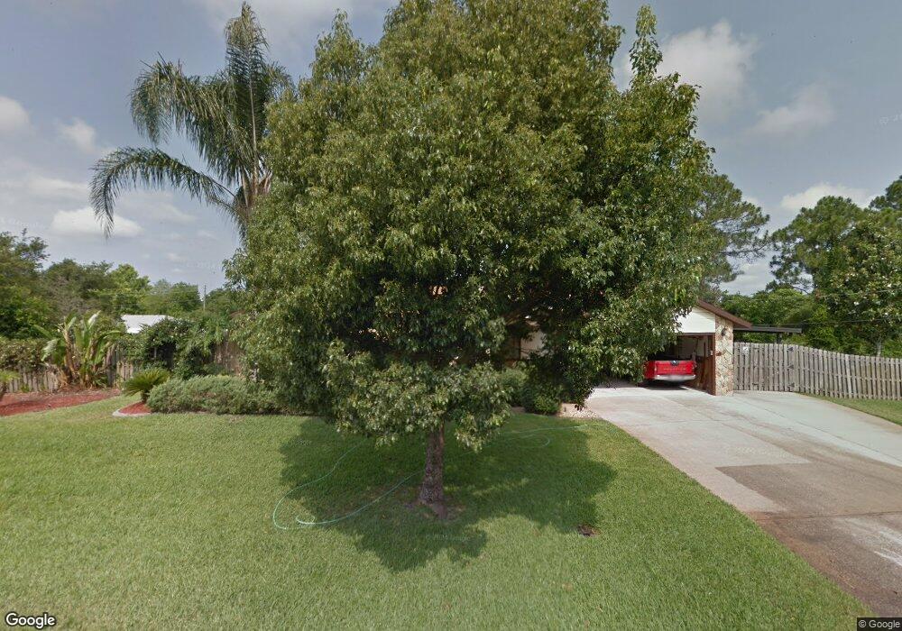
This home is located at 6740 Bryant Rd, Cocoa, FL 32927 and is currently estimated at $372,635, approximately $198 per square foot. 6740 Bryant Rd is a home located in Brevard County with nearby schools including Enterprise Elementary School, Space Coast Junior/Senior High School, and Sculptor Charter School.
Ownership History
Date
Name
Owned For
Owner Type
Purchase Details
Closed on
Dec 29, 2020
Sold by
Hovis Urmila S
Bought by
Hovis Mark C
Current Estimated Value
Purchase Details
Closed on
Apr 8, 1998
Sold by
Shally Robert J and Shally Julie K
Bought by
Shally Julie K
Create a Home Valuation Report for This Property
The Home Valuation Report is an in-depth analysis detailing your home's value as well as a comparison with similar homes in the area
Home Values in the Area
Average Home Value in this Area
Purchase History
We collect this data history from publicly available records. To have your information removed, we recommend requesting removal directly through your county’s website.
| Date | Buyer | Sale Price | Title Company |
|---|---|---|---|
| Hovis Mark C | -- | None Available | |
| Shally Julie K | -- | -- |
Source: Public Records
Tax History
| Year | Tax Paid | Tax Assessment Tax Assessment Total Assessment is a certain percentage of the fair market value that is determined by local assessors to be the total taxable value of land and additions on the property. | Land | Improvement |
|---|---|---|---|---|
| 2025 | $1,523 | $106,220 | -- | -- |
| 2024 | $1,484 | $103,230 | -- | -- |
| 2023 | $1,484 | $100,230 | $0 | $0 |
| 2022 | $1,386 | $97,320 | $0 | $0 |
| 2021 | $1,381 | $94,490 | $0 | $0 |
| 2020 | $1,304 | $93,190 | $0 | $0 |
| 2019 | $1,239 | $91,100 | $0 | $0 |
| 2018 | $1,230 | $89,410 | $0 | $0 |
| 2017 | $1,219 | $87,580 | $0 | $0 |
| 2016 | $1,220 | $85,780 | $36,000 | $49,780 |
| 2015 | $1,232 | $85,190 | $30,000 | $55,190 |
| 2014 | $1,233 | $84,520 | $22,000 | $62,520 |
Source: Public Records
Map
Nearby Homes
- 6815 Bryant Rd
- 6601 Cedar Ave
- 6813 Cecil Rd
- 6615 Dock Ave
- 6965 Hundred Acre Dr
- 5555 Brandon St
- 00 Unknown
- 6450 Ember Ave
- 6581 Bancroft Ave
- 5145 Carter St
- 5070 Curtis Blvd
- 6643 Emil Ave
- 6570 Bancroft Ave
- 5155 Mayflower St
- 5424 Flint Rd
- 5525 Fairbridge St
- 6460 Irving Rd
- 5165 Patricia St
- 5075 Carter St
- 6438 Hudson Rd
Your Personal Tour Guide
Ask me questions while you tour the home.