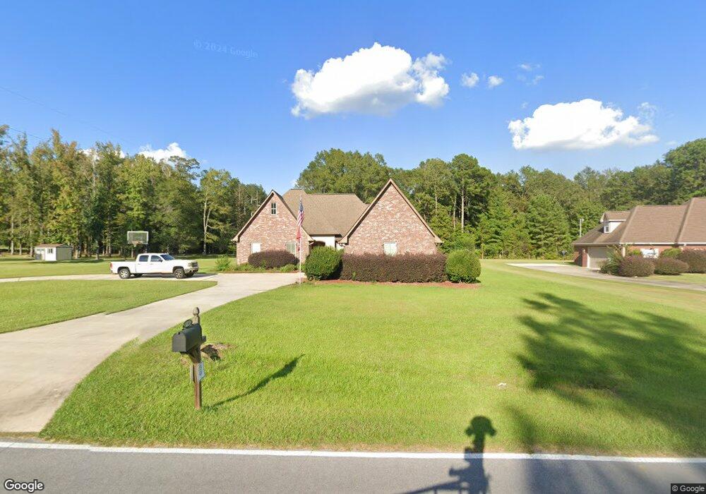
6740 King Rd Meridian, MS 39305
Estimated Value: $378,319 - $430,000
Studio
--
Bath
3,135
Sq Ft
$125/Sq Ft
Est. Value
About This Home
This home is located at 6740 King Rd, Meridian, MS 39305 and is currently estimated at $392,580, approximately $125 per square foot. 6740 King Rd is a home.
Ownership History
Date
Name
Owned For
Owner Type
Purchase Details
Closed on
Oct 28, 2016
Sold by
Henry Neil A and Henry Amanda K
Bought by
Myers Christopher L and Myers Kristi K
Current Estimated Value
Home Financials for this Owner
Home Financials are based on the most recent Mortgage that was taken out on this home.
Original Mortgage
$263,000
Outstanding Balance
$210,911
Interest Rate
3.47%
Estimated Equity
$181,669
Purchase Details
Closed on
Feb 10, 2012
Sold by
Bill Powell Construction Llc
Bought by
Henry Neil and Henry Amanda
Purchase Details
Closed on
Jun 8, 2011
Sold by
Kimg Farms Development Llc
Bought by
Bill Powell Construction Inc
Create a Home Valuation Report for This Property
The Home Valuation Report is an in-depth analysis detailing your home's value as well as a comparison with similar homes in the area
Purchase History
| Date | Buyer | Sale Price | Title Company |
|---|---|---|---|
| Myers Christopher L | -- | -- | |
| Henry Neil | -- | -- | |
| Bill Powell Construction Inc | -- | -- |
Source: Public Records
Mortgage History
| Date | Status | Borrower | Loan Amount |
|---|---|---|---|
| Open | Henry Neil | $263,000 |
Source: Public Records
Tax History
| Year | Tax Paid | Tax Assessment Tax Assessment Total Assessment is a certain percentage of the fair market value that is determined by local assessors to be the total taxable value of land and additions on the property. | Land | Improvement |
|---|---|---|---|---|
| 2025 | $3,359 | $30,828 | $0 | $0 |
| 2024 | $3,397 | $31,145 | $0 | $0 |
| 2023 | $2,923 | $27,153 | $0 | $0 |
| 2022 | $2,919 | $27,153 | $0 | $0 |
| 2021 | $2,886 | $27,153 | $0 | $0 |
| 2020 | $2,778 | $27,153 | $0 | $0 |
| 2019 | $2,795 | $27,308 | $0 | $0 |
| 2018 | $2,763 | $0 | $0 | $0 |
| 2017 | $2,763 | $273,080 | $30,000 | $243,080 |
| 2016 | $2,742 | $273,080 | $30,000 | $243,080 |
| 2015 | -- | $260,310 | $27,500 | $232,810 |
| 2014 | -- | $260,310 | $27,500 | $232,810 |
Source: Public Records
Map
Nearby Homes
- 7651 King Rd
- 6630 Windsor Rd
- 8525 State Blvd
- 7606 Pineridge Dr
- 0 Green Field Dr
- 7537 State Boulevard Extension
- 7951 Greenfield Dr
- 3518 50th St
- 2705 56th St
- 0 Chandler Rd
- 1917 61st Ct
- 5817 18th Place
- 3161 45th St
- 4600 32nd Ave
- 6233 14th Ave
- 6721 13th Place
- 4324 32nd Place
- 0 Poplar Springs Dr
- 1212 68th Ct
- 1200 62nd St
Your Personal Tour Guide
Ask me questions while you tour the home.