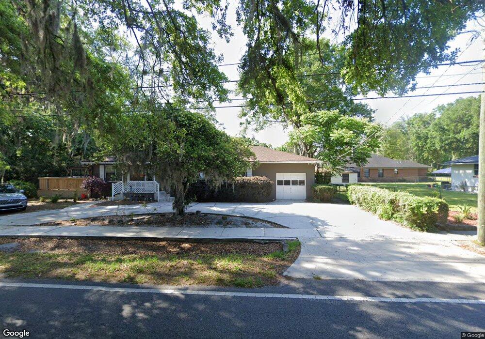
6746 Hyde Grove Ave Jacksonville, FL 32210
Hyde Park NeighborhoodEstimated Value: $244,046 - $262,000
3
Beds
1
Bath
1,684
Sq Ft
$150/Sq Ft
Est. Value
About This Home
This home is located at 6746 Hyde Grove Ave, Jacksonville, FL 32210 and is currently estimated at $253,262, approximately $150 per square foot. 6746 Hyde Grove Ave is a home located in Duval County with nearby schools including Hyde Park Elementary School, Lake Shore Middle School, and Edward H. White High School.
Ownership History
Date
Name
Owned For
Owner Type
Purchase Details
Closed on
Sep 25, 2024
Sold by
Kelsay Christopher and Kelsay Julie
Bought by
Kelsay Christopher Ray and Kelsay Julie Massey
Current Estimated Value
Purchase Details
Closed on
Oct 8, 1999
Sold by
Fussell Ronald W
Bought by
Kelsay Christopher and Kelsay Julie
Home Financials for this Owner
Home Financials are based on the most recent Mortgage that was taken out on this home.
Original Mortgage
$83,231
Interest Rate
7.85%
Mortgage Type
Balloon
Create a Home Valuation Report for This Property
The Home Valuation Report is an in-depth analysis detailing your home's value as well as a comparison with similar homes in the area
Home Values in the Area
Average Home Value in this Area
Purchase History
| Date | Buyer | Sale Price | Title Company |
|---|---|---|---|
| Kelsay Christopher Ray | $100 | None Listed On Document | |
| Kelsay Christopher | $83,800 | Southern Title |
Source: Public Records
Mortgage History
| Date | Status | Borrower | Loan Amount |
|---|---|---|---|
| Previous Owner | Kelsay Christopher | $83,231 |
Source: Public Records
Tax History Compared to Growth
Tax History
| Year | Tax Paid | Tax Assessment Tax Assessment Total Assessment is a certain percentage of the fair market value that is determined by local assessors to be the total taxable value of land and additions on the property. | Land | Improvement |
|---|---|---|---|---|
| 2025 | $1,614 | $123,063 | -- | -- |
| 2024 | $1,560 | $119,595 | -- | -- |
| 2023 | $1,560 | $116,112 | $0 | $0 |
| 2022 | $1,417 | $112,731 | $0 | $0 |
| 2021 | $1,397 | $109,448 | $0 | $0 |
| 2020 | $1,380 | $107,937 | $0 | $0 |
| 2019 | $1,264 | $100,268 | $0 | $0 |
| 2018 | $0 | $98,399 | $0 | $0 |
| 2017 | $0 | $96,376 | $0 | $0 |
| 2016 | $302 | $94,394 | $0 | $0 |
| 2015 | -- | $93,738 | $0 | $0 |
| 2014 | -- | $92,995 | $0 | $0 |
Source: Public Records
Map
Nearby Homes
- 6819 Mcmullin St
- 1832 Navaho Ave
- 1704 Memory Ln
- 6717 Bakersfield Dr
- 6711 Bakersfield Dr
- 7009 Hanson Dr S
- 2036 Bunting Dr
- 1728 Londonderry Rd
- 7004 Dayton Rd
- 6938 Hanson Dr N
- 7045 Bonnie Brae Ln
- 1619 Mount Vernon Dr
- 6867 Miss Muffet Ln N
- 1627 Westminister Ave
- 6351 Fabian Dr
- 1971 Jammes Rd
- 2133 Hugh Edwards Dr
- 1630 Westminister Ave
- 2204 Burpee Dr
- 6340 Fabian Dr
- 1911 Coulee Ave
- 6745 Hyde Grove Ave
- 1919 Coulee Ave
- 6767 Hyde Grove Ave
- 1912 Lane Ln S
- 1912 Lane Ave S
- 1920 Lane Ave S
- 1878 Lane Ave S
- 1923 Coulee Ave
- 6808 Hyde Grove Ave
- 1906 Lane Ave S
- 1845 Coulee Ave
- 1880 Coulee Ave
- 1937 Coulee Ave
- 6820 Hyde Grove Ave
- 1934 Lane Ave S
- 1936 Lane Ave S
- 1850 Lane Ave S
- 1918 Coulee Ave
- 1854 Coulee Ave