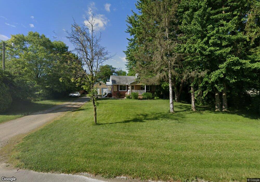
6750 E State Route 571 Tipp City, OH 45371
Estimated Value: $250,000 - $269,000
3
Beds
1
Bath
952
Sq Ft
$273/Sq Ft
Est. Value
About This Home
This home is located at 6750 E State Route 571, Tipp City, OH 45371 and is currently estimated at $259,638, approximately $272 per square foot. 6750 E State Route 571 is a home located in Miami County with nearby schools including Bethel Elementary School, Bethel Middle School, and Bethel High School.
Ownership History
Date
Name
Owned For
Owner Type
Purchase Details
Closed on
May 9, 2022
Sold by
Henderson and Lori
Bought by
Ortel Andrew T and Ortel Tracey E
Current Estimated Value
Purchase Details
Closed on
Dec 29, 2014
Sold by
White Real Estate & Remodeling Llc
Bought by
Henderson Edward and Henderson Lori
Purchase Details
Closed on
May 14, 2014
Sold by
Fannie Mae
Bought by
White Ron
Purchase Details
Closed on
Dec 17, 2002
Sold by
Butler Keith A
Bought by
Butler Linda S
Purchase Details
Closed on
Jan 29, 1993
Bought by
Butler Keith A
Create a Home Valuation Report for This Property
The Home Valuation Report is an in-depth analysis detailing your home's value as well as a comparison with similar homes in the area
Home Values in the Area
Average Home Value in this Area
Purchase History
| Date | Buyer | Sale Price | Title Company |
|---|---|---|---|
| Ortel Andrew T | $205,000 | Ross Anne E | |
| Henderson Edward | $109,500 | Attorney | |
| White Ron | $30,000 | Servicelink | |
| Butler Linda S | $100,000 | -- | |
| Butler Keith A | $20,700 | -- |
Source: Public Records
Mortgage History
| Date | Status | Borrower | Loan Amount |
|---|---|---|---|
| Closed | Butler Linda S | -- |
Source: Public Records
Tax History Compared to Growth
Tax History
| Year | Tax Paid | Tax Assessment Tax Assessment Total Assessment is a certain percentage of the fair market value that is determined by local assessors to be the total taxable value of land and additions on the property. | Land | Improvement |
|---|---|---|---|---|
| 2024 | $2,961 | $62,060 | $11,940 | $50,120 |
| 2023 | $2,961 | $62,060 | $11,940 | $50,120 |
| 2022 | $2,927 | $62,060 | $11,940 | $50,120 |
| 2021 | $1,978 | $39,030 | $9,940 | $29,090 |
| 2020 | $1,966 | $39,030 | $9,940 | $29,090 |
| 2019 | $1,912 | $37,520 | $9,940 | $27,580 |
| 2018 | $1,719 | $31,570 | $8,260 | $23,310 |
| 2017 | $1,721 | $31,570 | $8,260 | $23,310 |
| 2016 | $1,550 | $31,570 | $8,260 | $23,310 |
| 2015 | $1,580 | $30,350 | $7,950 | $22,400 |
| 2014 | $1,580 | $30,350 | $7,950 | $22,400 |
| 2013 | $1,308 | $30,350 | $7,950 | $22,400 |
Source: Public Records
Map
Nearby Homes
- 0 Ohio 201
- 7817 Ohio 201
- 7540 Agenbroad Rd
- 7032 Honeylocust St
- 7715 E New Carlisle Rd
- 5315 E State Route 571
- 605 Fenview Dr
- 6345 Ohio 202
- 0 Ohio 202 Unit 23014095
- 0 Ohio 202 Unit 23014098
- 7337 Ross Rd
- 907 White Pine St
- 930 Firwood Dr
- 1101 Cambridge Ct Unit 1103
- 6782 Us Route 40
- 8540 Mann Rd
- 129 Solar Dr
- 210 Zimmerman St
- 6780 E Walnut St
- 224 Orth Dr
- 6776 E State Route 571
- 6777 E State Route 571
- 6753 E State Route 571
- 6714 E State Route 571
- 6707 E State Route 571
- 6705 E State Route 571
- 6695 E State Route 571
- 6677 E State Route 571
- 6885 Ohio 571
- 6885 E State Route 571
- 6915 E State Route 571
- 6616 E State Route 571
- 6613 E State Route 571
- 5970 State Route 201
- 5920 State Route 201
- 6622 E State Route 571
- 5890 State Route 201
- 6574 E State Route 571
- 5850 State Route 201
- 6558 E State Route 571