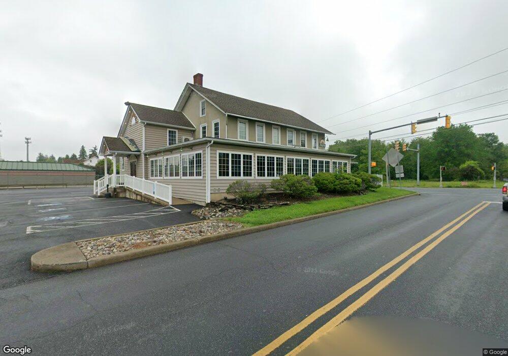
6751 Ruppsville Rd Allentown, PA 18106
Upper Macungie Township NeighborhoodEstimated Value: $747,299
--
Bed
1
Bath
5,012
Sq Ft
$149/Sq Ft
Est. Value
About This Home
This home is located at 6751 Ruppsville Rd, Allentown, PA 18106 and is currently estimated at $747,299, approximately $149 per square foot. 6751 Ruppsville Rd is a home located in Lehigh County with nearby schools including Fogelsville Elementary School, Springhouse Middle School, and Parkland High School.
Ownership History
Date
Name
Owned For
Owner Type
Purchase Details
Closed on
Dec 10, 2024
Sold by
Pickering Ronald E and Pickering Clarissa C
Bought by
6751 Rupp Llc
Current Estimated Value
Purchase Details
Closed on
Oct 9, 1995
Sold by
Daniels Robert G and Daniels Peggy J
Bought by
Pickering Ronald E and Pickering Clairissa C
Purchase Details
Closed on
Nov 24, 1976
Bought by
Daniels Robert G and Daniels Peggy J
Create a Home Valuation Report for This Property
The Home Valuation Report is an in-depth analysis detailing your home's value as well as a comparison with similar homes in the area
Home Values in the Area
Average Home Value in this Area
Purchase History
| Date | Buyer | Sale Price | Title Company |
|---|---|---|---|
| 6751 Rupp Llc | $720,000 | Abe Settlement Services | |
| Pickering Ronald E | $235,000 | -- | |
| Daniels Robert G | $70,000 | -- |
Source: Public Records
Tax History Compared to Growth
Tax History
| Year | Tax Paid | Tax Assessment Tax Assessment Total Assessment is a certain percentage of the fair market value that is determined by local assessors to be the total taxable value of land and additions on the property. | Land | Improvement |
|---|---|---|---|---|
| 2025 | $10,054 | $464,600 | $180,100 | $284,500 |
| 2024 | $9,673 | $464,600 | $180,100 | $284,500 |
| 2023 | $9,441 | $464,600 | $180,100 | $284,500 |
| 2022 | $9,399 | $464,600 | $284,500 | $180,100 |
| 2021 | $9,399 | $464,600 | $180,100 | $284,500 |
| 2020 | $9,399 | $464,600 | $180,100 | $284,500 |
| 2019 | $9,199 | $464,600 | $180,100 | $284,500 |
| 2018 | $9,018 | $464,600 | $180,100 | $284,500 |
| 2017 | $8,888 | $464,600 | $180,100 | $284,500 |
| 2016 | -- | $464,600 | $180,100 | $284,500 |
| 2015 | -- | $464,600 | $180,100 | $284,500 |
| 2014 | -- | $464,600 | $180,100 | $284,500 |
Source: Public Records
Map
Nearby Homes
- 172 Wyndham Dr
- 318 Tupelo Ct
- 6342 Chapmans Rd
- 6401 Fir Rd
- 2021 Hickory Ln
- 515 Ponds Edge Ln
- 357 Barn Swallow Ln
- 818 Rebecca Ln
- 366 Indigo Way
- 5926 Holiday Dr
- 5920 Michaels Crossing
- 441 Sawgrass Dr
- 319 Hopewell Dr
- 165 Robert Dr
- 5821 Daniel St
- 5530 Holiday Dr
- 1325 Wynewood Rd
- 1087 Meadowlark Dr
- Charleston Plan at Wrenfield
- Regent Plan at Wrenfield
- 6755 Schantz Rd
- 6741 Ruppsville Rd
- 6739 Ruppsville Rd
- 6737 Ruppsville Rd
- 6738 Ruppsville Rd
- 6478 Tupelo Rd
- 100 Ramapo Trail
- 100 Ramapo Trail
- 6483 Tupelo Rd
- 6732 Ruppsville Rd
- 6474 Tupelo Rd
- 6651 Schantz Rd
- 6648 Schantz Rd
- 6479 Tupelo Rd
- 6470 Tupelo Rd
- 6475 Tupelo Rd
- 6623 Schantz Rd
- 6466 Tupelo Rd
- 6650 Androsky Rd
- 6471 Tupelo Rd