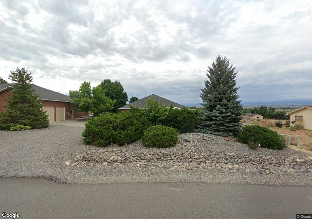
67610 Oak Wood Dr Montrose, CO 81401
Estimated Value: $738,000 - $856,000
3
Beds
3
Baths
2,710
Sq Ft
$297/Sq Ft
Est. Value
About This Home
This home is located at 67610 Oak Wood Dr, Montrose, CO 81401 and is currently estimated at $804,690, approximately $296 per square foot. 67610 Oak Wood Dr is a home located in Montrose County with nearby schools including Cottonwood Elementary School, Centennial Middle School, and Montrose High School.
Ownership History
Date
Name
Owned For
Owner Type
Purchase Details
Closed on
Apr 21, 2004
Sold by
Barminski William J and Barminski Katherine A
Bought by
Barminski William J and Barminski Kathryn A
Current Estimated Value
Purchase Details
Closed on
Sep 30, 1994
Sold by
Barminski Katherine A
Bought by
Barminski William J and Barminski Katherine A
Purchase Details
Closed on
May 29, 1992
Sold by
Mack John P
Bought by
Barminski Katherine A
Purchase Details
Closed on
Mar 1, 1991
Sold by
Mack Jason R and Mack Linda M
Bought by
Mack John P
Purchase Details
Closed on
Feb 28, 1991
Sold by
Solar Hills Ranch Ltd
Bought by
Mack Jason R and Mack Linda M
Create a Home Valuation Report for This Property
The Home Valuation Report is an in-depth analysis detailing your home's value as well as a comparison with similar homes in the area
Home Values in the Area
Average Home Value in this Area
Purchase History
| Date | Buyer | Sale Price | Title Company |
|---|---|---|---|
| Barminski William J | -- | -- | |
| Barminski William J | -- | -- | |
| Barminski Katherine A | $26,000 | -- | |
| Mack John P | -- | -- | |
| Mack Jason R | $24,300 | -- |
Source: Public Records
Tax History Compared to Growth
Tax History
| Year | Tax Paid | Tax Assessment Tax Assessment Total Assessment is a certain percentage of the fair market value that is determined by local assessors to be the total taxable value of land and additions on the property. | Land | Improvement |
|---|---|---|---|---|
| 2024 | $3,339 | $53,030 | $10,210 | $42,820 |
| 2023 | $3,339 | $65,960 | $11,330 | $54,630 |
| 2022 | $2,356 | $40,700 | $6,600 | $34,100 |
| 2021 | $2,427 | $41,880 | $6,790 | $35,090 |
| 2020 | $2,035 | $37,080 | $6,340 | $30,740 |
| 2019 | $2,048 | $37,080 | $6,340 | $30,740 |
| 2018 | $2,279 | $32,460 | $5,320 | $27,140 |
| 2017 | $2,261 | $32,460 | $5,320 | $27,140 |
| 2016 | $2,187 | $31,910 | $5,350 | $26,560 |
| 2015 | $2,148 | $31,910 | $5,350 | $26,560 |
| 2014 | $2,023 | $32,130 | $5,350 | $26,780 |
Source: Public Records
Map
Nearby Homes
- 16303 6760 Rd
- 16168 6794 Ct
- Lot 11 Galway Ct
- Lot 10 Galway Ct
- Lot 9 Galway Ct
- Lot 8 Galway Ct
- Lot 14 Killarney Ln
- Lot 17 Killarney Ln
- Lot 7 Galway Ct
- 3310 Donnegal Dr
- 3302 Donnegal Dr
- 2231 Hill St
- 3161 Silver Fox Dr
- 3415 Chestnut Dr
- 2941 Lost Creek Rd N
- 3004 Silver Fox Dr
- 2308 Mead Ln
- Lot C18 Chestnut Dr
- 2132 Patriot Ct
- 3450 Honey Locust Dr
- 16330 6750 Rd
- 16318 6765 Rd
- 67578 Oak Wood Dr
- 16301 6765 Rd
- 6765 Road
- 16306 6765 Rd
- 16313 6750 Rd
- 16280 6765 Rd
- 67522 Oak Wood Dr
- 67561 Oak Wood Dr
- 67601 Oakridge Ln
- 16222 6765 Rd
- 6765 Rd
- 16265 6760 Rd
- 67571 Oakridge Ln
- 67501 Oak Wood Dr
- 16317 6750 Rd
- 16323 6750 Rd
- 67466 Oak Wood Dr
- 0 Oak Wood Dr Unit 615529