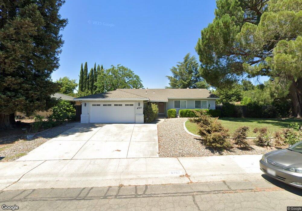
6767 Langston Way Sacramento, CA 95831
Pocket-Greenhaven NeighborhoodEstimated Value: $586,408 - $633,000
3
Beds
2
Baths
1,498
Sq Ft
$409/Sq Ft
Est. Value
About This Home
This home is located at 6767 Langston Way, Sacramento, CA 95831 and is currently estimated at $612,102, approximately $408 per square foot. 6767 Langston Way is a home located in Sacramento County with nearby schools including Genevieve Didion School, Sam Brannan Middle School, and John F. Kennedy High School.
Ownership History
Date
Name
Owned For
Owner Type
Purchase Details
Closed on
Nov 2, 2009
Sold by
Luck Michael A and Luck Patricia M
Bought by
Yeung Chiufan
Current Estimated Value
Home Financials for this Owner
Home Financials are based on the most recent Mortgage that was taken out on this home.
Original Mortgage
$178,000
Outstanding Balance
$115,751
Interest Rate
4.92%
Mortgage Type
New Conventional
Estimated Equity
$496,351
Purchase Details
Closed on
Jun 27, 2007
Sold by
Luck Michael A and Luck Patricia M
Bought by
Luck Michael A and Luck Patricia M
Purchase Details
Closed on
Feb 25, 1998
Sold by
Smith Ruth Royal Revocable Trust and Cecelia Catherine
Bought by
Luck Michael A and Luck Patricia M
Home Financials for this Owner
Home Financials are based on the most recent Mortgage that was taken out on this home.
Original Mortgage
$121,125
Interest Rate
6.99%
Create a Home Valuation Report for This Property
The Home Valuation Report is an in-depth analysis detailing your home's value as well as a comparison with similar homes in the area
Home Values in the Area
Average Home Value in this Area
Purchase History
| Date | Buyer | Sale Price | Title Company |
|---|---|---|---|
| Yeung Chiufan | $280,000 | Placer Title Company | |
| Luck Michael A | -- | None Available | |
| Luck Michael A | $127,500 | Stewart Title |
Source: Public Records
Mortgage History
| Date | Status | Borrower | Loan Amount |
|---|---|---|---|
| Open | Yeung Chiufan | $178,000 | |
| Previous Owner | Luck Michael A | $121,125 |
Source: Public Records
Tax History Compared to Growth
Tax History
| Year | Tax Paid | Tax Assessment Tax Assessment Total Assessment is a certain percentage of the fair market value that is determined by local assessors to be the total taxable value of land and additions on the property. | Land | Improvement |
|---|---|---|---|---|
| 2025 | $4,389 | $361,411 | $129,073 | $232,338 |
| 2024 | $4,389 | $354,326 | $126,543 | $227,783 |
| 2023 | $4,278 | $347,379 | $124,062 | $223,317 |
| 2022 | $4,219 | $340,569 | $121,630 | $218,939 |
| 2021 | $4,016 | $333,893 | $119,246 | $214,647 |
| 2020 | $4,042 | $330,471 | $118,024 | $212,447 |
| 2019 | $3,956 | $323,992 | $115,710 | $208,282 |
| 2018 | $3,853 | $317,641 | $113,442 | $204,199 |
| 2017 | $3,795 | $311,414 | $111,218 | $200,196 |
| 2016 | $3,708 | $305,309 | $109,038 | $196,271 |
| 2015 | $3,649 | $300,724 | $107,401 | $193,323 |
| 2014 | $3,559 | $294,835 | $105,298 | $189,537 |
Source: Public Records
Map
Nearby Homes
- 0 Riverside Blvd
- 6980 Riverside Blvd
- 487 Twin River Way
- 10 Fleet Ct
- 7232 Bayview Way
- 7262 Harbor Light Way
- 26 Marina Grande Ct
- 14 Westlite Ct
- 763 La Contenta Way
- 792 Parklin Ave
- 6235 Allenport Way
- 462 de Mar Dr
- 22 Basil Ct
- 4 Bingham Cir
- 64 Moonlit Cir
- 37 Starlit Cir
- 4 Marina Blue Ct
- 4074 Southampton St
- 989 Johnfer Way
- 4057 Southampton St
- 6755 Orleans Way
- 6771 Langston Way
- 6752 Orleans Way
- 6768 Langston Way
- 6775 Langston Way
- 6748 Orleans Way
- 6781 Orleans Way
- 6772 Langston Way
- 6765 Orleans Way
- 6760 Orleans Way
- 6744 Orleans Way
- 6789 Orleans Way
- 6776 Langston Way
- 6781 Langston Way
- 338 Blackbird Ln
- 6735 Orleans Way
- 6764 Orleans Way
- 6740 Orleans Way
- 6793 Orleans Way
- 6731 Orleans Way