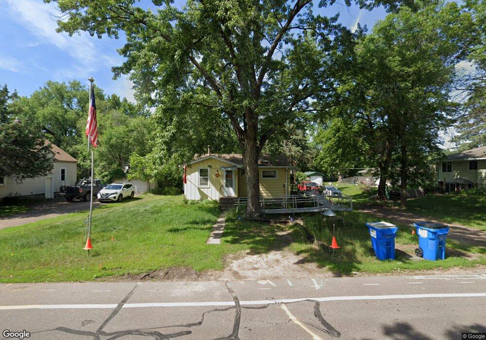
6768 Maple St North Branch, MN 55056
Estimated Value: $168,000 - $212,000
1
Bed
1
Bath
568
Sq Ft
$334/Sq Ft
Est. Value
About This Home
This home is located at 6768 Maple St, North Branch, MN 55056 and is currently estimated at $189,967, approximately $334 per square foot. 6768 Maple St is a home located in Chisago County with nearby schools including North Branch Middle School, Sunrise River Elementary School, and North Branch Senior High School.
Ownership History
Date
Name
Owned For
Owner Type
Purchase Details
Closed on
Sep 27, 2017
Sold by
Kingen Jay L and Kingen Karin
Bought by
Louis James
Current Estimated Value
Home Financials for this Owner
Home Financials are based on the most recent Mortgage that was taken out on this home.
Original Mortgage
$99,000
Outstanding Balance
$82,294
Interest Rate
3.82%
Mortgage Type
VA
Estimated Equity
$107,673
Purchase Details
Closed on
Jan 6, 2005
Sold by
Smetana William J
Bought by
Kingen Jay L
Create a Home Valuation Report for This Property
The Home Valuation Report is an in-depth analysis detailing your home's value as well as a comparison with similar homes in the area
Home Values in the Area
Average Home Value in this Area
Purchase History
| Date | Buyer | Sale Price | Title Company |
|---|---|---|---|
| Louis James | $99,000 | -- | |
| Kingen Jay L | $106,000 | -- |
Source: Public Records
Mortgage History
| Date | Status | Borrower | Loan Amount |
|---|---|---|---|
| Open | Louis James | $99,000 |
Source: Public Records
Tax History Compared to Growth
Tax History
| Year | Tax Paid | Tax Assessment Tax Assessment Total Assessment is a certain percentage of the fair market value that is determined by local assessors to be the total taxable value of land and additions on the property. | Land | Improvement |
|---|---|---|---|---|
| 2024 | $1,064 | $78,400 | $0 | $0 |
| 2023 | $1,064 | $101,600 | $0 | $0 |
| 2022 | $1,262 | $89,200 | $0 | $0 |
| 2021 | $1,004 | $63,800 | $0 | $0 |
| 2020 | $970 | $90,200 | $40,000 | $50,200 |
| 2019 | $904 | $0 | $0 | $0 |
| 2018 | $818 | $0 | $0 | $0 |
| 2017 | $1,282 | $0 | $0 | $0 |
| 2016 | $1,258 | $0 | $0 | $0 |
| 2015 | $742 | $0 | $0 | $0 |
| 2014 | -- | $52,100 | $0 | $0 |
Source: Public Records
Map
Nearby Homes
- 38958 Elm Ct
- 38558 Grand Ave
- XXXXX Maple St
- 38946 7th Ave
- 39183 Grand Ave
- 38692 Hawthorne Ave
- 36XXX Forest Blvd
- 38578 Hawthorne Ave
- 7255 Hawthorne Ct
- 7222 Hawthorne Ct
- 7246 385th St
- TBD Saint Croix Trail
- 39590 Hemingway Ave
- 39xxx Hemingway Ave
- 374xx-N40 Hemingway Ave
- 7348 384th Ct
- 5244 391st St
- 38470 Glacier Dr
- XXX Ash St
- 38280 Great Oaks Ct
- 6752 Maple St
- 38782 Grand Ave
- 32235 Jodrell St NE
- 6728 Maple St
- 6769 Maple St
- 6731 Maple St
- 38726 Grand Ave
- 6690 Maple St
- 38851 2nd Ave
- 38708 Grand Ave
- 6683 Main St
- 6720 Main St
- 38694 Grand Ave
- 38871 2nd Ave
- 6700 Main St
- 6849 Saint Croix Trail
- 6658 Maple St
- 6682 Main St
- 38884 2nd Ave
- 38861 Grand Ave