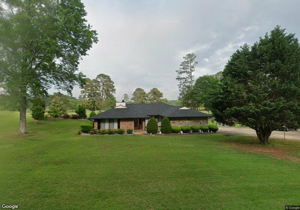
677 Shaw Rd Sharpsburg, GA 30277
Estimated Value: $402,496 - $509,000
3
Beds
2
Baths
2,346
Sq Ft
$192/Sq Ft
Est. Value
About This Home
This home is located at 677 Shaw Rd, Sharpsburg, GA 30277 and is currently estimated at $451,374, approximately $192 per square foot. 677 Shaw Rd is a home located in Coweta County with nearby schools including Canongate Elementary School, Madras Middle School, and Northgate High School.
Ownership History
Date
Name
Owned For
Owner Type
Purchase Details
Closed on
Oct 22, 2007
Sold by
Westbrooks Jack L
Bought by
Blake Trevor B and Blake Barbara Y
Current Estimated Value
Home Financials for this Owner
Home Financials are based on the most recent Mortgage that was taken out on this home.
Original Mortgage
$70,000
Outstanding Balance
$43,610
Interest Rate
6.26%
Mortgage Type
New Conventional
Estimated Equity
$407,764
Purchase Details
Closed on
Oct 13, 2005
Sold by
Honea Harold E
Bought by
Westbrooks Jack L
Purchase Details
Closed on
Oct 27, 1993
Bought by
Honea Harold E
Purchase Details
Closed on
Sep 30, 1991
Bought by
Westbrooks Jack L
Purchase Details
Closed on
Apr 26, 1991
Bought by
Honea Harold E
Purchase Details
Closed on
Apr 2, 1991
Bought by
Farmers And Merchant
Purchase Details
Closed on
Apr 30, 1988
Bought by
Gaultney Anne M
Create a Home Valuation Report for This Property
The Home Valuation Report is an in-depth analysis detailing your home's value as well as a comparison with similar homes in the area
Home Values in the Area
Average Home Value in this Area
Purchase History
| Date | Buyer | Sale Price | Title Company |
|---|---|---|---|
| Blake Trevor B | $259,000 | -- | |
| Westbrooks Jack L | -- | -- | |
| Honea Harold E | -- | -- | |
| Westbrooks Jack L | $143,000 | -- | |
| Honea Harold E | $129,000 | -- | |
| Farmers And Merchant | $142,400 | -- | |
| Gaultney Anne M | -- | -- |
Source: Public Records
Mortgage History
| Date | Status | Borrower | Loan Amount |
|---|---|---|---|
| Open | Blake Trevor B | $70,000 |
Source: Public Records
Tax History Compared to Growth
Tax History
| Year | Tax Paid | Tax Assessment Tax Assessment Total Assessment is a certain percentage of the fair market value that is determined by local assessors to be the total taxable value of land and additions on the property. | Land | Improvement |
|---|---|---|---|---|
| 2025 | $2,094 | $170,581 | $36,000 | $134,581 |
| 2024 | $1,764 | $155,599 | $36,000 | $119,599 |
| 2023 | $1,764 | $153,176 | $32,000 | $121,176 |
| 2022 | $1,547 | $140,893 | $32,000 | $108,893 |
| 2021 | $1,017 | $116,863 | $24,000 | $92,863 |
| 2020 | $1,536 | $116,863 | $24,000 | $92,863 |
| 2019 | $1,728 | $100,669 | $24,000 | $76,669 |
| 2018 | $1,733 | $100,669 | $24,000 | $76,669 |
| 2017 | $1,447 | $90,923 | $24,000 | $66,923 |
| 2016 | $1,790 | $90,923 | $24,000 | $66,923 |
| 2015 | $1,747 | $90,923 | $24,000 | $66,923 |
| 2014 | $1,350 | $77,725 | $16,000 | $61,725 |
Source: Public Records
Map
Nearby Homes
- 9 Warrior Way
- 70 N Strathmore Dr
- 0 Fischer Spur Rd Unit 10495301
- 20 Skipton Ct
- 40 Wenham Ln
- 56 Hudgen Rd
- 10 Monteray Ct
- 35 Palmer Place
- 127 Northgate Preserve Dr
- 518 Palmetto Tyrone Rd
- 46 I W Brooks Rd
- 291 Cannongate Rd
- 259 Strathmore Dr Unit 3
- 306 Northgate Preserve Dr
- 50 Big Oaks Ct
- 40 Joe Lee Dr
- 30 Joe Lee Dr
- 27 Dorian Ct
- 158 Cranford Mill Dr
- 177 Cranford Mill Dr
- 655 Shaw Rd
- 688 Shaw Rd
- 13 Snead Cir
- 0 Snead Cir Unit 8704051
- 0 Snead Cir Unit 8914251
- 102 Sarazen Cir
- 631 Shaw Rd
- 102 Snead Cir
- 723 Shaw Rd
- 104 Sarazen Cir
- 103 Snead Cir
- 634 Shaw Rd Unit 19
- 634 Shaw Rd
- 730 Shaw Rd
- 737 Shaw Rd
- 105 Snead Cir
- 501 Shaw Rd
- 104 Snead Cir
- 103 Sarazen Cir
- 0 Sarazen Cir Unit 3231691