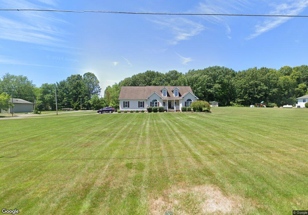
677 Watson Rd Deerfield, OH 44411
Estimated Value: $334,000 - $388,000
3
Beds
2
Baths
2,042
Sq Ft
$177/Sq Ft
Est. Value
About This Home
This home is located at 677 Watson Rd, Deerfield, OH 44411 and is currently estimated at $361,904, approximately $177 per square foot. 677 Watson Rd is a home located in Portage County with nearby schools including Southeast High School.
Ownership History
Date
Name
Owned For
Owner Type
Purchase Details
Closed on
Aug 26, 2002
Sold by
Walters Ralph J and Walters Marian J
Bought by
Lambert Dennis and Lambert Amy
Current Estimated Value
Home Financials for this Owner
Home Financials are based on the most recent Mortgage that was taken out on this home.
Original Mortgage
$29,750
Outstanding Balance
$12,699
Interest Rate
6.54%
Estimated Equity
$349,205
Create a Home Valuation Report for This Property
The Home Valuation Report is an in-depth analysis detailing your home's value as well as a comparison with similar homes in the area
Home Values in the Area
Average Home Value in this Area
Purchase History
| Date | Buyer | Sale Price | Title Company |
|---|---|---|---|
| Lambert Dennis | $35,000 | Mk Title Agency Of Stark Cou |
Source: Public Records
Mortgage History
| Date | Status | Borrower | Loan Amount |
|---|---|---|---|
| Open | Lambert Dennis | $29,750 |
Source: Public Records
Tax History Compared to Growth
Tax History
| Year | Tax Paid | Tax Assessment Tax Assessment Total Assessment is a certain percentage of the fair market value that is determined by local assessors to be the total taxable value of land and additions on the property. | Land | Improvement |
|---|---|---|---|---|
| 2024 | $4,095 | $115,330 | $8,260 | $107,070 |
| 2023 | $2,793 | $71,230 | $6,370 | $64,860 |
| 2022 | $2,903 | $71,230 | $6,370 | $64,860 |
| 2021 | $2,928 | $71,230 | $6,370 | $64,860 |
| 2020 | $3,043 | $71,230 | $6,370 | $64,860 |
| 2019 | $3,051 | $71,230 | $6,370 | $64,860 |
| 2018 | $3,030 | $66,850 | $7,070 | $59,780 |
| 2017 | $3,030 | $66,850 | $7,070 | $59,780 |
| 2016 | $3,020 | $66,850 | $7,070 | $59,780 |
| 2015 | $3,027 | $66,850 | $7,070 | $59,780 |
| 2014 | $3,087 | $66,850 | $7,070 | $59,780 |
| 2013 | $3,057 | $66,850 | $7,070 | $59,780 |
Source: Public Records
Map
Nearby Homes
- 1060 State Route 14
- 9663 Berlin Heights Dr
- 20871 N Benton Rd W
- 0 Ohio 14
- 1731 Ohio 225
- 1864 State Route 225
- 10569 Shadyside Ln
- 105 Hartzell Rd
- 10745 Leffingwell Rd
- 1440 Porter Rd
- 2171 Alliance Rd
- 2332 McClintocksburg Rd
- 10985 Johnson Rd
- 0 Knoll St NE
- 15789 Coalbank St NE
- 15520 Coalbank St NE
- 11030 12th St
- 2953 State Route 225
- 13975 Greenbower St NE
- 0 German Church St NE
- 9044 Fewtown Rd
- 9040 Fewtown Rd
- 699 Watson Rd
- 9011 Fewtown Rd
- 9062 Fewtown Rd
- 9034 Fewtown Rd
- 9084 Fewtown Rd
- 8977 Fewtown Rd
- 9006 Fewtown Rd
- 9030 Fewtown Rd
- 9026 Fewtown Rd
- 718 Watson Rd
- 8988 Fewtown Rd
- 730 Watson Rd
- 8978 Fewtown Rd
- V/L Fewtown Rd
- 8956 Fewtown Rd
- 8959 Fewtown Rd
- 8966 Fewtown Rd
- 9113 Fewtown Rd