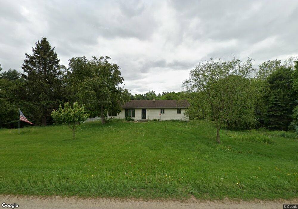
6770 Poorman Rd Battle Creek, MI 49017
Estimated Value: $172,000 - $226,000
3
Beds
1
Bath
1,344
Sq Ft
$150/Sq Ft
Est. Value
About This Home
This home is located at 6770 Poorman Rd, Battle Creek, MI 49017 and is currently estimated at $201,884, approximately $150 per square foot. 6770 Poorman Rd is a home located in Calhoun County with nearby schools including North Pennfield Elementary School, Pennfield Dunlap Elementary School, and Pennfield Middle School.
Ownership History
Date
Name
Owned For
Owner Type
Purchase Details
Closed on
Sep 21, 2018
Sold by
Artis Jeffry M and Artis Terral L
Bought by
Paulson Kristopher
Current Estimated Value
Home Financials for this Owner
Home Financials are based on the most recent Mortgage that was taken out on this home.
Original Mortgage
$129,797
Outstanding Balance
$113,201
Interest Rate
4.6%
Mortgage Type
New Conventional
Estimated Equity
$88,683
Create a Home Valuation Report for This Property
The Home Valuation Report is an in-depth analysis detailing your home's value as well as a comparison with similar homes in the area
Home Values in the Area
Average Home Value in this Area
Purchase History
| Date | Buyer | Sale Price | Title Company |
|---|---|---|---|
| Paulson Kristopher | $1,285,000 | Devon Title Co |
Source: Public Records
Mortgage History
| Date | Status | Borrower | Loan Amount |
|---|---|---|---|
| Open | Paulson Kristopher | $129,797 |
Source: Public Records
Tax History Compared to Growth
Tax History
| Year | Tax Paid | Tax Assessment Tax Assessment Total Assessment is a certain percentage of the fair market value that is determined by local assessors to be the total taxable value of land and additions on the property. | Land | Improvement |
|---|---|---|---|---|
| 2025 | $2,652 | $97,100 | $0 | $0 |
| 2024 | $1,207 | $84,200 | $0 | $0 |
| 2023 | $2,339 | $74,030 | $0 | $0 |
| 2022 | $1,095 | $67,710 | $0 | $0 |
| 2021 | $2,298 | $61,380 | $0 | $0 |
| 2020 | $2,260 | $58,090 | $0 | $0 |
| 2019 | $2,123 | $51,450 | $0 | $0 |
| 2018 | $1,905 | $49,240 | $6,450 | $42,790 |
| 2017 | $0 | $50,290 | $0 | $0 |
| 2016 | $0 | $47,410 | $0 | $0 |
| 2015 | -- | $48,800 | $16,424 | $32,376 |
| 2014 | -- | $45,380 | $16,424 | $28,956 |
Source: Public Records
Map
Nearby Homes
- 6475 Poorman Rd
- 22150 East Ave N
- 21520 Swafford Rd
- 850 Sylvan Dr
- 855 Sylvan Dr
- 118 Red Bird Ln
- 22511 Capital Ave NE
- V/L East Ave N
- 6381 Saint Marys Lake Rd
- 22770 Waubascon Rd
- Vl Waubascon Rd Lot Unit WP001
- VL Waubascon Rd Lot#wp001
- 0 Bauman Rd Unit 25034846
- 0 Bauman Rd Unit 25034837
- 8290 Huff Rd
- 14475 North Ave
- 5658 Bauman Rd
- 106 Buckingham
- 9559 Brian Dr
- 23720 M 78
- 6751 Poorman Rd
- 6851 Poorman Rd
- 6715 Poorman Rd
- 6700 Poorman Rd
- 6951 Poorman Rd
- 23101 East Ave N
- 22933 East Ave N
- 6625 Poorman Rd
- 22927 East Ave N
- 7205 Poorman Rd
- 0 Poorman Rd
- 22819 East Ave N
- 22980 East Ave N
- 22875 East Ave N
- 23050 East Ave N
- 23104 East Ave N
- 7081 Poorman Rd
- 6600 Poorman Rd
- 22813 East Ave N
- 7068 Poorman Rd