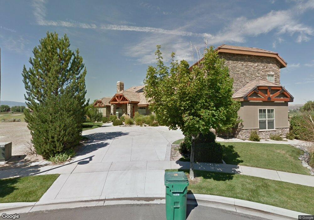
6773 Eagle Wing Dr Sparks, NV 89436
Wingfield Springs NeighborhoodEstimated Value: $1,305,000 - $1,561,000
4
Beds
4
Baths
3,857
Sq Ft
$376/Sq Ft
Est. Value
About This Home
This home is located at 6773 Eagle Wing Dr, Sparks, NV 89436 and is currently estimated at $1,450,996, approximately $376 per square foot. 6773 Eagle Wing Dr is a home located in Washoe County with nearby schools including Van Gorder Elementary School, Sky Ranch Middle School, and Spanish Springs High School.
Ownership History
Date
Name
Owned For
Owner Type
Purchase Details
Closed on
Jun 17, 2005
Sold by
Frazer Edward R and Frazer Kathleen D
Bought by
Boyer James D
Current Estimated Value
Home Financials for this Owner
Home Financials are based on the most recent Mortgage that was taken out on this home.
Original Mortgage
$766,400
Interest Rate
5.72%
Mortgage Type
Fannie Mae Freddie Mac
Purchase Details
Closed on
Feb 8, 1999
Sold by
Whittemore Harvey and Whittemore Annette F
Bought by
Frazer Edward R
Purchase Details
Closed on
Aug 17, 1998
Sold by
Bunker Richard W and Bunker Carole Ann
Bought by
Whittemore Harvey and Whittemore Annette F
Purchase Details
Closed on
Jul 30, 1997
Sold by
Loeb Enterprises Ltd Liability Company
Bought by
Bunker Richard W and Bunker Carole Ann
Create a Home Valuation Report for This Property
The Home Valuation Report is an in-depth analysis detailing your home's value as well as a comparison with similar homes in the area
Home Values in the Area
Average Home Value in this Area
Purchase History
| Date | Buyer | Sale Price | Title Company |
|---|---|---|---|
| Boyer James D | $958,000 | First Centennial Title Co | |
| Frazer Edward R | $620,000 | -- | |
| Whittemore Harvey | $135,000 | -- | |
| Bunker Richard W | $109,000 | First American Title Co |
Source: Public Records
Mortgage History
| Date | Status | Borrower | Loan Amount |
|---|---|---|---|
| Closed | Boyer James D | $766,400 |
Source: Public Records
Tax History
| Year | Tax Paid | Tax Assessment Tax Assessment Total Assessment is a certain percentage of the fair market value that is determined by local assessors to be the total taxable value of land and additions on the property. | Land | Improvement |
|---|---|---|---|---|
| 2026 | -- | $408,208 | $69,300 | $338,909 |
| 2025 | $9,332 | $409,968 | $65,100 | $344,868 |
| 2024 | $9,332 | $410,493 | $63,000 | $347,493 |
| 2023 | $9,065 | $393,708 | $63,700 | $330,008 |
| 2022 | $8,795 | $326,781 | $51,450 | $275,331 |
| 2021 | $8,539 | $315,277 | $41,178 | $274,099 |
| 2020 | $8,287 | $315,986 | $41,178 | $274,808 |
| 2019 | $8,052 | $307,513 | $38,675 | $268,838 |
| 2018 | $7,819 | $284,503 | $35,490 | $249,013 |
| 2017 | $7,591 | $267,872 | $34,300 | $233,572 |
| 2016 | $7,397 | $263,369 | $34,300 | $229,069 |
| 2015 | $1,868 | $260,028 | $26,950 | $233,078 |
| 2014 | $7,168 | $237,116 | $18,865 | $218,251 |
| 2013 | -- | $191,792 | $15,680 | $176,112 |
Source: Public Records
Map
Nearby Homes
- 6713 Eagle Wing Cir
- 6726 Runnymede Dr
- 7279 Silver King Dr
- 6970 Island Queen Ct
- 6790 Talmedge Cir
- 6831 Island Queen Ct Unit 16
- 7240 Silver King Dr
- 7201 Silver King Dr
- 6894 Cinnamon Dr
- 2880 Thistle Belle Ct
- 6572 Angels Orchard Dr
- 3647 Lepus Dr
- 7290 Island Queen Dr
- 7381 Silver King Dr
- 3031 Honey Arbor Way
- 6787 Centaurus Dr
- 7214 Grand Island Dr
- 2850 Friar Rock Ct
- 7045 Krug Dr
- 2880 Friar Rock Ct
- 6773 Eagle Wing Cir
- 6761 Eagle Wing Cir
- 6785 Eagle Wing Cir
- 6785 Eagle Wing Dr
- 6749 Eagle Wing Cir
- 6805 Eagle Wing Dr
- 6772 Eagle Wing Dr
- 6737 Eagle Wing Dr
- 3095 Diamond Dust Ct
- 6767 Woodrose Ct Unit 4A
- 6781 Woodrose Ct
- 3085 Diamond Dust Ct
- 6804 Eagle Wing Dr
- 6725 Eagle Wing Dr
- 6725 Eagle Wing Cir
- 6795 Woodrose Ct
- 6812 Eagle Wing Dr
- 6812 Eagle Wing Cir
- 3075 Diamond Dust Ct
- 6713 Eagle Wing Dr
Your Personal Tour Guide
Ask me questions while you tour the home.