67780 Poor Farm Rd High Bridge, WI 54846
Estimated Value: $165,000 - $255,000
--
Bed
--
Bath
--
Sq Ft
5
Acres
About This Home
This home is located at 67780 Poor Farm Rd, High Bridge, WI 54846 and is currently estimated at $203,155. 67780 Poor Farm Rd is a home located in Ashland County with nearby schools including Mellen Public School and House Of The Lord Christian Academy.
Ownership History
Date
Name
Owned For
Owner Type
Purchase Details
Closed on
Sep 8, 2023
Sold by
Benabides Gabriel B and Benabides Tammy L.
Bought by
Falt Ronny L and Falt Kristi E.
Current Estimated Value
Purchase Details
Closed on
Oct 15, 2019
Sold by
Benabides Tammy L and Lindquist Gerald W
Bought by
Benabides Tammy L and Lindquist Gerald W
Home Financials for this Owner
Home Financials are based on the most recent Mortgage that was taken out on this home.
Original Mortgage
$60,000
Interest Rate
3.7%
Mortgage Type
New Conventional
Purchase Details
Closed on
Feb 17, 2017
Sold by
Lindquist Barbara A
Bought by
Lindquist Gerald W
Purchase Details
Closed on
Jul 21, 2006
Sold by
Lindvista Barbara A
Bought by
Lindsust Gerald W and Lindsust Tammy L
Create a Home Valuation Report for This Property
The Home Valuation Report is an in-depth analysis detailing your home's value as well as a comparison with similar homes in the area
Home Values in the Area
Average Home Value in this Area
Purchase History
| Date | Buyer | Sale Price | Title Company |
|---|---|---|---|
| Falt Ronny L | $200,000 | Choice Title, Llc | |
| Benabides Tammy L | -- | None Available | |
| Lindquist Gerald W | $75,000 | -- | |
| Lindsust Gerald W | -- | None Available |
Source: Public Records
Mortgage History
| Date | Status | Borrower | Loan Amount |
|---|---|---|---|
| Previous Owner | Benabides Tammy L | $60,000 | |
| Previous Owner | Lindquist Gerald W | $10,000 | |
| Previous Owner | Lindguist Gerald W | $20,000 |
Source: Public Records
Tax History Compared to Growth
Tax History
| Year | Tax Paid | Tax Assessment Tax Assessment Total Assessment is a certain percentage of the fair market value that is determined by local assessors to be the total taxable value of land and additions on the property. | Land | Improvement |
|---|---|---|---|---|
| 2024 | $2,529 | $182,700 | $26,000 | $156,700 |
| 2023 | $1,343 | $75,700 | $6,500 | $69,200 |
| 2022 | $1,367 | $75,700 | $6,500 | $69,200 |
| 2021 | $1,599 | $75,700 | $6,500 | $69,200 |
| 2020 | $1,219 | $75,700 | $6,500 | $69,200 |
| 2019 | $1,066 | $75,700 | $6,500 | $69,200 |
| 2018 | $1,038 | $75,700 | $6,500 | $69,200 |
| 2017 | $1,213 | $75,700 | $6,500 | $69,200 |
| 2016 | $1,189 | $75,700 | $6,500 | $69,200 |
| 2015 | $1,402 | $75,700 | $6,500 | $69,200 |
| 2014 | $1,151 | $75,700 | $6,500 | $69,200 |
| 2013 | $1,216 | $75,700 | $6,500 | $69,200 |
Source: Public Records
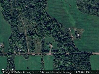
Map
Nearby Homes
- 39243 N York Rd
- 66282 County Road C
- TBD Marengo River Rd E
- 67131 Marengo River Rd E
- 000 van Ornum Rd
- 90 ACRES Kornstead Rd
- 72303 Pufal Rd
- ON Kornstead Rd Unit 80± acre
- 36550 Loon Lake Dr
- 61817 Marengo River Rd
- Lot 2 CSM 786 Wisconsin 169
- 137 E Tyler Ave
- 421 S Main St
- 427 Lake Dr
- ON Will Rd Unit 40 acres
- ON Pufal Rd
- 75767 Town Road 37
- 30775 Petrin Rd
- ON W Lake Dr Unit 79+/- A
- 0000 Government Rd