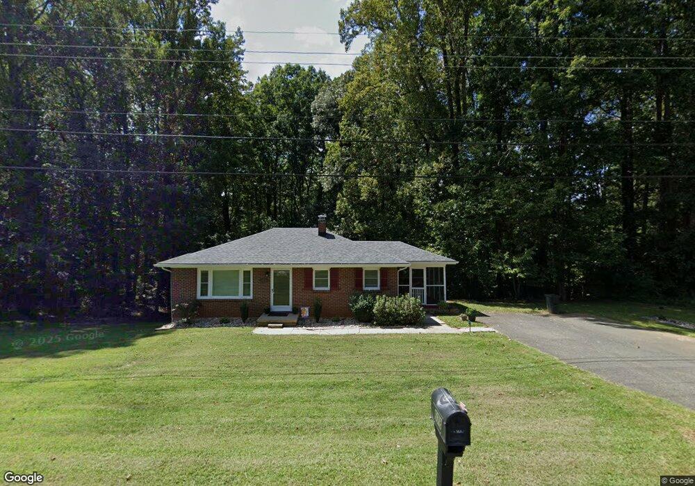
678 Dixie Airport Rd Madison Heights, VA 24572
Estimated Value: $145,806 - $214,000
2
Beds
1
Bath
918
Sq Ft
$194/Sq Ft
Est. Value
About This Home
This home is located at 678 Dixie Airport Rd, Madison Heights, VA 24572 and is currently estimated at $177,952, approximately $193 per square foot. 678 Dixie Airport Rd is a home located in Amherst County with nearby schools including Amelon Elementary School, Monelison Middle School, and Amherst County High School.
Ownership History
Date
Name
Owned For
Owner Type
Purchase Details
Closed on
Nov 2, 2020
Sold by
Miller Theta B
Bought by
Miller Theta B
Current Estimated Value
Purchase Details
Closed on
Mar 20, 2017
Sold by
Miller Robert A and Miller Alexandra L
Bought by
Miller Theta B
Purchase Details
Closed on
Mar 14, 2017
Sold by
Miller Theta B and The Ann D Baldwin Revocable Tr
Bought by
Miller Robert A and Miller Alexandra L
Purchase Details
Closed on
Mar 7, 2013
Sold by
Baldwin Ann D
Bought by
Baldwin Ann D
Create a Home Valuation Report for This Property
The Home Valuation Report is an in-depth analysis detailing your home's value as well as a comparison with similar homes in the area
Home Values in the Area
Average Home Value in this Area
Purchase History
| Date | Buyer | Sale Price | Title Company |
|---|---|---|---|
| Miller Theta B | -- | None Available | |
| Miller Theta B | $100,000 | None Available | |
| Miller Robert A | -- | None Available | |
| Baldwin Ann D | -- | None Available |
Source: Public Records
Tax History Compared to Growth
Tax History
| Year | Tax Paid | Tax Assessment Tax Assessment Total Assessment is a certain percentage of the fair market value that is determined by local assessors to be the total taxable value of land and additions on the property. | Land | Improvement |
|---|---|---|---|---|
| 2025 | $528 | $86,600 | $20,000 | $66,600 |
| 2024 | $528 | $86,600 | $20,000 | $66,600 |
| 2023 | $528 | $86,600 | $20,000 | $66,600 |
| 2022 | $528 | $86,600 | $20,000 | $66,600 |
| 2021 | $528 | $86,600 | $20,000 | $66,600 |
| 2020 | $528 | $86,600 | $20,000 | $66,600 |
| 2019 | $539 | $88,300 | $26,000 | $62,300 |
| 2018 | $539 | $88,300 | $26,000 | $62,300 |
| 2017 | $539 | $88,300 | $26,000 | $62,300 |
| 2016 | $539 | $88,300 | $26,000 | $62,300 |
| 2015 | $494 | $88,300 | $26,000 | $62,300 |
| 2014 | $494 | $88,300 | $26,000 | $62,300 |
Source: Public Records
Map
Nearby Homes
- 121 Crestwood Dr
- 250 S Wood Duck Dr
- 150 Glenwood Dr
- 327 Dixie Airport Rd
- 272 Dixie Airport Rd
- 505 Royal Gardens Ct
- 0 Commonwealth Dr Unit 361760
- 51 Patrick Ct
- 151 Stratford Place
- TBD Stratford Place Unit 39
- 0 Lot 10 & 11 Stoney Creek Dr Unit 345183
- 164 Glade Rd
- 289 Todd Ln
- 4123 S Amherst Hwy
- 1769 Izaak Walton Rd
- 0 Monticello Ln
- 255 Glade Rd
- 172 Stoney Creek Dr
- 0 Izaak Walton Rd
- 11 Stoney Creek Dr
- 683 Dixie Airport Rd
- 656 Dixie Airport Rd
- 695 Dixie Airport Rd
- 671 Dixie Airport Rd
- 702 Dixie Airport Rd
- 654 Dixie Airport Rd
- 665 Dixie Airport Rd
- 701 Dixie Airport Rd
- 705 Dixie Airport Rd
- 145 Shearingham Dr
- 703 Dixie Airport Rd
- 712 Dixie Airport Rd
- 642 Dixie Airport Rd
- 122 Lamont Dr
- 149 Shearingham Dr
- 715 Dixie Airport Rd
- 128 Lamont Dr
- 161 Shearingham Dr
- 0 Lamont Dr
- 170172 Pine Acres Dr