Estimated Value: $330,000 - $397,195
4
Beds
1
Bath
1,550
Sq Ft
$233/Sq Ft
Est. Value
About This Home
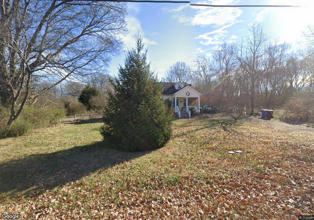
This home is located at 678 N Wright Rd, Alcoa, TN 37701 and is currently estimated at $360,549, approximately $232 per square foot. 678 N Wright Rd is a home located in Blount County with nearby schools including Alcoa Elementary School, Alcoa Middle School, and Alcoa High School.
Ownership History
Date
Name
Owned For
Owner Type
Purchase Details
Closed on
Aug 31, 2009
Sold by
Epd Development Llc
Bought by
Atwood Laura
Current Estimated Value
Home Financials for this Owner
Home Financials are based on the most recent Mortgage that was taken out on this home.
Original Mortgage
$135,230
Outstanding Balance
$88,081
Interest Rate
5.19%
Estimated Equity
$272,468
Purchase Details
Closed on
Mar 1, 2007
Sold by
First Tennessee Bank N A
Bought by
Epd Development Llc
Purchase Details
Closed on
Feb 23, 2007
Sold by
First Tennessee Bank N A
Bought by
Epd Development Llc
Purchase Details
Closed on
Aug 16, 2006
Bought by
First Tennessee Bank N A
Purchase Details
Closed on
Oct 8, 1993
Sold by
Dishman Lassie
Bought by
Dishman Thoma Roe
Purchase Details
Closed on
Aug 11, 1980
Bought by
Dishman Lossie E
Create a Home Valuation Report for This Property
The Home Valuation Report is an in-depth analysis detailing your home's value as well as a comparison with similar homes in the area
Home Values in the Area
Average Home Value in this Area
Purchase History
| Date | Buyer | Sale Price | Title Company |
|---|---|---|---|
| Atwood Laura | $139,900 | -- | |
| Epd Development Llc | $115,000 | -- | |
| Epd Development Llc | $115,000 | -- | |
| First Tennessee Bank N A | $109,600 | -- | |
| Dishman Thoma Roe | $42,900 | -- | |
| Dishman Lossie E | -- | -- |
Source: Public Records
Mortgage History
| Date | Status | Borrower | Loan Amount |
|---|---|---|---|
| Open | Dishman Lossie E | $135,230 |
Source: Public Records
Tax History
| Year | Tax Paid | Tax Assessment Tax Assessment Total Assessment is a certain percentage of the fair market value that is determined by local assessors to be the total taxable value of land and additions on the property. | Land | Improvement |
|---|---|---|---|---|
| 2025 | -- | $73,200 | $26,550 | $46,650 |
| 2024 | -- | $73,200 | $26,550 | $46,650 |
| 2023 | $2,401 | $73,200 | $26,550 | $46,650 |
| 2022 | $2,048 | $43,200 | $17,275 | $25,925 |
| 2021 | $2,048 | $43,200 | $17,275 | $25,925 |
| 2020 | $2,048 | $43,200 | $17,275 | $25,925 |
| 2019 | $2,048 | $43,200 | $17,275 | $25,925 |
| 2018 | $1,785 | $40,300 | $17,275 | $23,025 |
| 2017 | $1,785 | $40,300 | $17,275 | $23,025 |
| 2016 | $1,785 | $40,300 | $17,275 | $23,025 |
| 2015 | $1,656 | $40,300 | $17,275 | $23,025 |
| 2014 | $1,472 | $40,300 | $17,275 | $23,025 |
| 2013 | $1,472 | $35,825 | $0 | $0 |
Source: Public Records
Map
Nearby Homes
- 835 E Lincoln Rd
- 104 Roosevelt St
- 203 Allen Ct
- 2392 Cecelia Ave
- 204 Seventh St
- 101 Freemont Cir
- 2620 Marshall St
- 471 E Lincoln Rd
- 0 N Wright Rd
- 115 Howard St
- 966 Poplar St
- 922 Poplar St
- 2638 Orton Dr
- 200 N 5th St
- 0 Old Knoxville Pike
- 1240 N Wright Rd
- 2501 Cecelia Ave
- 106 S 5th St
- 602 Mcginley St
- 203 Mavis Ln
- 690 N Wright Rd
- 679 N Wright Rd
- 665 N Wright Rd
- 685 N Wright Rd
- 704 N Wright Rd
- 693 N Wright Rd
- 657 N Wright Rd
- 650 N Wright Rd
- 701 N Wright Rd
- 651 N Wright Rd
- 707 N Wright Rd
- 722 N Wright Rd
- 638 N Wright Rd
- 639 N Wright Rd
- 715 N Wright Rd
- 630 N Wright Rd
- 725 N Wright Rd
- 732 N Wright Rd
- 627 N Wright Rd
- 740 N Wright Rd
Your Personal Tour Guide
Ask me questions while you tour the home.