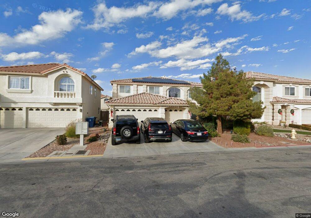
678 Pepperwood Grove Ct Las Vegas, NV 89183
Silverado Ranch NeighborhoodEstimated Value: $586,385 - $682,000
6
Beds
3
Baths
3,210
Sq Ft
$199/Sq Ft
Est. Value
About This Home
This home is located at 678 Pepperwood Grove Ct, Las Vegas, NV 89183 and is currently estimated at $639,846, approximately $199 per square foot. 678 Pepperwood Grove Ct is a home located in Clark County with nearby schools including John C. Bass Elementary School, Charles Silvestri Junior High School, and Liberty High School.
Ownership History
Date
Name
Owned For
Owner Type
Purchase Details
Closed on
May 21, 2024
Sold by
Perera Jayani and Perera Adauctus G
Bought by
Perera Family Trust and Perera
Current Estimated Value
Purchase Details
Closed on
May 21, 2007
Sold by
Harris Michael V and Harris Debra F
Bought by
Perera Adauctus G and Perera Kdona
Home Financials for this Owner
Home Financials are based on the most recent Mortgage that was taken out on this home.
Original Mortgage
$387,500
Interest Rate
6.62%
Mortgage Type
Unknown
Purchase Details
Closed on
Nov 24, 2004
Sold by
Canyons Iv Inc
Bought by
Harris Michael and Harris Debra F
Home Financials for this Owner
Home Financials are based on the most recent Mortgage that was taken out on this home.
Original Mortgage
$337,300
Interest Rate
5.7%
Mortgage Type
Unknown
Create a Home Valuation Report for This Property
The Home Valuation Report is an in-depth analysis detailing your home's value as well as a comparison with similar homes in the area
Home Values in the Area
Average Home Value in this Area
Purchase History
| Date | Buyer | Sale Price | Title Company |
|---|---|---|---|
| Perera Family Trust | -- | None Listed On Document | |
| Perera Adauctus G | $484,400 | Land Title Of Nevada | |
| Harris Michael | $410,250 | First Amer Title Co Of Nv |
Source: Public Records
Mortgage History
| Date | Status | Borrower | Loan Amount |
|---|---|---|---|
| Previous Owner | Perera Adauctus G | $387,500 | |
| Previous Owner | Harris Michael | $337,300 | |
| Closed | Harris Michael | $42,150 |
Source: Public Records
Tax History Compared to Growth
Tax History
| Year | Tax Paid | Tax Assessment Tax Assessment Total Assessment is a certain percentage of the fair market value that is determined by local assessors to be the total taxable value of land and additions on the property. | Land | Improvement |
|---|---|---|---|---|
| 2025 | $2,928 | $176,811 | $54,950 | $121,861 |
| 2024 | $2,843 | $176,811 | $54,950 | $121,861 |
| 2023 | $2,320 | $163,648 | $48,300 | $115,348 |
| 2022 | $2,761 | $141,495 | $36,750 | $104,745 |
| 2021 | $2,680 | $134,198 | $34,650 | $99,548 |
| 2020 | $2,599 | $131,123 | $32,550 | $98,573 |
| 2019 | $2,524 | $126,377 | $29,400 | $96,977 |
| 2018 | $2,450 | $116,969 | $24,500 | $92,469 |
| 2017 | $3,131 | $106,766 | $23,450 | $83,316 |
| 2016 | $2,320 | $95,317 | $17,850 | $77,467 |
| 2015 | $2,315 | $81,321 | $16,100 | $65,221 |
| 2014 | $2,248 | $74,363 | $10,500 | $63,863 |
Source: Public Records
Map
Nearby Homes
- 577 Leap Frog Ave
- 554 Campus Oaks Ct
- 527 Leap Frog Ave
- 10590 Medicine Bow St
- 10656 Timber Stand St
- 681 Stone Hammer Ave
- 484 Fiddlehead Ave
- 10802 Serendipity Ct
- 647 Great River Ave
- 855 Beartooth Falls Ct
- 10568 Salmon Leap St
- 10680 Spruce Bough St
- 10479 Baby Bud St
- 645 Soaring Wings Ave
- 895 Beartooth Falls Ct
- 628 Soaring Wings Ave
- 10968 Geyser Peak St
- 967 Coronado Peak Ave
- 854 Sheerwater Ave
- 3756 Toscanella Ave
- 668 Pepperwood Grove Ct
- 684 Pepperwood Grove Ct
- 675 Pacific Star Ct
- 690 Pepperwood Grove Ct
- 660 Pepperwood Grove Ct
- 669 Pacific Star Ct
- 681 Pacific Star Ct
- 663 Pacific Star Ct
- 679 Pepperwood Grove Ct
- 687 Pacific Star Ct
- 10744 Wildhurst St
- 696 Pepperwood Grove Ct
- 652 Pepperwood Grove Ct
- 691 Pepperwood Grove Ct
- 657 Pacific Star Ct
- 10750 Wildhurst St
- 693 Pacific Star Ct
- 697 Pepperwood Grove Ct
- 10756 Wildhurst St
- 649 Pacific Star Ct