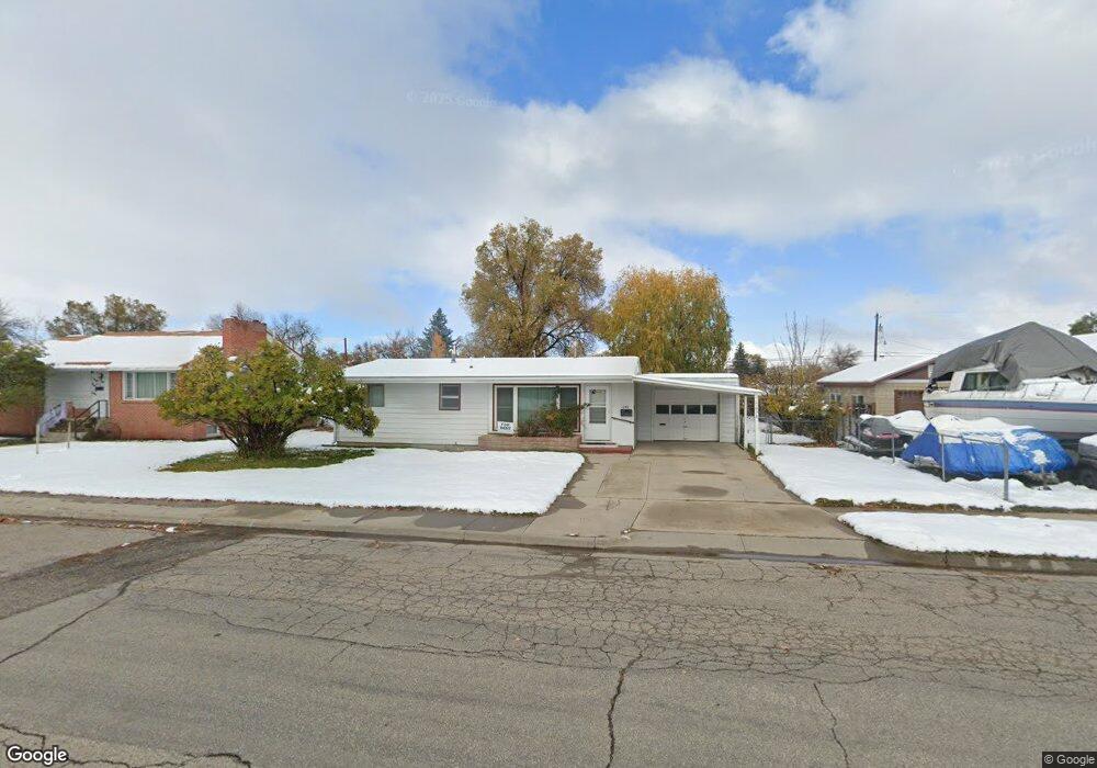
678 Shoshone St Lander, WY 82520
Estimated Value: $325,000 - $398,000
2
Beds
1
Bath
1,194
Sq Ft
$299/Sq Ft
Est. Value
About This Home
This home is located at 678 Shoshone St, Lander, WY 82520 and is currently estimated at $356,880, approximately $298 per square foot. 678 Shoshone St is a home located in Fremont County with nearby schools including Lander Valley High School and Lander Christian Academy.
Ownership History
Date
Name
Owned For
Owner Type
Purchase Details
Closed on
Sep 18, 2019
Sold by
Ferry Sandra Lee and Outland Cheryl Ann
Bought by
Masson William John
Current Estimated Value
Home Financials for this Owner
Home Financials are based on the most recent Mortgage that was taken out on this home.
Original Mortgage
$104,500
Outstanding Balance
$91,534
Interest Rate
3.6%
Mortgage Type
New Conventional
Estimated Equity
$265,346
Create a Home Valuation Report for This Property
The Home Valuation Report is an in-depth analysis detailing your home's value as well as a comparison with similar homes in the area
Home Values in the Area
Average Home Value in this Area
Purchase History
| Date | Buyer | Sale Price | Title Company |
|---|---|---|---|
| Masson William John | -- | First American Title Ins Co |
Source: Public Records
Mortgage History
| Date | Status | Borrower | Loan Amount |
|---|---|---|---|
| Open | Masson William John | $104,500 |
Source: Public Records
Tax History Compared to Growth
Tax History
| Year | Tax Paid | Tax Assessment Tax Assessment Total Assessment is a certain percentage of the fair market value that is determined by local assessors to be the total taxable value of land and additions on the property. | Land | Improvement |
|---|---|---|---|---|
| 2025 | $1,853 | $18,602 | $4,216 | $14,386 |
| 2024 | $1,853 | $24,004 | $5,622 | $18,382 |
| 2023 | $1,730 | $22,595 | $5,082 | $17,513 |
| 2022 | $1,331 | $17,765 | $5,082 | $12,683 |
| 2021 | $1,209 | $15,615 | $4,924 | $10,691 |
| 2020 | $1,170 | $15,146 | $4,924 | $10,222 |
| 2019 | $1,162 | $14,801 | $4,924 | $9,877 |
| 2018 | $900 | $14,344 | $4,924 | $9,420 |
| 2017 | $882 | $14,091 | $4,924 | $9,167 |
| 2016 | $944 | $14,886 | $4,924 | $9,962 |
| 2015 | $918 | $14,684 | $4,924 | $9,760 |
| 2014 | $835 | $13,651 | $4,924 | $8,727 |
Source: Public Records
Map
Nearby Homes
- 605 Cliff St
- 791 Garner Dr
- 824 Vance Dr
- 796 Welch Blvd
- 333 Cascade St
- 960 Dabich Ave
- 275 Cascade St
- 835 Garfield St
- 120 Roaring Fork Ct
- 617 Main St Unit LotWP001
- 975 S 2nd St
- 180 S 10th St
- 230 Capitol St
- 200 Sweetwater St
- 108 Canyon St
- 400 S 1st St
- 360 N 9th St
- 200 Irwin Ln
- 685 Cedar St
- 442 Eugene St
- 658 Shoshone St
- 696 Shoshone St
- 623 Shoshone St
- 637 Shoshone St
- 611 Shoshone St
- 746 S 7th St
- 805 S 6th St
- 679 Cascade St
- 810 S 7th St
- 815 S 6th St
- 839 S 6th St
- 839 S 6th St Unit Shoshone St
- 708 Shoshone St
- 805 S 7th St
- 691 Cascade St
- 845 S 6th St
- 845 S 6th St Unit Shoshone St
- 845 S 6th St Unit S. 9th St.
- 822 S 7th St
- 745 S 7th St