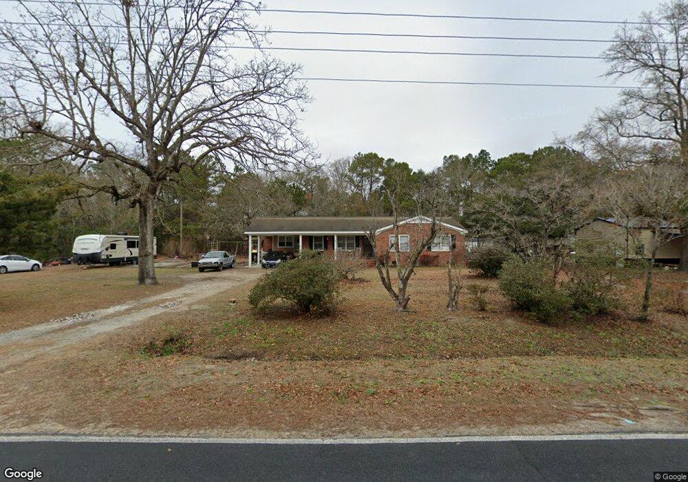
678 Taft Rd SW Supply, NC 28462
Estimated Value: $216,000 - $272,000
3
Beds
2
Baths
1,260
Sq Ft
$197/Sq Ft
Est. Value
About This Home
This home is located at 678 Taft Rd SW, Supply, NC 28462 and is currently estimated at $247,902, approximately $196 per square foot. 678 Taft Rd SW is a home located in Brunswick County with nearby schools including Virginia Williamson Elementary School, Cedar Grove Middle School, and West Brunswick High School.
Ownership History
Date
Name
Owned For
Owner Type
Purchase Details
Closed on
Apr 30, 2009
Sold by
Evans Barry Keith and Evans Anita Gales
Bought by
Evans Sarah
Current Estimated Value
Home Financials for this Owner
Home Financials are based on the most recent Mortgage that was taken out on this home.
Original Mortgage
$58,913
Interest Rate
5.01%
Mortgage Type
FHA
Purchase Details
Closed on
Jun 20, 2006
Sold by
Evans Barry Keith and Evans Anita Gales
Bought by
Evans Christopher D
Purchase Details
Closed on
Mar 1, 2006
Sold by
Evans Barry Keith and Evans Anita Gales
Bought by
Evans Christopher D
Create a Home Valuation Report for This Property
The Home Valuation Report is an in-depth analysis detailing your home's value as well as a comparison with similar homes in the area
Home Values in the Area
Average Home Value in this Area
Purchase History
| Date | Buyer | Sale Price | Title Company |
|---|---|---|---|
| Evans Sarah | $60,000 | None Available | |
| Evans Christopher D | -- | Chicago Title Insurance Comp | |
| Evans Christopher D | -- | None Available |
Source: Public Records
Mortgage History
| Date | Status | Borrower | Loan Amount |
|---|---|---|---|
| Closed | Evans Sarah | $58,913 |
Source: Public Records
Tax History Compared to Growth
Tax History
| Year | Tax Paid | Tax Assessment Tax Assessment Total Assessment is a certain percentage of the fair market value that is determined by local assessors to be the total taxable value of land and additions on the property. | Land | Improvement |
|---|---|---|---|---|
| 2025 | $727 | $154,130 | $30,890 | $123,240 |
| 2024 | $727 | $154,130 | $30,890 | $123,240 |
| 2023 | $656 | $154,130 | $30,890 | $123,240 |
| 2022 | $656 | $94,020 | $24,710 | $69,310 |
| 2021 | $656 | $94,020 | $24,710 | $69,310 |
| 2020 | $656 | $94,020 | $24,710 | $69,310 |
| 2019 | $619 | $24,710 | $24,710 | $0 |
| 2018 | $557 | $24,320 | $21,620 | $2,700 |
| 2017 | $557 | $24,320 | $21,620 | $2,700 |
| 2016 | $532 | $24,320 | $21,620 | $2,700 |
| 2015 | $532 | $89,130 | $21,620 | $67,510 |
| 2014 | $614 | $116,110 | $46,330 | $69,780 |
Source: Public Records
Map
Nearby Homes
- 665 Pelican Roost Dr SW
- 2.25 Ac Taft Rd SW
- 1071 Windward Dr N
- 712 Sand Castle Dr SW
- 587 Mary Lou Ln SW
- 528 Mary Lou Ln SW
- 534 Mary Lou Ln SW
- 1114 Windward Dr N
- 691 Eastwind Dr SW
- 1135 Wilma Ave SW
- 679 Westwind Dr SW
- 1150 Wilma Ave SW
- 1024 SW Maple View Rd
- 1168 Wilma Ave SW
- 613 Southwind Dr SW
- 1106 S Windward Dr SW
- 580 S Windward Dr SW
- 568 S Windward Dr SW
- Midland_2 Plan at Ruffins River Landing
- Cotswold_3 Plan at Ruffins River Landing
- 686 Taft Rd SW
- 686 Sea Wind Ct SW
- 711 Taft Rd SW
- 654 Sea Wind Ct SW
- 668 Pelican Roost Dr SW
- 1017 Easterly Dr SW
- 605 Pelican Roost Dr SW
- 699 Pelican Roost Dr SW
- 695 Pelican Roost Dr SW
- 683 Sea Wind Ct SW
- 630 Taft Rd SW
- 1036 Easterly Dr SW
- 698 Pelican Roost Dr SW
- 718 Taft Rd SW
- 640 Sand Castle Dr SW
- 642 Sea Wind Ct SW
- 644 Sand Castle Dr SW
- 1050 Easterly Dr SW
- 637 Sand Castle Dr SW
- 2.53 Ac Taft Rd SW