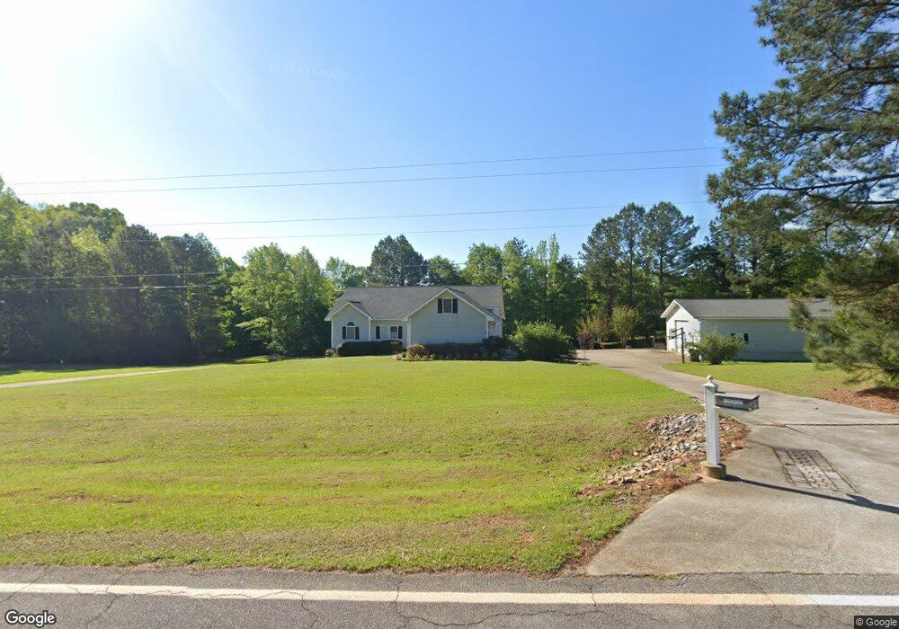
678 Vickery Rd Meansville, GA 30256
Estimated Value: $361,000 - $469,000
3
Beds
2
Baths
2,080
Sq Ft
$192/Sq Ft
Est. Value
About This Home
This home is located at 678 Vickery Rd, Meansville, GA 30256 and is currently estimated at $398,806, approximately $191 per square foot. 678 Vickery Rd is a home located in Upson County with nearby schools including Upson-Lee South Elementary School, Upson-Lee North Elementary School, and Upson-Lee Middle School.
Ownership History
Date
Name
Owned For
Owner Type
Purchase Details
Closed on
May 20, 2019
Sold by
Dillard Elmer Gene
Bought by
Draime Sean P
Current Estimated Value
Home Financials for this Owner
Home Financials are based on the most recent Mortgage that was taken out on this home.
Original Mortgage
$299,570
Outstanding Balance
$261,747
Interest Rate
4.1%
Mortgage Type
New Conventional
Estimated Equity
$137,059
Purchase Details
Closed on
May 1, 2019
Sold by
Dillard Randall J
Bought by
Dillard Elmer Gene and Dillard Anita P
Home Financials for this Owner
Home Financials are based on the most recent Mortgage that was taken out on this home.
Original Mortgage
$299,570
Outstanding Balance
$261,747
Interest Rate
4.1%
Mortgage Type
New Conventional
Estimated Equity
$137,059
Create a Home Valuation Report for This Property
The Home Valuation Report is an in-depth analysis detailing your home's value as well as a comparison with similar homes in the area
Home Values in the Area
Average Home Value in this Area
Purchase History
| Date | Buyer | Sale Price | Title Company |
|---|---|---|---|
| Draime Sean P | $292,500 | -- | |
| Dillard Elmer Gene | -- | -- |
Source: Public Records
Mortgage History
| Date | Status | Borrower | Loan Amount |
|---|---|---|---|
| Open | Draime Sean P | $299,570 |
Source: Public Records
Tax History Compared to Growth
Tax History
| Year | Tax Paid | Tax Assessment Tax Assessment Total Assessment is a certain percentage of the fair market value that is determined by local assessors to be the total taxable value of land and additions on the property. | Land | Improvement |
|---|---|---|---|---|
| 2024 | $3,415 | $134,095 | $14,459 | $119,636 |
| 2023 | $3,390 | $132,079 | $14,459 | $117,620 |
| 2022 | $2,838 | $102,354 | $8,294 | $94,060 |
| 2021 | $2,338 | $88,712 | $8,293 | $80,419 |
| 2020 | $2,234 | $79,206 | $7,209 | $71,997 |
| 2019 | $2,441 | $79,663 | $7,209 | $72,454 |
| 2018 | $2,442 | $79,663 | $7,209 | $72,454 |
| 2017 | $2,032 | $60,442 | $7,209 | $53,233 |
| 2016 | $1,968 | $57,570 | $6,007 | $51,563 |
| 2015 | $1,968 | $57,570 | $6,007 | $51,563 |
| 2014 | $2,054 | $59,975 | $8,693 | $51,282 |
Source: Public Records
Map
Nearby Homes
- 205 Willow Rd
- 145 Apple Rd
- 328 Rain Valley Cir
- 325 Rain Valley Cir
- 3854 Us Hwy 19
- 101 Trent Jones Cir
- 259 Bonanza Dr
- 121 Sheppard Rd
- 561 Jugtown Rd
- 124 Brookfield Dr
- 297 Bishop Rd
- 0 Stewart Rd
- 928 Hwy 19
- 2540 Hannahs Mill Rd
- 1243 US Hwy 19
- 781 N Delray Rd
- 0 Daniel Rd Unit 10644862
- 2345 Rose Hill Rd
- 206 Shannon Ct
- 0 Alabama Rd Unit 22813063
- 612 Vickery Rd
- 9 Gassette Rd
- 718 Vickery Rd
- 440 Thompson Rd
- 0 Vickery Rd Unit 2955462
- 0 Vickery Rd Unit 7149848
- 0 Vickery Rd Unit 7354852
- 0 Vickery Rd Unit 11 7379354
- 0 Vickery Rd
- 00 Vickery Rd
- 460 Thompson Rd
- 753 Vickery Rd
- 103 Quigley Ln
- 105 Quigley Ln
- 770 Vickery Rd
- 770 Vickery Rd Unit 10
- 18 Quigley Ln
- 107 Quigley Ln
- 295 Thompson Rd
- 76 Gassette Rd