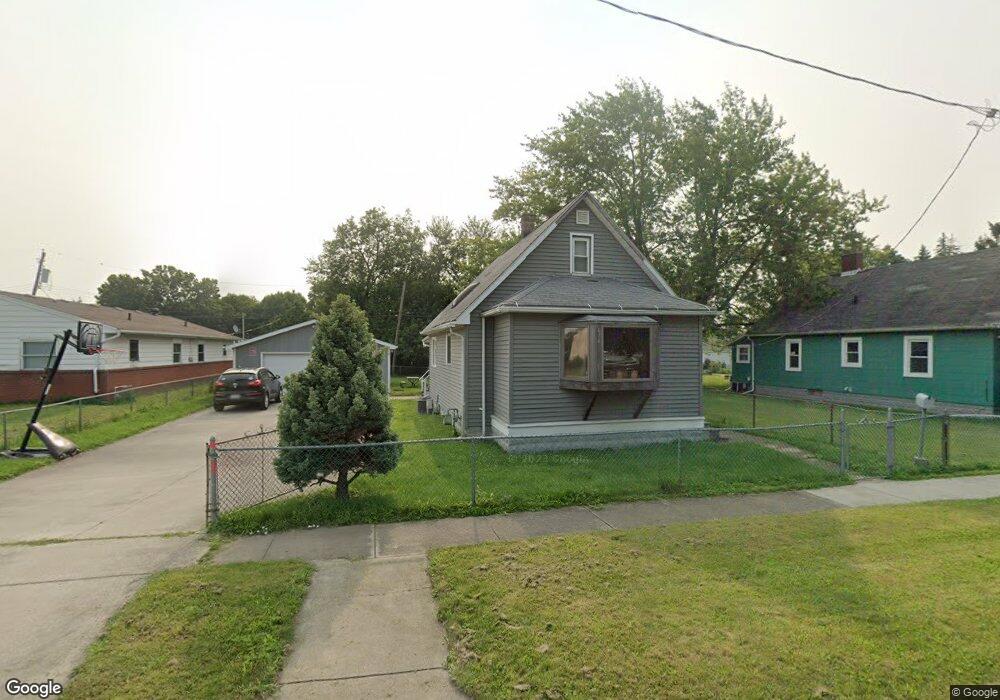
678 Whitlock Ave Toledo, OH 43605
Birmingham NeighborhoodEstimated Value: $88,000 - $93,000
3
Beds
1
Bath
978
Sq Ft
$93/Sq Ft
Est. Value
About This Home
This home is located at 678 Whitlock Ave, Toledo, OH 43605 and is currently estimated at $91,442, approximately $93 per square foot. 678 Whitlock Ave is a home located in Lucas County with nearby schools including Birmingham Elementary School, Waite High School, and Toledo Preparatory Academy.
Ownership History
Date
Name
Owned For
Owner Type
Purchase Details
Closed on
Aug 14, 2002
Sold by
Rife Charles R and Rife Lillian Gertrude
Bought by
Rife Charles R and Rife Lillian Gertrude
Current Estimated Value
Purchase Details
Closed on
Sep 24, 1997
Sold by
Rife Tamra Marie M
Bought by
Rife Charles R
Create a Home Valuation Report for This Property
The Home Valuation Report is an in-depth analysis detailing your home's value as well as a comparison with similar homes in the area
Home Values in the Area
Average Home Value in this Area
Purchase History
| Date | Buyer | Sale Price | Title Company |
|---|---|---|---|
| Rife Charles R | -- | -- | |
| Rife Charles R | -- | -- |
Source: Public Records
Tax History Compared to Growth
Tax History
| Year | Tax Paid | Tax Assessment Tax Assessment Total Assessment is a certain percentage of the fair market value that is determined by local assessors to be the total taxable value of land and additions on the property. | Land | Improvement |
|---|---|---|---|---|
| 2024 | $672 | $20,440 | $6,090 | $14,350 |
| 2023 | $1,148 | $16,415 | $4,935 | $11,480 |
| 2022 | $1,153 | $16,415 | $4,935 | $11,480 |
| 2021 | $1,175 | $16,415 | $4,935 | $11,480 |
| 2020 | $1,291 | $15,960 | $4,795 | $11,165 |
| 2019 | $1,249 | $15,960 | $4,795 | $11,165 |
| 2018 | $1,260 | $15,960 | $4,795 | $11,165 |
| 2017 | $1,281 | $15,610 | $4,690 | $10,920 |
| 2016 | $1,295 | $44,600 | $13,400 | $31,200 |
| 2015 | $1,287 | $44,600 | $13,400 | $31,200 |
| 2014 | $982 | $15,610 | $4,690 | $10,920 |
| 2013 | $982 | $15,610 | $4,690 | $10,920 |
Source: Public Records
Map
Nearby Homes
- 632 Whitlock Ave
- 2320 Valentine St
- 2388 York St
- 2142 Woodford St
- 2220 Genesee St
- 2137 Valentine St
- 325 Whittemore St
- 2052 Front St
- 2142 Consaul St
- 358 Burger St
- 266 Milford St
- 2849 Hartley St
- 26 Magyar St
- 2329 Seaman St
- 15 Van Buren Ave
- 316 Columbus St
- 2803 N Summit St
- 3510 Corduroy Rd
- 2958 Springwood St S
- 2218 Chase St
- 672 Whitlock Ave
- 2650 Stitt St
- 670 Whitlock Ave
- 684 Whitlock Ave
- 2654 Stitt St
- 701 Reineck Dr
- 711 Reineck Dr
- 669 Reineck Dr
- 2656 Stitt St
- 665 Whitlock Ave
- 665 Reineck Dr
- 658 Whitlock Ave
- 719 Reineck Dr
- 661 Reineck Dr
- 725 Reineck Dr
- 659 Whitlock Ave
- 731 Reineck Dr
- 648 Whitlock Ave
- 646 Whitlock Ave
- 651 Whitlock Ave