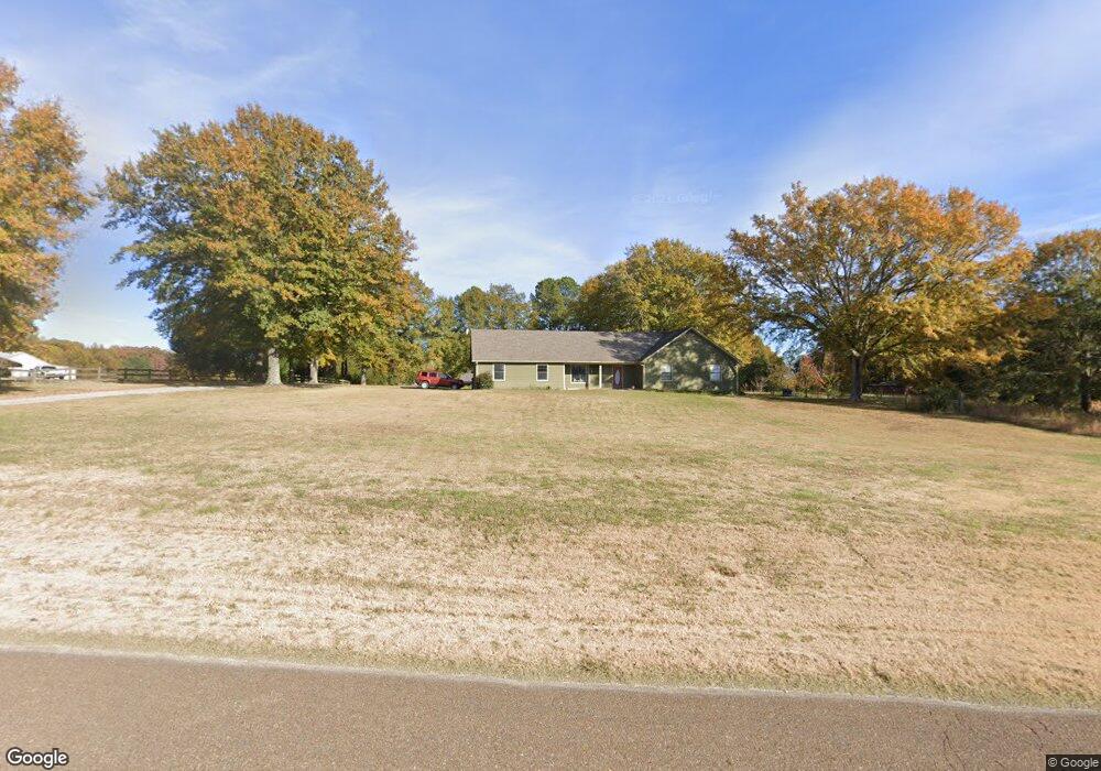
6780 Long Rd Arlington, TN 38002
Estimated Value: $294,000 - $369,000
3
Beds
2
Baths
1,555
Sq Ft
$215/Sq Ft
Est. Value
About This Home
This home is located at 6780 Long Rd, Arlington, TN 38002 and is currently estimated at $334,774, approximately $215 per square foot. 6780 Long Rd is a home located in Shelby County with nearby schools including Barrets Elementary School and Bolton High School.
Ownership History
Date
Name
Owned For
Owner Type
Purchase Details
Closed on
Jun 11, 2012
Sold by
Mckee Michael Scott and Mckee Jamie E
Bought by
Long Rod Llc
Current Estimated Value
Purchase Details
Closed on
Jun 17, 2011
Sold by
Moskovitz David and Leatherman Teresa
Bought by
Mckee Michael Scott and Mckee Jamie E
Home Financials for this Owner
Home Financials are based on the most recent Mortgage that was taken out on this home.
Original Mortgage
$69,000
Interest Rate
4.71%
Mortgage Type
New Conventional
Purchase Details
Closed on
Jun 1, 2000
Sold by
English Dennis H and English Janice C
Bought by
Moskovitz David and Moskovitz Teresa
Home Financials for this Owner
Home Financials are based on the most recent Mortgage that was taken out on this home.
Original Mortgage
$133,875
Interest Rate
8.11%
Create a Home Valuation Report for This Property
The Home Valuation Report is an in-depth analysis detailing your home's value as well as a comparison with similar homes in the area
Home Values in the Area
Average Home Value in this Area
Purchase History
| Date | Buyer | Sale Price | Title Company |
|---|---|---|---|
| Long Rod Llc | -- | None Available | |
| Mckee Michael Scott | $169,000 | None Available | |
| Moskovitz David | $157,500 | -- | |
| Moskovitz David | $157,500 | -- |
Source: Public Records
Mortgage History
| Date | Status | Borrower | Loan Amount |
|---|---|---|---|
| Previous Owner | Mckee Michael Scott | $69,000 | |
| Previous Owner | Moskovitz David | $133,875 |
Source: Public Records
Tax History Compared to Growth
Tax History
| Year | Tax Paid | Tax Assessment Tax Assessment Total Assessment is a certain percentage of the fair market value that is determined by local assessors to be the total taxable value of land and additions on the property. | Land | Improvement |
|---|---|---|---|---|
| 2025 | $1,793 | $72,725 | $25,825 | $46,900 |
| 2024 | -- | $52,900 | $18,975 | $33,925 |
| 2023 | $1,793 | $52,900 | $18,975 | $33,925 |
| 2022 | $1,793 | $52,900 | $18,975 | $33,925 |
| 2021 | $1,825 | $52,900 | $18,975 | $33,925 |
| 2020 | $1,691 | $41,750 | $16,050 | $25,700 |
| 2019 | $1,691 | $41,750 | $16,050 | $25,700 |
| 2018 | $1,691 | $41,750 | $16,050 | $25,700 |
| 2017 | $1,716 | $41,750 | $16,050 | $25,700 |
| 2016 | $1,716 | $39,275 | $0 | $0 |
| 2014 | $1,716 | $39,275 | $0 | $0 |
Source: Public Records
Map
Nearby Homes
- 11280 Pleasant Ridge Rd
- 10941 Lubov Rd
- 11850 Us 70 Hwy
- 11819 Highway 70
- 0 Us 70 Hwy Unit 10096004
- 6038 Armistead St
- 11162 Anderson Bend Cove
- 11272 Ardsley Dr N
- 5724 E Ardsley Dr
- 11641 Turley Ln
- 5995 Henning Oaks Cove
- 5698 Gerber Rd
- 5694 Gerber Rd
- 5730 Ardsley Dr E
- 5718 Ardsley Dr E
- 5714 Ardsley Dr E
- 0 Milton Wilson Rd Unit 10201644
- 0 Milton Wilson Rd Unit 10197853
- 0 Milton Wilson Rd Unit 10203797
- 60 Lancaster Dr