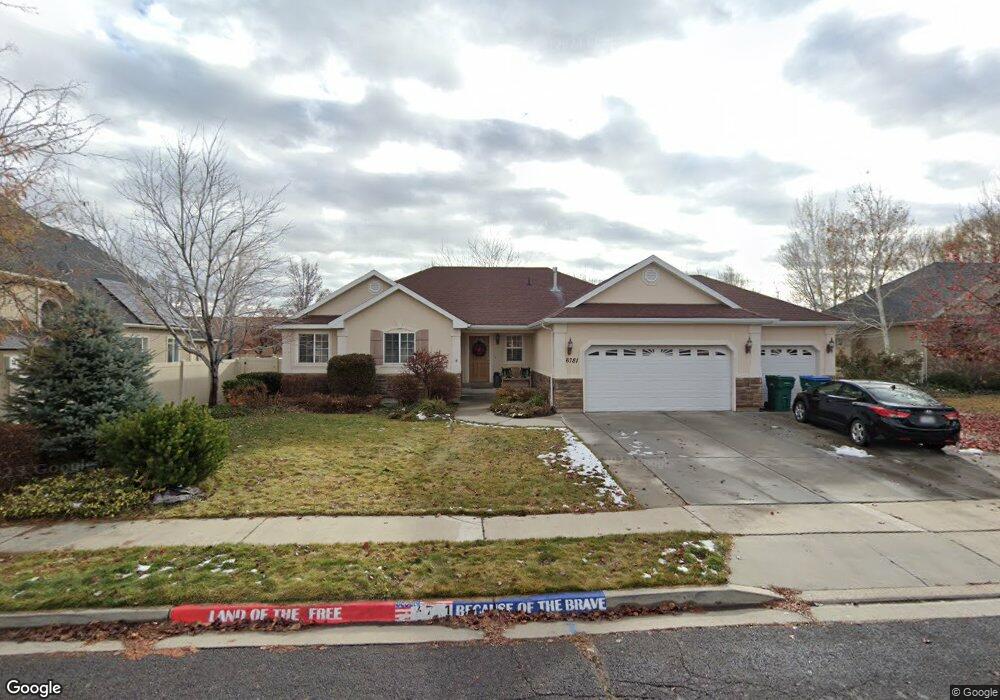
6781 W 10430 N Unit 2 Highland, UT 84003
Estimated Value: $811,000 - $954,000
3
Beds
3
Baths
1,760
Sq Ft
$505/Sq Ft
Est. Value
About This Home
This home is located at 6781 W 10430 N Unit 2, Highland, UT 84003 and is currently estimated at $888,364, approximately $504 per square foot. 6781 W 10430 N Unit 2 is a home located in Utah County with nearby schools including Freedom Elementary School, Mountain Ridge Junior High School, and Lone Peak High School.
Ownership History
Date
Name
Owned For
Owner Type
Purchase Details
Closed on
Sep 20, 2022
Sold by
Sharp and Karen
Bought by
Sharp Family Trust
Current Estimated Value
Purchase Details
Closed on
Jun 30, 2022
Sold by
Merrill Spencer B
Bought by
Sharp Michael and Sharp Karen
Home Financials for this Owner
Home Financials are based on the most recent Mortgage that was taken out on this home.
Original Mortgage
$495,000
Interest Rate
5.09%
Mortgage Type
New Conventional
Purchase Details
Closed on
Jun 22, 2012
Sold by
Lawsun Robert Royal and Lawsun Lynette
Bought by
Merril Speneer B and Merril Genny L
Home Financials for this Owner
Home Financials are based on the most recent Mortgage that was taken out on this home.
Original Mortgage
$255,200
Interest Rate
3.25%
Mortgage Type
Adjustable Rate Mortgage/ARM
Purchase Details
Closed on
May 18, 2005
Sold by
Lawson Robert R and Lawson Lynette
Bought by
Lawson Robert Royal and Lawson Lynette
Home Financials for this Owner
Home Financials are based on the most recent Mortgage that was taken out on this home.
Original Mortgage
$10,000
Interest Rate
5.74%
Mortgage Type
Unknown
Purchase Details
Closed on
Dec 31, 2002
Sold by
Canterbury Development & Investment Inc
Bought by
Lawson Rob and Lawson Lynette
Home Financials for this Owner
Home Financials are based on the most recent Mortgage that was taken out on this home.
Original Mortgage
$215,000
Interest Rate
5.96%
Mortgage Type
Construction
Purchase Details
Closed on
Dec 30, 2002
Sold by
Lawson Rob and Lawson Lynette
Bought by
Lawson Robert R and Lawson Lynette
Home Financials for this Owner
Home Financials are based on the most recent Mortgage that was taken out on this home.
Original Mortgage
$215,000
Interest Rate
5.96%
Mortgage Type
Construction
Create a Home Valuation Report for This Property
The Home Valuation Report is an in-depth analysis detailing your home's value as well as a comparison with similar homes in the area
Home Values in the Area
Average Home Value in this Area
Purchase History
| Date | Buyer | Sale Price | Title Company |
|---|---|---|---|
| Sharp Family Trust | -- | -- | |
| Sharp Michael | -- | Utah First Title | |
| Merril Speneer B | -- | Select Title Insurance Agenc | |
| Lawson Robert Royal | -- | Cottonwood Title Insurance | |
| Lawson Rob | -- | Signature Title | |
| Lawson Robert R | -- | First American Title Co |
Source: Public Records
Mortgage History
| Date | Status | Borrower | Loan Amount |
|---|---|---|---|
| Previous Owner | Sharp Michael | $495,000 | |
| Previous Owner | Merril Speneer B | $255,200 | |
| Previous Owner | Lawson Robert Royal | $10,000 | |
| Previous Owner | Lawson Robert Royal | $232,800 | |
| Previous Owner | Lawson Robert R | $215,000 |
Source: Public Records
Tax History Compared to Growth
Tax History
| Year | Tax Paid | Tax Assessment Tax Assessment Total Assessment is a certain percentage of the fair market value that is determined by local assessors to be the total taxable value of land and additions on the property. | Land | Improvement |
|---|---|---|---|---|
| 2025 | $3,210 | $418,550 | $346,400 | $414,600 |
| 2024 | $3,210 | $396,495 | $0 | $0 |
| 2023 | $3,048 | $406,065 | $0 | $0 |
| 2022 | $3,009 | $388,795 | $0 | $0 |
| 2021 | $2,647 | $509,400 | $184,900 | $324,500 |
| 2020 | $2,521 | $475,800 | $160,800 | $315,000 |
| 2019 | $2,375 | $468,900 | $160,800 | $308,100 |
| 2018 | $2,273 | $426,500 | $154,100 | $272,400 |
| 2017 | $2,232 | $223,520 | $0 | $0 |
| 2016 | $2,043 | $191,180 | $0 | $0 |
| 2015 | $2,062 | $182,930 | $0 | $0 |
| 2014 | $1,975 | $173,690 | $0 | $0 |
Source: Public Records
Map
Nearby Homes
- 10434 N 6400 W
- 1602 E Center Pointe Dr
- 1602 E Center Pointe Dr Unit 1
- 1610 E Center Pointe Dr
- 6373 W 10500 N
- 6372 W 10400 N
- 9967 N 6670 W
- 6399 W 10150 N
- 975 E 2850 N
- 9924 N 6630 W Unit 9
- 6692 W 9770 N
- 6271 W 10830 St N
- 975 E 2125 N
- 6190 W 10050 N
- 2208 N 825 E
- 859 E 2125 N
- 2752 N 600 E
- 3368 N 700 E
- 11337 N 5950 W Unit 7
- 10818 N 6000 W
- 6781 W 10430 N
- 6795 W 10430 N
- 6795 W 10430 N Unit 3
- 10417 N 6750 W
- 6767 10430 N Unit 1
- 10400 N 6750 W
- 10444 N 6790 W
- 6811 W 10430 N
- 6786 W 10430 N
- 10443 N 6790 W
- 10443 N 6790 W Unit 29
- 10457 N 6750 W
- 10457 N 6750 W Unit 35
- 6827 W 10430 N
- 6827 W 10430 N Unit 5
- 10458 N 6790 W
- 10458 N 6790 W Unit 32
- 10392 N 6830 W
- 10392 Cottonwood Meadows Cir Unit 1
- 10392 Cottonwood Meadows Cir