Estimated Value: $312,729 - $379,000
About This Home
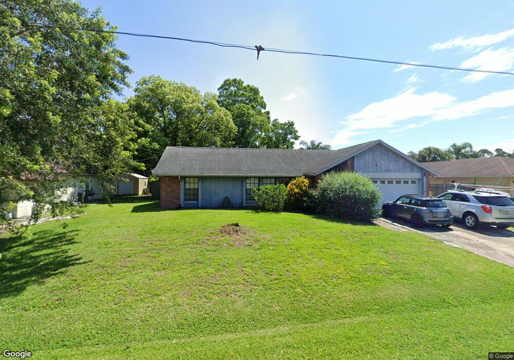
This home is located at 6785 Cairo Rd, Cocoa, FL 32927 and is currently estimated at $347,682, approximately $188 per square foot. 6785 Cairo Rd is a home located in Brevard County with nearby schools including Enterprise Elementary School, Space Coast Junior/Senior High School, and Sculptor Charter School.
Ownership History
We collect this data history from publicly available records. To have your information removed, we recommend requesting removal directly through your county’s website.
Purchase Details
Home Financials for this Owner
Home Financials are based on the most recent Mortgage that was taken out on this home.Home Values in the Area
Average Home Value in this Area
Purchase History
We collect this data history from publicly available records. To have your information removed, we recommend requesting removal directly through your county’s website.
| Date | Buyer | Sale Price | Title Company |
|---|---|---|---|
| $82,500 | -- |
Mortgage History
We collect this data history from publicly available records. To have your information removed, we recommend requesting removal directly through your county’s website.
| Date | Status | Borrower | Loan Amount |
|---|---|---|---|
| Open | $84,150 |
Tax History
We collect this data history from publicly available records. To have your information removed, we recommend requesting removal directly through your county’s website.
| Year | Tax Paid | Tax Assessment Tax Assessment Total Assessment is a certain percentage of the fair market value that is determined by local assessors to be the total taxable value of land and additions on the property. | Land | Improvement |
|---|---|---|---|---|
| 2025 | $1,337 | $90,930 | -- | -- |
| 2024 | $1,298 | $88,370 | -- | -- |
| 2023 | $1,298 | $85,800 | $0 | $0 |
| 2022 | $1,211 | $83,310 | $0 | $0 |
| 2021 | $1,199 | $80,890 | $0 | $0 |
| 2020 | $1,120 | $79,780 | $0 | $0 |
| 2019 | $1,052 | $77,990 | $0 | $0 |
| 2018 | $1,041 | $76,540 | $0 | $0 |
| 2017 | $1,026 | $74,970 | $0 | $0 |
| 2016 | $1,036 | $73,430 | $18,000 | $55,430 |
| 2015 | $1,046 | $72,920 | $15,000 | $57,920 |
| 2014 | $1,051 | $72,350 | $11,000 | $61,350 |
Map
- 6813 Cecil Rd
- 5135 Market St
- 5070 Curtis Blvd
- 5145 Carter St
- 5160 Carter St
- 6615 Dock Ave
- 5155 Mayflower St
- 00 Unknown
- 5075 Carter St
- 6570 Dock Ave
- 6560 Dock Ave
- 5165 Patricia St
- 6450 Ember Ave
- 6965 Hundred Acre Dr
- 5555 Brandon St
- 5002 Bogey Place
- 6574 Haven Ave
- 6442 Fairchild Ave
- 5424 Flint Rd
- 6581 Bancroft Ave
Ask me questions while you tour the home.