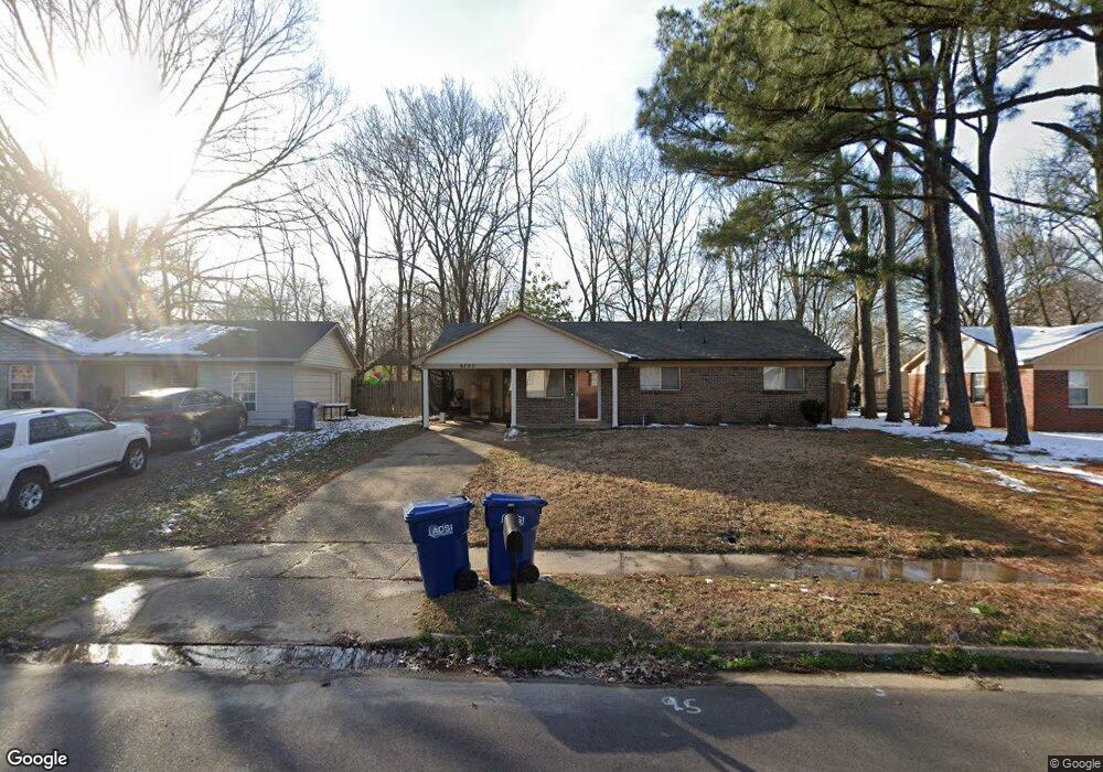
6785 Camelot Rd Horn Lake, MS 38637
Estimated Value: $127,000 - $174,000
4
Beds
2
Baths
1,175
Sq Ft
$134/Sq Ft
Est. Value
About This Home
This home is located at 6785 Camelot Rd, Horn Lake, MS 38637 and is currently estimated at $157,260, approximately $133 per square foot. 6785 Camelot Rd is a home located in DeSoto County with nearby schools including Horn Lake Elementary School, Horn Lake Intermediate School, and Horn Lake Middle School.
Ownership History
Date
Name
Owned For
Owner Type
Purchase Details
Closed on
May 27, 2021
Sold by
Mcclay Patrick
Bought by
Mcciay Properties Llc
Current Estimated Value
Home Financials for this Owner
Home Financials are based on the most recent Mortgage that was taken out on this home.
Original Mortgage
$100,000
Interest Rate
2.9%
Mortgage Type
Credit Line Revolving
Purchase Details
Closed on
Aug 19, 2009
Sold by
Dennis Isaac G and Dennis Becky J
Bought by
Mcclay Patrick
Create a Home Valuation Report for This Property
The Home Valuation Report is an in-depth analysis detailing your home's value as well as a comparison with similar homes in the area
Home Values in the Area
Average Home Value in this Area
Purchase History
| Date | Buyer | Sale Price | Title Company |
|---|---|---|---|
| Mcciay Properties Llc | -- | Guardian Title Llc | |
| Mcclay Patrick | $38,676 | None Available |
Source: Public Records
Mortgage History
| Date | Status | Borrower | Loan Amount |
|---|---|---|---|
| Closed | Mcciay Properties Llc | $100,000 |
Source: Public Records
Tax History Compared to Growth
Tax History
| Year | Tax Paid | Tax Assessment Tax Assessment Total Assessment is a certain percentage of the fair market value that is determined by local assessors to be the total taxable value of land and additions on the property. | Land | Improvement |
|---|---|---|---|---|
| 2024 | $1,376 | $9,249 | $2,250 | $6,999 |
| 2023 | $1,376 | $9,249 | $0 | $0 |
| 2022 | $1,376 | $9,249 | $2,250 | $6,999 |
| 2021 | $1,375 | $9,239 | $2,250 | $6,989 |
| 2020 | $1,292 | $8,679 | $2,250 | $6,429 |
| 2019 | $1,292 | $8,679 | $2,250 | $6,429 |
| 2017 | $1,268 | $14,694 | $8,472 | $6,222 |
| 2016 | $1,234 | $8,472 | $2,250 | $6,222 |
| 2015 | $1,226 | $14,694 | $8,472 | $6,222 |
| 2014 | $1,234 | $8,472 | $0 | $0 |
| 2013 | $1,200 | $8,472 | $0 | $0 |
Source: Public Records
Map
Nearby Homes
- 6670 Embassy Cir
- 2848 Normandy Dr
- 2919 Normandy Dr
- 2880 Briarwood Dr
- 2950 Briarwood Dr
- 6265 Foxbriar Dr
- 2605 Valleybrook Rd
- 2388 Pappy Ln
- 2895 Valleybrook Rd
- 3305 Tulane Rd W
- 2920 Devon Cir
- 7135 Hampton Dr
- 3430 Mayfair Dr
- 7088 Foxhall Dr
- 6505 Riverdale Rd
- 3405 Woodbine Cove
- 3530 Woodmont Cove
- 7429 Perrin Ln
- 3031 Caitlynn Cir S
- 7424 Crystal Dr
- 6795 Camelot Rd
- 6775 Camelot Rd
- 6765 Camelot Rd
- 2705 Eastbrook Dr
- 2725 Eastbrook Dr
- 6760 Camelot Rd
- 6770 Camelot Rd
- 6605 Ridgewood Rd
- 6780 Camelot Rd
- 6595 Ridgewood Rd
- 2655 Eastbrook Dr
- 2690 Dogwood Cove
- 2700 Eastbrook Dr
- 2730 Eastbrook Dr
- 2645 Eastbrook Dr
- 6740 Camelot Rd
- 2760 Birchfield Cove
- 2670 Eastbrook Dr
- 6585 Ridgewood Rd
- 2695 Dogwood Cove