Estimated Value: $173,000 - $653,000
4
Beds
4
Baths
3,282
Sq Ft
$141/Sq Ft
Est. Value
About This Home
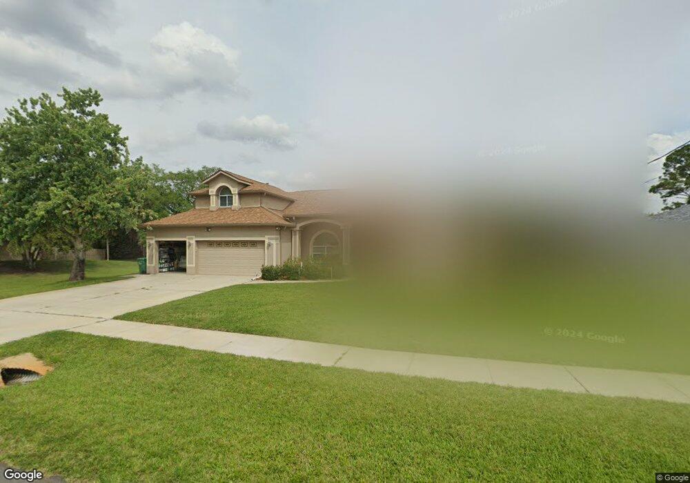
This home is located at 6785 Opal Ave, Cocoa, FL 32927 and is currently estimated at $462,311, approximately $140 per square foot. 6785 Opal Ave is a home located in Brevard County with nearby schools including Atlantis Elementary School, Space Coast Junior/Senior High School, and Sculptor Charter School.
Ownership History
Date
Name
Owned For
Owner Type
Purchase Details
Closed on
Nov 15, 2016
Sold by
Nagy Michael
Bought by
Nagy Michael and Armstrong Kim Marie
Current Estimated Value
Purchase Details
Closed on
Nov 1, 2000
Sold by
Benson Jeanne A
Bought by
Nagy Michael and Nagy Linda J
Create a Home Valuation Report for This Property
The Home Valuation Report is an in-depth analysis detailing your home's value as well as a comparison with similar homes in the area
Home Values in the Area
Average Home Value in this Area
Purchase History
| Date | Buyer | Sale Price | Title Company |
|---|---|---|---|
| Nagy Michael | -- | None Available | |
| Nagy Michael | $19,500 | -- |
Source: Public Records
Tax History
| Year | Tax Paid | Tax Assessment Tax Assessment Total Assessment is a certain percentage of the fair market value that is determined by local assessors to be the total taxable value of land and additions on the property. | Land | Improvement |
|---|---|---|---|---|
| 2025 | $3,098 | $225,360 | -- | -- |
| 2024 | $3,049 | $219,010 | -- | -- |
| 2023 | $3,049 | $212,640 | $0 | $0 |
| 2022 | $2,863 | $206,450 | $0 | $0 |
| 2021 | $2,917 | $200,440 | $0 | $0 |
| 2020 | $2,828 | $197,680 | $0 | $0 |
| 2019 | $2,776 | $193,240 | $0 | $0 |
| 2018 | $2,783 | $189,640 | $0 | $0 |
| 2017 | $2,804 | $185,740 | $0 | $0 |
| 2016 | $2,841 | $181,920 | $29,000 | $152,920 |
| 2015 | $2,913 | $180,660 | $29,000 | $151,660 |
| 2014 | $2,929 | $179,230 | $29,000 | $150,230 |
Source: Public Records
Map
Nearby Homes
- 4760 Ivan St
- 4824 Curtis Blvd
- 6820 Caliph Ave
- 6990 Camden Ave
- 4790 Greenhill St
- 4625 Curtis Blvd
- 0000 Unknown St
- 4852 Alfred St
- 6947 Carlowe Ave
- 6620 Grissom Pkwy
- 4688 Fairsun St
- 7155 Export Ave
- 5080 Mayflower St
- 7160 Carlowe Ave
- 6499 Pleasant Ave
- 5095 Hogan Place
- 7245 Grissom Pkwy
- 7065 Bright Ave
- 5200 Frisco St
- 5155 Mayflower St
Your Personal Tour Guide
Ask me questions while you tour the home.