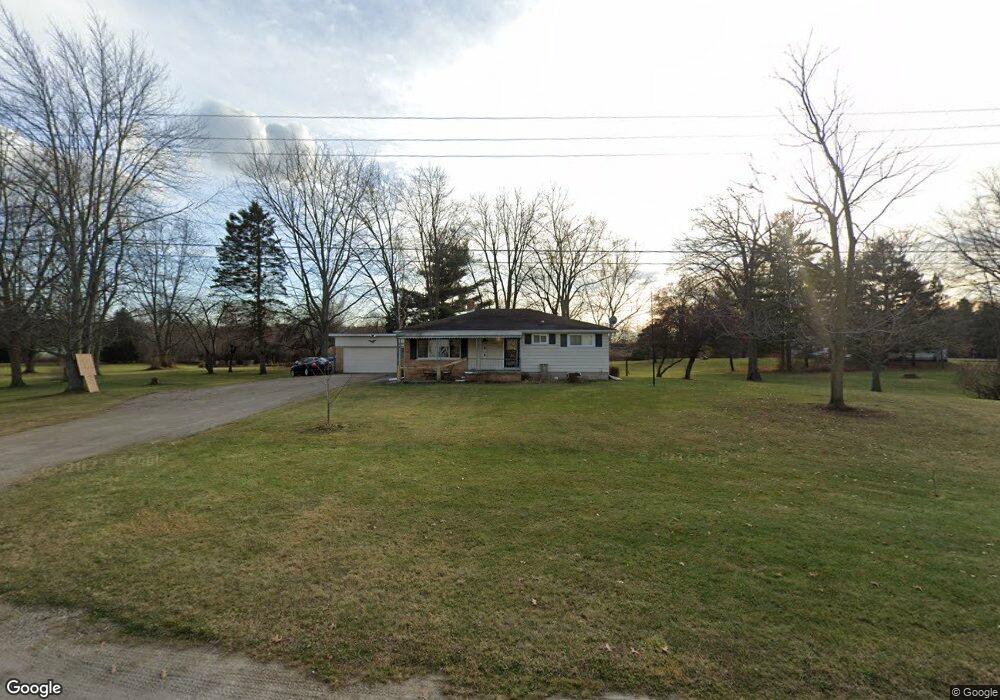
679 Bree Rd East China, MI 48054
East China Township NeighborhoodEstimated Value: $209,000 - $367,000
--
Bed
--
Bath
1,200
Sq Ft
$224/Sq Ft
Est. Value
About This Home
This home is located at 679 Bree Rd, East China, MI 48054 and is currently estimated at $269,274, approximately $224 per square foot. 679 Bree Rd is a home located in St. Clair County with nearby schools including Pine River Elementary School, St. Clair Middle School, and St. Clair High School.
Ownership History
Date
Name
Owned For
Owner Type
Purchase Details
Closed on
Aug 23, 2023
Sold by
Zobl Christopher
Bought by
Zobl Christopher
Current Estimated Value
Purchase Details
Closed on
Aug 11, 2023
Sold by
Zobl Christopher and Zobl Carrie
Bought by
Zobl Christopher
Purchase Details
Closed on
Apr 29, 2016
Sold by
Zimmer Ned A and Zimmer Vicki
Bought by
Zobl Christopher and Zobl Carrie
Purchase Details
Closed on
Aug 15, 2013
Sold by
Bacon Donn C and Bacon Mary Lou
Bought by
Bacon Donn C and Bacon Mary Lou
Purchase Details
Closed on
Jan 7, 2010
Sold by
Zimmer Ned A and Zimmer Vicki
Bought by
Zobl Christopher and Zobl Carrie
Create a Home Valuation Report for This Property
The Home Valuation Report is an in-depth analysis detailing your home's value as well as a comparison with similar homes in the area
Home Values in the Area
Average Home Value in this Area
Purchase History
| Date | Buyer | Sale Price | Title Company |
|---|---|---|---|
| Zobl Christopher | -- | None Listed On Document | |
| Zobl Christopher | -- | None Listed On Document | |
| Zobl Christopher | -- | None Listed On Document | |
| Zobl Christopher | $102,000 | Attorney | |
| Bacon Donn C | -- | None Available | |
| Bacon Donn C | -- | None Available | |
| Zobl Christopher | -- | Devon Title Agency |
Source: Public Records
Tax History Compared to Growth
Tax History
| Year | Tax Paid | Tax Assessment Tax Assessment Total Assessment is a certain percentage of the fair market value that is determined by local assessors to be the total taxable value of land and additions on the property. | Land | Improvement |
|---|---|---|---|---|
| 2025 | $1,902 | $114,700 | $0 | $0 |
| 2024 | $1,060 | $108,300 | $0 | $0 |
| 2023 | $974 | $95,300 | $0 | $0 |
| 2022 | $1,587 | $74,500 | $0 | $0 |
| 2021 | $1,478 | $70,000 | $0 | $0 |
| 2020 | $1,478 | $67,400 | $67,400 | $0 |
| 2019 | $1,379 | $62,100 | $0 | $0 |
| 2018 | $1,418 | $58,800 | $0 | $0 |
| 2016 | $906 | $54,400 | $0 | $0 |
| 2015 | -- | $51,900 | $51,900 | $0 |
| 2014 | -- | $49,100 | $49,100 | $0 |
| 2013 | -- | $48,900 | $0 | $0 |
Source: Public Records
Map
Nearby Homes
- 306 Hawks Nest Dr
- 330 Hawks Nest Dr
- 1627 S Riverside Ave Unit 4
- 3656 River Rd
- 207 Palmer St
- 3708 Riverview Terrace N
- 1464 S Riverside Ave
- 3705 Riverview Terrace N
- 3730 Riverview Terrace N
- LOT 24 River Rd
- 3930 River Rd
- 3995 River Rd
- 517 Cedar St
- TBD Range
- 5119 Saint Clair Hwy
- 5148 Ivy Ln
- 703 Trumbull St
- 310 S 6th St
- 206 S 4th St
- 1805 Clinton Ave
- 679 Bree Rd
- 701 Bree Rd
- 600 Bree Rd Unit D-1
- 600 Bree Rd Unit D-1
- 505 Bree Rd
- 3515 Range Rd
- 705 Bree Rd
- 515 Manor Park Dr
- 477 Manor Park Dr
- 433 Manor Park Dr
- 611 Manor Park Dr
- 399 Manor Park Dr
- 311 Manor Park Dr
- 355 Manor Park Dr
- 333 Bree Rd Unit 7
- 350 Bree Rd
- 600 Manor Park Dr
- 470 Manor Park Dr
- 510 Manor Park Dr
- 277 Manor Park Dr