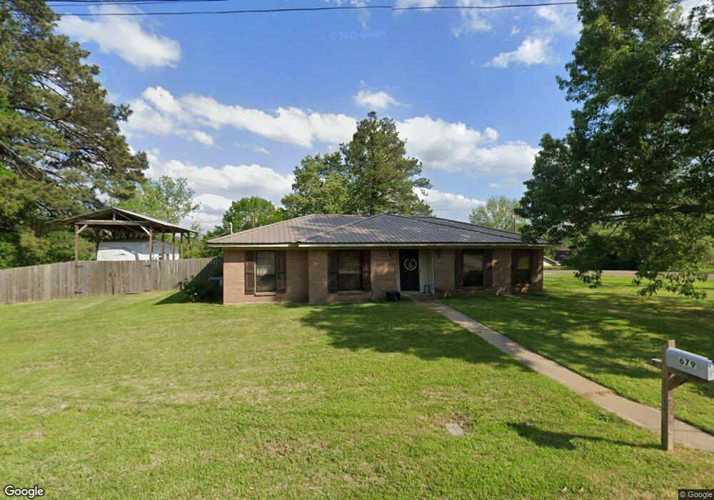
679 Lakeside Dr Vicksburg, MS 39180
Estimated Value: $162,185 - $192,000
--
Bed
--
Bath
1,800
Sq Ft
$101/Sq Ft
Est. Value
About This Home
This home is located at 679 Lakeside Dr, Vicksburg, MS 39180 and is currently estimated at $181,046, approximately $100 per square foot. 679 Lakeside Dr is a home located in Warren County with nearby schools including South Park Elementary School, Vicksburg Junior High School, and Vicksburg High School.
Ownership History
Date
Name
Owned For
Owner Type
Purchase Details
Closed on
Apr 11, 2007
Sold by
Murphy Stacey Anne Stoddard
Bought by
Kirklin Thomas W and Kirklin Paige S
Current Estimated Value
Home Financials for this Owner
Home Financials are based on the most recent Mortgage that was taken out on this home.
Original Mortgage
$105,000
Outstanding Balance
$63,486
Interest Rate
6.15%
Mortgage Type
Purchase Money Mortgage
Estimated Equity
$117,560
Create a Home Valuation Report for This Property
The Home Valuation Report is an in-depth analysis detailing your home's value as well as a comparison with similar homes in the area
Home Values in the Area
Average Home Value in this Area
Purchase History
| Date | Buyer | Sale Price | Title Company |
|---|---|---|---|
| Kirklin Thomas W | -- | -- | |
| Kirklin Thomas W | -- | -- | |
| Kirklin Thomas W | -- | -- | |
| Kirklin Thomas W | -- | -- |
Source: Public Records
Mortgage History
| Date | Status | Borrower | Loan Amount |
|---|---|---|---|
| Open | Kirklin Thomas W | $105,000 | |
| Closed | Kirklin Thomas W | $105,000 |
Source: Public Records
Tax History Compared to Growth
Tax History
| Year | Tax Paid | Tax Assessment Tax Assessment Total Assessment is a certain percentage of the fair market value that is determined by local assessors to be the total taxable value of land and additions on the property. | Land | Improvement |
|---|---|---|---|---|
| 2024 | $1,150 | $11,908 | $0 | $0 |
| 2023 | $1,150 | $11,908 | $0 | $0 |
| 2022 | $1,150 | $11,908 | $0 | $0 |
| 2021 | $1,133 | $11,766 | $0 | $0 |
| 2020 | $1,133 | $11,766 | $0 | $0 |
| 2019 | $1,136 | $11,766 | $0 | $0 |
| 2018 | $1,007 | $11,766 | $0 | $0 |
| 2015 | $673 | $9,800 | $0 | $0 |
| 2014 | $641 | $9,800 | $0 | $0 |
| 2013 | -- | $9,832 | $0 | $0 |
Source: Public Records
Map
Nearby Homes
- 411 Goodrum Rd
- 409 Lakeside Dr
- 6025 Castle Rd
- 6010 Queens Point
- 4315 Camelot Dr
- 6103 Lancelot Ln
- 105 Robinhood Rd
- Lot 9 Stratford Way
- 1006 Yorktown Rd
- 105 Stratford Way
- 35 Vernon Ln
- 80 Edgewood Place
- 110 King Arthur's Ridge Rd
- 768 Lake Blvd
- 00 Smith Rd
- 9245 Halls Ferry Rd
- 6 Indian Hills Rd
- 1632 Fisher Ferry Rd Unit A2
- 3075 Burnt House Rd
- 1245 Sweetgum Ln
- 50 Sunnybrook Cir
- 711 Lakeside Dr
- 656 Lakeside Dr
- 39 Sunnybrook Cir
- 712 Lakeside Dr
- 631 Lakeside Dr
- 686 Lakeside Dr
- 130 Sunnybrook Cir
- 70 Sunnybrook Cir
- 640 Lakeside Dr
- 743 Lakeside Dr
- 61 Sunnybrook Cir
- 150 Sunnybrook Cir
- 000 Sunnybrook Cir
- 609 Lakeside Dr
- 81 Sunnybrook Cir
- 736 Lakeside Dr
- 300 Lake Blvd
- 801 Lakeside Dr
- 409 Goodrum Rd