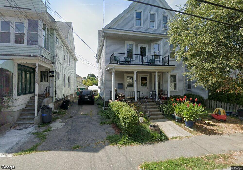
68 Broadway Quincy, MA 02169
Quincy Point NeighborhoodEstimated Value: $736,067 - $1,135,000
6
Beds
3
Baths
3,310
Sq Ft
$288/Sq Ft
Est. Value
About This Home
This home is located at 68 Broadway, Quincy, MA 02169 and is currently estimated at $951,767, approximately $287 per square foot. 68 Broadway is a home located in Norfolk County with nearby schools including Point Webster Middle School, Clifford H. Marshall Elementary School, and Quincy High School.
Ownership History
Date
Name
Owned For
Owner Type
Purchase Details
Closed on
Jan 28, 2014
Sold by
Cameron Robert A and Cameron Laura L
Bought by
Cameron Robert A and Cameron Nancy
Current Estimated Value
Purchase Details
Closed on
Sep 29, 1995
Sold by
Nigro Jennie E
Bought by
Cameron Robert A and Cameron Patricia R
Home Financials for this Owner
Home Financials are based on the most recent Mortgage that was taken out on this home.
Original Mortgage
$165,000
Interest Rate
7.89%
Mortgage Type
Purchase Money Mortgage
Create a Home Valuation Report for This Property
The Home Valuation Report is an in-depth analysis detailing your home's value as well as a comparison with similar homes in the area
Home Values in the Area
Average Home Value in this Area
Purchase History
| Date | Buyer | Sale Price | Title Company |
|---|---|---|---|
| Cameron Robert A | -- | -- | |
| Cameron Robert A | $185,000 | -- |
Source: Public Records
Mortgage History
| Date | Status | Borrower | Loan Amount |
|---|---|---|---|
| Previous Owner | Cameron Robert A | $165,000 | |
| Previous Owner | Cameron Robert A | $70,000 |
Source: Public Records
Tax History Compared to Growth
Tax History
| Year | Tax Paid | Tax Assessment Tax Assessment Total Assessment is a certain percentage of the fair market value that is determined by local assessors to be the total taxable value of land and additions on the property. | Land | Improvement |
|---|---|---|---|---|
| 2025 | $10,540 | $914,100 | $253,800 | $660,300 |
| 2024 | $10,028 | $889,800 | $241,700 | $648,100 |
| 2023 | $9,143 | $821,500 | $219,800 | $601,700 |
| 2022 | $9,106 | $760,100 | $199,800 | $560,300 |
| 2021 | $9,065 | $746,700 | $199,800 | $546,900 |
| 2020 | $8,947 | $719,800 | $188,500 | $531,300 |
| 2019 | $8,858 | $705,800 | $174,500 | $531,300 |
| 2018 | $7,449 | $558,400 | $158,600 | $399,800 |
| 2017 | $7,565 | $533,900 | $151,100 | $382,800 |
| 2016 | $6,754 | $470,300 | $137,300 | $333,000 |
| 2015 | $6,614 | $453,000 | $129,600 | $323,400 |
| 2014 | $6,057 | $407,600 | $129,600 | $278,000 |
Source: Public Records
Map
Nearby Homes
- 41 Broadway
- 934 Southern Artery Unit 109
- 585 Washington St Unit model-1
- 585 Washington St Unit model-2
- 585 Washington St Unit model
- 26 Lawrence St
- 16 Perley Place
- 25 5th Ave
- 161 Sumner St Unit 2
- 161 Sumner St Unit 4
- 62 Lawn Ave
- 200 Cove Way Unit 614
- 19 Keyes St
- 51 Sumner St
- 313 Washington St
- 32 Sumner St
- 200 Falls Blvd Unit B305
- 200 Falls Blvd Unit C308
- 16 Dartmouth St Unit 16
- 15 Bower Rd Unit B5
- 64 Broadway
- 60 Broadway
- 78 Broadway
- 69 Broadway
- 65 Broadway
- 49 Germain Ave
- 57 Germain Ave
- 53 Germain Ave Unit 2R
- 53 Germain Ave Unit 1R
- 73 Broadway
- 73 Broadway Unit 1
- 73 Broadway Unit 2
- 73 Broadway Unit 3
- 54 Broadway Unit 1
- 45 Germain Ave
- 75 Broadway
- 55 Broadway
- 55 Germain Ave
- 59 Germain Ave
- 59 Germain Ave Unit 2