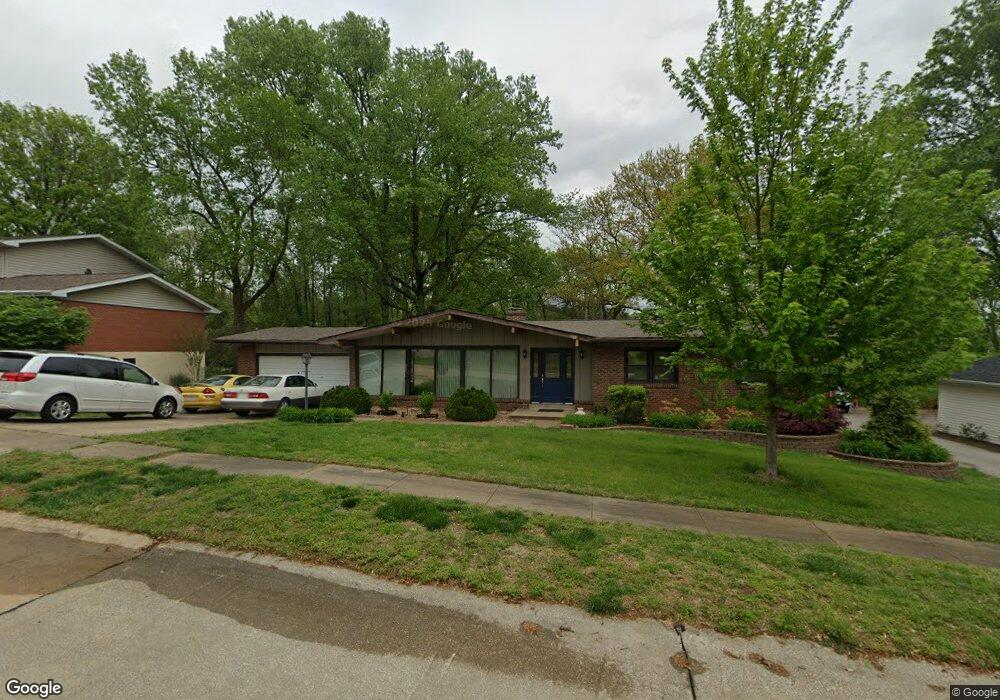
68 Burning Tree Dr Chesterfield, MO 63017
Estimated Value: $374,530 - $424,000
3
Beds
2
Baths
1,620
Sq Ft
$243/Sq Ft
Est. Value
About This Home
This home is located at 68 Burning Tree Dr, Chesterfield, MO 63017 and is currently estimated at $393,133, approximately $242 per square foot. 68 Burning Tree Dr is a home located in St. Louis County with nearby schools including River Bend Elementary School, Parkway Central Middle School, and Parkway Central High School.
Ownership History
Date
Name
Owned For
Owner Type
Purchase Details
Closed on
Jan 31, 2005
Sold by
Weichert Relocation Resources Inc
Bought by
Zheng Hong
Current Estimated Value
Home Financials for this Owner
Home Financials are based on the most recent Mortgage that was taken out on this home.
Original Mortgage
$187,200
Outstanding Balance
$95,464
Interest Rate
5.8%
Mortgage Type
New Conventional
Estimated Equity
$297,669
Create a Home Valuation Report for This Property
The Home Valuation Report is an in-depth analysis detailing your home's value as well as a comparison with similar homes in the area
Home Values in the Area
Average Home Value in this Area
Purchase History
| Date | Buyer | Sale Price | Title Company |
|---|---|---|---|
| Zheng Hong | $234,000 | Integrity Land Title Co Inc | |
| Relocation Weichert | -- | Integrity Land Title Co Inc |
Source: Public Records
Mortgage History
| Date | Status | Borrower | Loan Amount |
|---|---|---|---|
| Open | Zheng Hong | $187,200 |
Source: Public Records
Tax History Compared to Growth
Tax History
| Year | Tax Paid | Tax Assessment Tax Assessment Total Assessment is a certain percentage of the fair market value that is determined by local assessors to be the total taxable value of land and additions on the property. | Land | Improvement |
|---|---|---|---|---|
| 2025 | $3,547 | $66,860 | $38,040 | $28,820 |
| 2024 | $3,547 | $53,480 | $24,680 | $28,800 |
| 2023 | $3,402 | $53,480 | $24,680 | $28,800 |
| 2022 | $3,116 | $44,550 | $24,680 | $19,870 |
| 2021 | $3,104 | $44,550 | $24,680 | $19,870 |
| 2020 | $3,220 | $44,410 | $21,150 | $23,260 |
| 2019 | $3,150 | $44,410 | $21,150 | $23,260 |
| 2018 | $3,253 | $42,540 | $19,380 | $23,160 |
| 2017 | $3,165 | $42,540 | $19,380 | $23,160 |
| 2016 | $2,953 | $37,700 | $15,870 | $21,830 |
| 2015 | $3,095 | $37,700 | $15,870 | $21,830 |
| 2014 | $3,042 | $39,620 | $9,410 | $30,210 |
Source: Public Records
Map
Nearby Homes
- 56 Forest Crest Dr
- 13489 Beaulac Dr
- 13449 Manorlac Dr Unit 9D
- 13579 Coliseum Dr Unit G
- 13573 Coliseum Dr
- 13555 Coliseum Dr Unit G
- 13417 Forestlac Dr
- 13515 Coliseum Dr Unit E
- 13515 Coliseum Dr Unit A
- 13503 Coliseum Dr
- 922 Pavillion Dr
- 85 Glen Cove Dr
- 857 Coalport Dr
- 13314 Wood Chapel Dr
- 290 Ridge Trail Ct
- 13453 Coliseum Dr Unit E
- 14257 Forest Crest Dr
- 548 Eagle Manor Ln
- 1125 Matador Dr
- 596 Eagle Manor Ln
- 67 Burning Tree Dr
- 69 Burning Tree Dr
- 66 Burning Tree Dr
- 88 Burning Tree Dr
- 90 Burning Tree Dr
- 70 Burning Tree Dr
- 87 Burning Tree Dr
- 91 Burning Tree Dr
- 65 Burning Tree Dr
- 188 Glen Cove Dr
- 189 Glen Cove Dr
- 187 Glen Cove Dr
- 86 Burning Tree Dr
- 92 Burning Tree Dr
- 190 Glen Cove Dr
- 186 Glen Cove Dr
- 64 Burning Tree Dr
- 63 Highland Park Dr
- 85 Burning Tree Dr
- 191 Glen Cove Dr