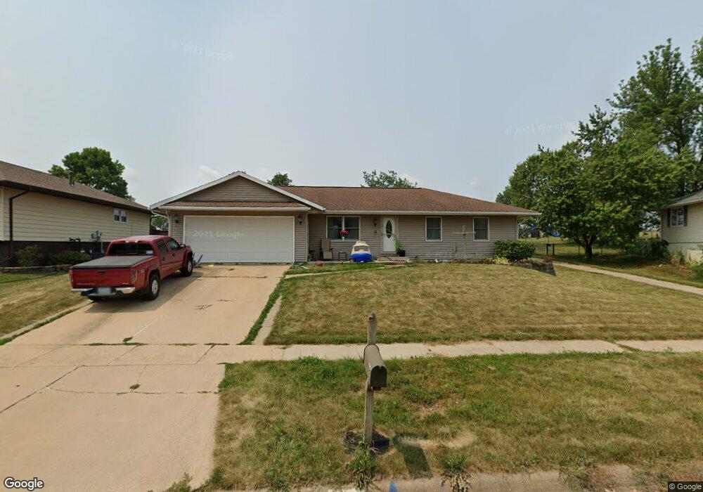
68 Clive Dr NW Cedar Rapids, IA 52405
Estimated Value: $223,000 - $248,000
3
Beds
2
Baths
1,280
Sq Ft
$187/Sq Ft
Est. Value
About This Home
This home is located at 68 Clive Dr NW, Cedar Rapids, IA 52405 and is currently estimated at $239,547, approximately $187 per square foot. 68 Clive Dr NW is a home located in Linn County with nearby schools including Junction City Elementary School, Hoover Elementary School, and Kentucky Tech - Ashland Reg Tech Center.
Ownership History
Date
Name
Owned For
Owner Type
Purchase Details
Closed on
Apr 28, 1998
Sold by
Carter Randolph L and Carter Kim L
Bought by
Prier Randy J
Current Estimated Value
Home Financials for this Owner
Home Financials are based on the most recent Mortgage that was taken out on this home.
Original Mortgage
$87,400
Outstanding Balance
$17,196
Interest Rate
7.18%
Estimated Equity
$222,351
Create a Home Valuation Report for This Property
The Home Valuation Report is an in-depth analysis detailing your home's value as well as a comparison with similar homes in the area
Home Values in the Area
Average Home Value in this Area
Purchase History
| Date | Buyer | Sale Price | Title Company |
|---|---|---|---|
| Prier Randy J | $91,500 | -- |
Source: Public Records
Mortgage History
| Date | Status | Borrower | Loan Amount |
|---|---|---|---|
| Open | Prier Randy J | $87,400 |
Source: Public Records
Tax History Compared to Growth
Tax History
| Year | Tax Paid | Tax Assessment Tax Assessment Total Assessment is a certain percentage of the fair market value that is determined by local assessors to be the total taxable value of land and additions on the property. | Land | Improvement |
|---|---|---|---|---|
| 2025 | $3,638 | $235,700 | $51,200 | $184,500 |
| 2024 | $3,840 | $216,100 | $46,800 | $169,300 |
| 2023 | $3,840 | $216,100 | $46,800 | $169,300 |
| 2022 | $3,358 | $190,900 | $46,800 | $144,100 |
| 2021 | $3,460 | $171,100 | $42,300 | $128,800 |
| 2020 | $3,460 | $165,400 | $40,100 | $125,300 |
| 2019 | $3,210 | $157,400 | $40,100 | $117,300 |
| 2018 | $3,116 | $157,400 | $40,100 | $117,300 |
| 2017 | $2,873 | $152,000 | $40,100 | $111,900 |
| 2016 | $2,873 | $135,200 | $37,100 | $98,100 |
| 2015 | $2,859 | $134,375 | $37,053 | $97,322 |
| 2014 | $2,674 | $134,375 | $37,053 | $97,322 |
| 2013 | $2,612 | $134,375 | $37,053 | $97,322 |
Source: Public Records
Map
Nearby Homes
- 56 Julia Ann Dr NW
- 3724 2nd Ave SW
- 3416 Sue Ln NW
- 3600 Midway Dr NW
- 3403 1st Ave SW
- 208 Lenora Dr NW
- 201 Edgewood Rd NW
- 4622 1st Ave NW Unit E
- 4619 1st Ave SW Unit 3
- 229 Jacolyn Dr NW
- 3701 16th Ave SW Unit 47
- 327 NW Edgewood Rd Unit 324, 330, 336, 342 C
- 4819 Ford Ave NW
- 3509 E Ave NW Unit D
- 3013 Sue Ln NW
- 4101 16th Ave SW Unit 64A
- 3507 E Ave NW Unit F
- 4910 Gordon Ave NW
- 3107 Johnson Ave NW Unit 4
- 225 31st St NW
- 66 Clive Dr NW
- 74 Clive Dr NW
- 60 Clive Dr NW
- 69 Clive Dr NW
- 3824 Sue Ln NW
- 56 Clive Dr NW
- 67 Clive Dr NW
- 3820 Sue Ln NW
- 3817 Sue Ln NW
- 61 Clive Dr NW
- 52 Clive Dr NW
- 3816 Sue Ln NW
- 57 Clive Dr NW
- 3811 Sue Ln NW
- 3961 Rollingwood Dr NW
- 3965 Rollingwood Dr NW
- 3812 Sue Ln NW
- 49 Clive Dr NW
- 3955 Rollingwood Dr NW
- 3809 Sue Ln NW