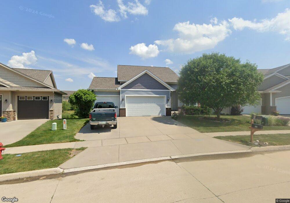
68 Colchester Dr Iowa City, IA 52245
Estimated Value: $417,000 - $509,000
3
Beds
2
Baths
2,050
Sq Ft
$226/Sq Ft
Est. Value
About This Home
This home is located at 68 Colchester Dr, Iowa City, IA 52245 and is currently estimated at $464,303, approximately $226 per square foot. 68 Colchester Dr is a home located in Johnson County with nearby schools including Helen Lemme Elementary School, Southeast Junior High School, and City High School.
Ownership History
Date
Name
Owned For
Owner Type
Purchase Details
Closed on
May 1, 2009
Sold by
Arlington Development Inc
Bought by
Fort Ronald and Fort Sondrae
Current Estimated Value
Home Financials for this Owner
Home Financials are based on the most recent Mortgage that was taken out on this home.
Original Mortgage
$256,000
Interest Rate
4.85%
Mortgage Type
Purchase Money Mortgage
Create a Home Valuation Report for This Property
The Home Valuation Report is an in-depth analysis detailing your home's value as well as a comparison with similar homes in the area
Home Values in the Area
Average Home Value in this Area
Purchase History
| Date | Buyer | Sale Price | Title Company |
|---|---|---|---|
| Fort Ronald | $327,500 | None Available |
Source: Public Records
Mortgage History
| Date | Status | Borrower | Loan Amount |
|---|---|---|---|
| Previous Owner | Fort Ronald | $256,000 |
Source: Public Records
Tax History Compared to Growth
Tax History
| Year | Tax Paid | Tax Assessment Tax Assessment Total Assessment is a certain percentage of the fair market value that is determined by local assessors to be the total taxable value of land and additions on the property. | Land | Improvement |
|---|---|---|---|---|
| 2025 | $7,952 | $469,140 | $70,880 | $398,260 |
| 2024 | $7,974 | $441,320 | $67,660 | $373,660 |
| 2023 | $7,758 | $441,320 | $67,660 | $373,660 |
| 2022 | $7,412 | $366,820 | $61,210 | $305,610 |
| 2021 | $7,406 | $366,820 | $61,210 | $305,610 |
| 2020 | $7,406 | $351,140 | $57,990 | $293,150 |
| 2019 | $7,234 | $351,140 | $57,990 | $293,150 |
| 2018 | $7,234 | $337,750 | $57,990 | $279,760 |
| 2017 | $7,046 | $337,750 | $57,990 | $279,760 |
| 2016 | $6,906 | $329,080 | $48,330 | $280,750 |
| 2015 | $6,906 | $329,080 | $48,330 | $280,750 |
| 2014 | $6,714 | $319,130 | $41,880 | $277,250 |
Source: Public Records
Map
Nearby Homes
- 4915 E Court St
- 192 Huntington Dr
- 458 Charlotte Ln
- 220 Camden Rd
- 107 Huntington Dr
- 653 Huntington Dr
- 485 Taft Ave SE
- 237 Camden Rd
- 96 Huntington Dr
- 275 Camden Rd Unit 275
- 180 Eversull Ln
- 225 Chadwick Ln
- 671 Barrington Rd
- 235 Chadwick Ln
- 85 Broadmoor Ln
- 285 Ashford Place
- 219 Eversull Ln
- 4121 Ruth St
- 14 Charles Dr
- 3880 Owl Song Ln
- 76 Colchester Dr
- 60 Colchester Dr
- 84 Colchester Dr
- 63 Colchester Dr
- 79 Colchester Dr
- 47 Colchester Dr
- 44 Colchester Dr
- 108 Colchester Dr
- 4780 E Court St Unit 21A
- 101 Colchester Dr
- 4782 E Court St Unit 22A
- 359 Huntington St
- 36 Colchester Dr
- 355 Huntington St Unit 19A
- 355 Huntington Dr
- 37 Colchester Dr
- 351 Huntington St Unit 18A
- 116 Colchester Dr
- 347 Huntington St
- 347 Huntington Dr