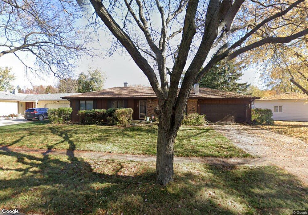
68 Devonshire Cir Elgin, IL 60123
Century Oaks West NeighborhoodEstimated Value: $333,000 - $356,491
3
Beds
3
Baths
1,227
Sq Ft
$280/Sq Ft
Est. Value
About This Home
This home is located at 68 Devonshire Cir, Elgin, IL 60123 and is currently estimated at $343,373, approximately $279 per square foot. 68 Devonshire Cir is a home located in Kane County with nearby schools including Century Oaks Elementary School, Kimball Middle School, and Larkin High School.
Ownership History
Date
Name
Owned For
Owner Type
Purchase Details
Closed on
Nov 13, 2003
Sold by
Reich John C and Reich Sandra B
Bought by
Taylor William B
Current Estimated Value
Home Financials for this Owner
Home Financials are based on the most recent Mortgage that was taken out on this home.
Original Mortgage
$208,724
Outstanding Balance
$96,832
Interest Rate
6.01%
Mortgage Type
FHA
Estimated Equity
$246,541
Create a Home Valuation Report for This Property
The Home Valuation Report is an in-depth analysis detailing your home's value as well as a comparison with similar homes in the area
Home Values in the Area
Average Home Value in this Area
Purchase History
| Date | Buyer | Sale Price | Title Company |
|---|---|---|---|
| Taylor William B | $212,000 | -- |
Source: Public Records
Mortgage History
| Date | Status | Borrower | Loan Amount |
|---|---|---|---|
| Open | Taylor William B | $208,724 |
Source: Public Records
Tax History
| Year | Tax Paid | Tax Assessment Tax Assessment Total Assessment is a certain percentage of the fair market value that is determined by local assessors to be the total taxable value of land and additions on the property. | Land | Improvement |
|---|---|---|---|---|
| 2024 | $6,625 | $90,787 | $25,563 | $65,224 |
| 2023 | $6,310 | $82,019 | $23,094 | $58,925 |
| 2022 | $5,965 | $74,787 | $21,058 | $53,729 |
| 2021 | $5,703 | $69,921 | $19,688 | $50,233 |
| 2020 | $5,541 | $66,750 | $18,795 | $47,955 |
| 2019 | $5,378 | $63,583 | $17,903 | $45,680 |
| 2018 | $5,123 | $57,818 | $16,866 | $40,952 |
| 2017 | $5,005 | $54,658 | $15,944 | $38,714 |
| 2016 | $4,768 | $50,708 | $14,792 | $35,916 |
| 2015 | -- | $46,478 | $13,558 | $32,920 |
| 2014 | -- | $45,905 | $13,391 | $32,514 |
| 2013 | -- | $47,116 | $13,744 | $33,372 |
Source: Public Records
Map
Nearby Homes
- 1345 S Madlock Ct
- 1790 Devonshire Ct
- 15 Creekside Cir Unit B
- 1212 Century Oaks Dr
- 1114 Century Oaks Dr
- 2013 Jeffrey Ln Unit 2013
- 906 Carol Ave
- 801 N Mclean Blvd Unit 214
- 801 N Mclean Blvd Unit 324
- 801 N Mclean Blvd Unit 226
- 801 N Mclean Blvd Unit 320
- 764 Scott Dr
- 1167 Florimond Dr
- 1104 Florimond Dr
- 10 Chateau Dr
- 13 Pioneer Park Place
- 936 Glen Oak Dr
- 716 Surrey Ln
- 2214 Colorado Ave Unit 4
- LOT 17 Teal Ave
- 66 Devonshire Cir
- 74 Devonshire Cir
- 1376 Sheffield Dr
- 1372 Sheffield Dr
- 64 Devonshire Cir
- 1384 Sheffield Dr Unit 1
- 69 Devonshire Cir
- 71 Devonshire Cir
- 88 Devonshire Cir Unit 1
- 67 Devonshire Cir
- 73 Devonshire Cir
- 62 Devonshire Cir
- 75 Brookwood Ct
- 65 Devonshire Cir
- 1390 Sheffield Dr
- 63 Devonshire Cir
- 1379 Sheffield Dr
- 60 Devonshire Cir
- 1351 Pappas Dr
- 1345 Pappas Dr
