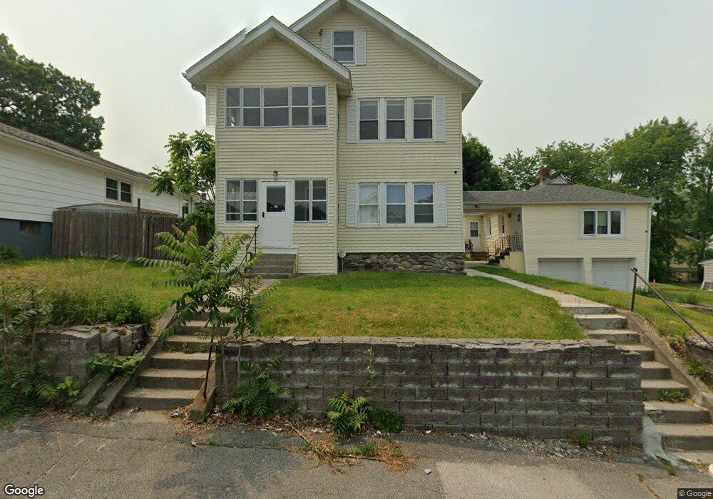
68 Farrar Ave Worcester, MA 01604
Grafton Hill NeighborhoodEstimated Value: $657,000 - $723,349
5
Beds
3
Baths
2,600
Sq Ft
$266/Sq Ft
Est. Value
About This Home
This home is located at 68 Farrar Ave, Worcester, MA 01604 and is currently estimated at $691,087, approximately $265 per square foot. 68 Farrar Ave is a home located in Worcester County with nearby schools including Jacob Hiatt Magnet School, Chandler Magnet, and Rice Square Elementary School.
Ownership History
Date
Name
Owned For
Owner Type
Purchase Details
Closed on
Feb 23, 2001
Sold by
Froio Joseph P and Froio Liberato
Bought by
Stuart John J
Current Estimated Value
Home Financials for this Owner
Home Financials are based on the most recent Mortgage that was taken out on this home.
Original Mortgage
$126,400
Interest Rate
6.89%
Mortgage Type
Purchase Money Mortgage
Create a Home Valuation Report for This Property
The Home Valuation Report is an in-depth analysis detailing your home's value as well as a comparison with similar homes in the area
Home Values in the Area
Average Home Value in this Area
Purchase History
| Date | Buyer | Sale Price | Title Company |
|---|---|---|---|
| Stuart John J | $158,000 | -- |
Source: Public Records
Mortgage History
| Date | Status | Borrower | Loan Amount |
|---|---|---|---|
| Open | Stuart John J | $30,000 | |
| Open | Stuart John J | $140,000 | |
| Closed | Stuart John J | $126,400 |
Source: Public Records
Tax History Compared to Growth
Tax History
| Year | Tax Paid | Tax Assessment Tax Assessment Total Assessment is a certain percentage of the fair market value that is determined by local assessors to be the total taxable value of land and additions on the property. | Land | Improvement |
|---|---|---|---|---|
| 2025 | $7,841 | $594,500 | $117,700 | $476,800 |
| 2024 | $7,667 | $557,600 | $117,700 | $439,900 |
| 2023 | $7,094 | $494,700 | $102,400 | $392,300 |
| 2022 | $6,368 | $418,700 | $81,900 | $336,800 |
| 2021 | $5,451 | $334,800 | $65,500 | $269,300 |
| 2020 | $4,648 | $273,400 | $65,500 | $207,900 |
| 2019 | $4,610 | $256,100 | $58,900 | $197,200 |
| 2018 | $4,690 | $248,000 | $58,900 | $189,100 |
| 2017 | $4,407 | $229,300 | $58,900 | $170,400 |
| 2016 | $4,231 | $205,300 | $42,900 | $162,400 |
| 2015 | $4,120 | $205,300 | $42,900 | $162,400 |
| 2014 | $4,012 | $205,300 | $42,900 | $162,400 |
Source: Public Records
Map
Nearby Homes
- 55 Standish St
- 121 Pilgrim Ave
- 169 Fairmont Ave
- 573 Grafton St
- 3 Bowker St
- 247 Pilgrim Ave
- 68 Dartmouth St
- 10 Lamar Ave
- 91 Standish St
- 17 Plantation St
- 10 Almont Ave
- 423 Grafton St Unit 7
- 94 Massasoit Rd
- 340 Hamilton St
- 22 Anderson Ave
- 93 Plantation St
- 70 Harrington Way
- 4 Everton Ave
- 15 Anderson Ave
- 3 Ingleside Ave