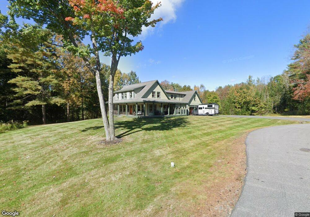
68 Flintlock Dr Cumberland Center, ME 04021
Estimated Value: $1,031,000 - $1,457,413
4
Beds
3
Baths
2,780
Sq Ft
$435/Sq Ft
Est. Value
About This Home
This home is located at 68 Flintlock Dr, Cumberland Center, ME 04021 and is currently estimated at $1,208,471, approximately $434 per square foot. 68 Flintlock Dr is a home located in Cumberland County with nearby schools including Mabel I. Wilson School, Greely Middle School 4-5, and Greely Middle School.
Ownership History
Date
Name
Owned For
Owner Type
Purchase Details
Closed on
Apr 7, 2005
Sold by
Spaldero Co Llc
Bought by
Whittier 2Nd W F and Whittier Jennifer M
Current Estimated Value
Home Financials for this Owner
Home Financials are based on the most recent Mortgage that was taken out on this home.
Original Mortgage
$188,000
Outstanding Balance
$92,062
Interest Rate
5%
Mortgage Type
Adjustable Rate Mortgage/ARM
Estimated Equity
$1,116,409
Create a Home Valuation Report for This Property
The Home Valuation Report is an in-depth analysis detailing your home's value as well as a comparison with similar homes in the area
Home Values in the Area
Average Home Value in this Area
Purchase History
| Date | Buyer | Sale Price | Title Company |
|---|---|---|---|
| Whittier 2Nd W F | -- | -- |
Source: Public Records
Mortgage History
| Date | Status | Borrower | Loan Amount |
|---|---|---|---|
| Open | Whittier 2Nd W F | $188,000 |
Source: Public Records
Tax History Compared to Growth
Tax History
| Year | Tax Paid | Tax Assessment Tax Assessment Total Assessment is a certain percentage of the fair market value that is determined by local assessors to be the total taxable value of land and additions on the property. | Land | Improvement |
|---|---|---|---|---|
| 2024 | $14,296 | $614,900 | $271,700 | $343,200 |
| 2023 | $13,620 | $614,900 | $271,700 | $343,200 |
| 2022 | $13,036 | $614,900 | $271,700 | $343,200 |
| 2021 | $12,636 | $614,900 | $271,700 | $343,200 |
| 2020 | $12,513 | $614,900 | $271,700 | $343,200 |
| 2019 | $12,206 | $614,900 | $271,700 | $343,200 |
| 2018 | $12,127 | $615,600 | $271,700 | $343,900 |
| 2017 | $11,573 | $615,600 | $271,700 | $343,900 |
| 2016 | $11,235 | $615,600 | $271,700 | $343,900 |
| 2015 | $11,142 | $615,600 | $271,700 | $343,900 |
| 2014 | $10,711 | $615,600 | $271,700 | $343,900 |
| 2013 | $10,465 | $615,600 | $271,700 | $343,900 |
Source: Public Records
Map
Nearby Homes
- 90 Harris Lot 1 Rd
- Lot 8 Coastal Pines
- TBD Coastal Pines Lot 8
- TBD Coastal Pines Lot 2
- 11 Coastal Pines Lot 5
- 99 Chets Way
- TBD Harris Lot 2 Rd
- 44 Essex Dr
- 445 Portland St
- 25 Powell Rd
- 254 Foreside Rd
- 1 Ledge Rd
- 186 Foreside Rd
- 16 Town Landing Rd
- 31 Stony Brook Ln
- 276 Foreside Rd
- 195 Hillside St
- 11 Apple Brook Dr
- 21 Ledge Rd
- 9 Newell Rd
- 70 Flintlock Dr
- 61 Flintlock Dr
- 43 Flintlock Dr
- 48 Flintlock Dr
- 33 Flintlock Dr
- 42 Flintlock Dr
- 0 Flintrock Ridge
- 34 Flintlock Dr
- 11 Hopes Way
- 8 Flintlock Dr
- 6 Flintlock Dr
- 4 Flintlock Dr
- 2 Flintlock Dr
- 10 Flintlock Dr
- 16 Hopes Way
- 9 Flintlock Ridge
- 7 Flintlock Ridge
- 9 Farms Edge Way
- 135 Tuttle Rd
- 125 Tuttle Rd