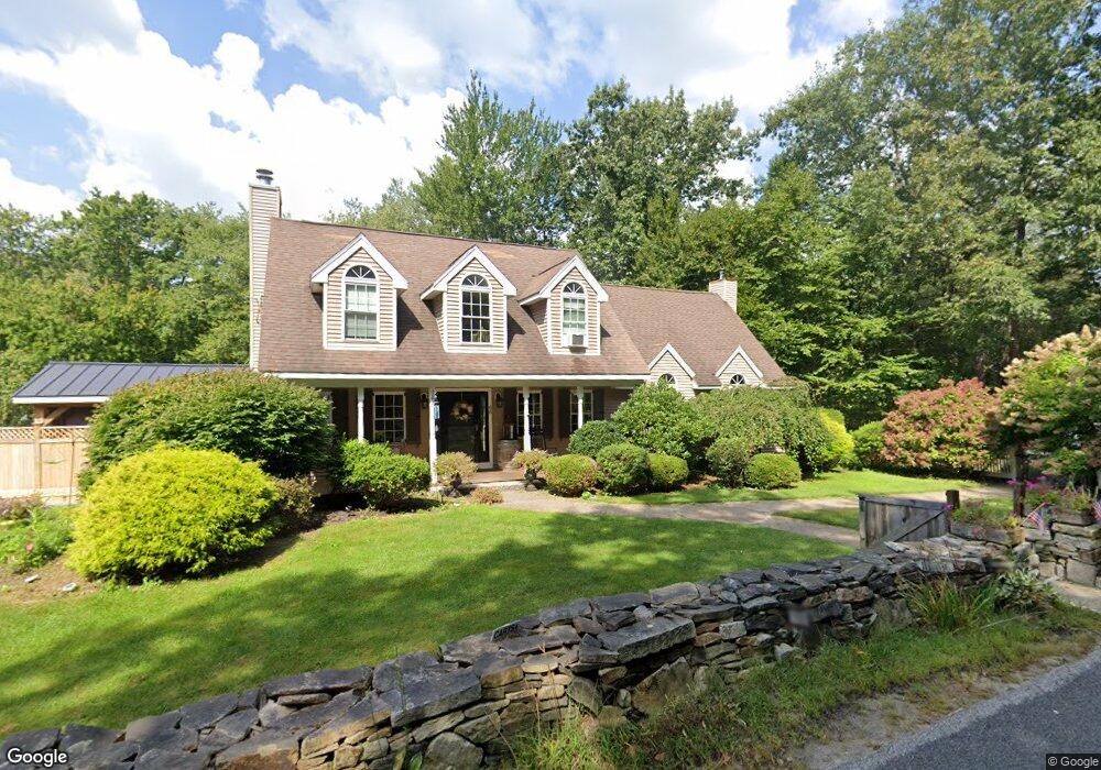
68 Haggerty Rd Charlton, MA 01507
Estimated Value: $520,723 - $585,000
3
Beds
2
Baths
1,920
Sq Ft
$289/Sq Ft
Est. Value
About This Home
This home is located at 68 Haggerty Rd, Charlton, MA 01507 and is currently estimated at $555,181, approximately $289 per square foot. 68 Haggerty Rd is a home located in Worcester County with nearby schools including Shepherd Hill Regional High School.
Ownership History
Date
Name
Owned For
Owner Type
Purchase Details
Closed on
Jan 2, 2018
Sold by
Smith Timothy A and Smith Terri A
Bought by
Smith Terri A
Current Estimated Value
Home Financials for this Owner
Home Financials are based on the most recent Mortgage that was taken out on this home.
Original Mortgage
$227,000
Outstanding Balance
$190,716
Interest Rate
3.95%
Mortgage Type
New Conventional
Estimated Equity
$364,465
Purchase Details
Closed on
Feb 17, 1999
Sold by
Clearview Homes Inc
Bought by
Smith Timothy A and Smith Terri A
Home Financials for this Owner
Home Financials are based on the most recent Mortgage that was taken out on this home.
Original Mortgage
$115,150
Interest Rate
6.75%
Mortgage Type
Purchase Money Mortgage
Create a Home Valuation Report for This Property
The Home Valuation Report is an in-depth analysis detailing your home's value as well as a comparison with similar homes in the area
Home Values in the Area
Average Home Value in this Area
Purchase History
| Date | Buyer | Sale Price | Title Company |
|---|---|---|---|
| Smith Terri A | -- | -- | |
| Smith Terri A | -- | -- | |
| Smith Timothy A | $151,534 | -- | |
| Smith Timothy A | $151,534 | -- |
Source: Public Records
Mortgage History
| Date | Status | Borrower | Loan Amount |
|---|---|---|---|
| Open | Smith Terri A | $227,000 | |
| Closed | Smith Terri A | $227,000 | |
| Previous Owner | Smith Timothy A | $160,000 | |
| Previous Owner | Smith Timothy A | $115,150 |
Source: Public Records
Tax History
| Year | Tax Paid | Tax Assessment Tax Assessment Total Assessment is a certain percentage of the fair market value that is determined by local assessors to be the total taxable value of land and additions on the property. | Land | Improvement |
|---|---|---|---|---|
| 2025 | $5,001 | $449,300 | $90,100 | $359,200 |
| 2024 | $4,831 | $426,000 | $90,100 | $335,900 |
| 2023 | $4,634 | $380,800 | $87,100 | $293,700 |
| 2022 | $4,675 | $351,800 | $79,300 | $272,500 |
| 2021 | $4,575 | $304,800 | $75,100 | $229,700 |
| 2020 | $4,509 | $301,800 | $72,100 | $229,700 |
| 2019 | $4,458 | $301,800 | $72,100 | $229,700 |
| 2018 | $4,074 | $301,800 | $72,100 | $229,700 |
| 2017 | $3,906 | $277,000 | $66,100 | $210,900 |
| 2016 | $3,817 | $277,000 | $66,100 | $210,900 |
| 2015 | $3,717 | $277,000 | $66,100 | $210,900 |
| 2014 | $3,484 | $275,200 | $68,500 | $206,700 |
Source: Public Records
Map
Nearby Homes
- 7 King Rd
- 2 Lelandville Rd
- 3 Lelandville Rd
- 2 Potter Village Rd
- 60 Saundersdale Rd
- 0 Freeman Rd Unit 73369281
- L2 Partridge Hill Rd
- L3 Partridge Hill Rd
- 0 Blood Rd
- 82 Prince Rd
- 72 NW Schoolhouse Rd
- 249 Dudley Southbridge Rd
- 86 Ramshorn Rd
- 0 Old Southbridge Rd
- 0 Putnam Rd
- Lot 7 Harrington Rd
- 20 Brentwood Dr
- 13 Dolge Ct
- 7 L Stevens Rd Unit A
- 7 L Stevens Rd Unit B
- Lot A Haggerty Rd
- Lot B Haggerty Rd
- Lot C Haggerty Rd
- 66 Haggerty Rd
- 72 Haggerty Rd
- 67 Haggerty Rd
- 69 Haggerty Rd
- 64 Haggerty Rd
- 2 Baker Pond Rd
- 71 Haggerty Rd
- 3 Baker Pond Rd
- 4 Baker Pond Rd
- 60 Haggerty Rd
- 5 Baker Pond Rd
- 59 Haggerty Rd
- 10 Baker Pond Rd
- 10 Baker Pond Rd
- 10 Baker Pond Rd
- 58 Haggerty Rd
- 75 Haggerty Rd
Your Personal Tour Guide
Ask me questions while you tour the home.