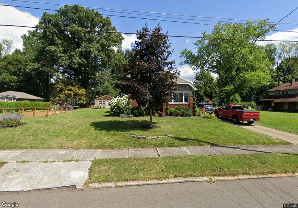
68 Maple Dr Youngstown, OH 44512
Estimated Value: $141,000 - $209,000
4
Beds
2
Baths
1,794
Sq Ft
$94/Sq Ft
Est. Value
About This Home
This home is located at 68 Maple Dr, Youngstown, OH 44512 and is currently estimated at $168,422, approximately $93 per square foot. 68 Maple Dr is a home located in Mahoning County with nearby schools including Boardman Glenwood Junior High School, Boardman High School, and Horizon Science Academy - Youngstown.
Ownership History
Date
Name
Owned For
Owner Type
Purchase Details
Closed on
Feb 1, 2003
Sold by
Thompson James E and Thompson Karen A
Bought by
Larson Rachel L
Current Estimated Value
Home Financials for this Owner
Home Financials are based on the most recent Mortgage that was taken out on this home.
Original Mortgage
$74,000
Outstanding Balance
$30,393
Interest Rate
6.01%
Estimated Equity
$138,029
Purchase Details
Closed on
Apr 13, 1995
Sold by
Stanley Charles D
Bought by
Thompson James E and Thompson Karen A
Home Financials for this Owner
Home Financials are based on the most recent Mortgage that was taken out on this home.
Original Mortgage
$64,600
Interest Rate
8.55%
Mortgage Type
New Conventional
Purchase Details
Closed on
Jul 9, 1986
Bought by
Stanley Charles D
Create a Home Valuation Report for This Property
The Home Valuation Report is an in-depth analysis detailing your home's value as well as a comparison with similar homes in the area
Home Values in the Area
Average Home Value in this Area
Purchase History
| Date | Buyer | Sale Price | Title Company |
|---|---|---|---|
| Larson Rachel L | $74,000 | -- | |
| Thompson James E | $68,000 | -- | |
| Stanley Charles D | $54,500 | -- |
Source: Public Records
Mortgage History
| Date | Status | Borrower | Loan Amount |
|---|---|---|---|
| Open | Larson Rachel L | $74,000 | |
| Previous Owner | Thompson James E | $64,600 |
Source: Public Records
Tax History
| Year | Tax Paid | Tax Assessment Tax Assessment Total Assessment is a certain percentage of the fair market value that is determined by local assessors to be the total taxable value of land and additions on the property. | Land | Improvement |
|---|---|---|---|---|
| 2025 | $2,166 | $43,510 | $6,280 | $37,230 |
| 2024 | $2,216 | $43,510 | $6,280 | $37,230 |
| 2023 | $2,186 | $43,510 | $6,280 | $37,230 |
| 2022 | $1,823 | $27,660 | $6,270 | $21,390 |
| 2021 | $1,824 | $27,660 | $6,270 | $21,390 |
| 2020 | $1,834 | $27,660 | $6,270 | $21,390 |
| 2019 | $1,831 | $24,480 | $5,550 | $18,930 |
| 2018 | $1,555 | $24,480 | $5,550 | $18,930 |
| 2017 | $1,511 | $24,480 | $5,550 | $18,930 |
| 2016 | $1,470 | $22,940 | $5,960 | $16,980 |
| 2015 | $1,177 | $18,760 | $2,930 | $15,830 |
| 2014 | $1,180 | $18,760 | $2,930 | $15,830 |
| 2013 | $1,165 | $18,760 | $2,930 | $15,830 |
Source: Public Records
Map
Nearby Homes
- 4441 Southern Blvd
- 63 Clifton Dr
- 4717 Market St
- 86 Terrace Dr
- 28 Jennette Dr
- 28 Terrace Dr
- 4144 Helena Ave
- 4127 Southern Blvd
- 4941 Market St
- 189 Beechwood Dr
- 94 Jennette Dr
- 132 Jennette Dr
- 196 Maywood Dr
- 4833 Oak Knoll Dr
- 4250 Oak Knoll Dr
- 144 Mill Creek Dr
- 192 Hollywood Ave
- 173 Clarencedale Ave
- 3916 Howard St
- 4206 Rush Blvd
- 78 Maple Dr
- 72 Maple Dr
- 4442 Southern Blvd
- 63 Maple Dr
- 71 Maple Dr
- 73 Maple Dr
- 4419 Howard St
- 59 Maple Dr
- 75 Maple Dr
- 4430 Southern Blvd
- 55 Maple Dr
- 50 Maple Dr
- 55 Pinehurst Ave
- 4504 4508 Southern Blvd
- 4415 Howard St
- 49 Maple Dr
- 46 Maple Dr
- 53 Pinehurst Ave
- 4418 Southern Blvd
- 66 Shadyside Dr Unit 68
Your Personal Tour Guide
Ask me questions while you tour the home.