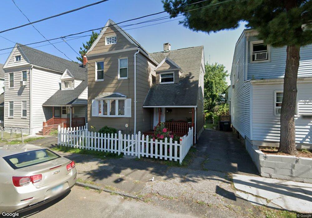
68 Olive St Bridgeport, CT 06605
West End-West Side NeighborhoodEstimated Value: $251,000 - $335,049
4
Beds
2
Baths
1,124
Sq Ft
$266/Sq Ft
Est. Value
About This Home
This home is located at 68 Olive St, Bridgeport, CT 06605 and is currently estimated at $299,512, approximately $266 per square foot. 68 Olive St is a home located in Fairfield County with nearby schools including James J. Curiale School, Bassick High School, and Catholic Academy of Bridgeport-St. Augustine Academy.
Ownership History
Date
Name
Owned For
Owner Type
Purchase Details
Closed on
Nov 5, 1991
Sold by
Federal Home Loan
Bought by
Negron Naida and Rosa Hector
Current Estimated Value
Home Financials for this Owner
Home Financials are based on the most recent Mortgage that was taken out on this home.
Original Mortgage
$34,250
Interest Rate
8.9%
Mortgage Type
Unknown
Create a Home Valuation Report for This Property
The Home Valuation Report is an in-depth analysis detailing your home's value as well as a comparison with similar homes in the area
Home Values in the Area
Average Home Value in this Area
Purchase History
| Date | Buyer | Sale Price | Title Company |
|---|---|---|---|
| Negron Naida | $36,000 | -- | |
| Negron Naida | $36,000 | -- |
Source: Public Records
Mortgage History
| Date | Status | Borrower | Loan Amount |
|---|---|---|---|
| Open | Negron Naida | $75,000 | |
| Closed | Negron Naida | $34,250 |
Source: Public Records
Tax History Compared to Growth
Tax History
| Year | Tax Paid | Tax Assessment Tax Assessment Total Assessment is a certain percentage of the fair market value that is determined by local assessors to be the total taxable value of land and additions on the property. | Land | Improvement |
|---|---|---|---|---|
| 2025 | $4,616 | $106,230 | $41,250 | $64,980 |
| 2024 | $4,616 | $106,230 | $41,250 | $64,980 |
| 2023 | $4,616 | $106,230 | $41,250 | $64,980 |
| 2022 | $4,616 | $106,230 | $41,250 | $64,980 |
| 2021 | $4,616 | $106,230 | $41,250 | $64,980 |
| 2020 | $4,338 | $80,350 | $25,010 | $55,340 |
| 2019 | $4,338 | $80,350 | $25,010 | $55,340 |
| 2018 | $4,369 | $80,350 | $25,010 | $55,340 |
| 2017 | $4,369 | $80,350 | $25,010 | $55,340 |
| 2016 | $4,369 | $80,350 | $25,010 | $55,340 |
| 2015 | $4,541 | $107,600 | $37,840 | $69,760 |
| 2014 | $4,541 | $107,600 | $37,840 | $69,760 |
Source: Public Records
Map
Nearby Homes
- 60 Olive St
- 1373 Iranistan Ave
- 592 Norman St Unit 594
- 1199 Iranistan Ave Unit 1201
- 826 Norman St
- 414 Wood Ave
- 393 Laurel Ave Unit 203
- 393 Laurel Ave Unit 415
- 357 Norman St
- 309 Pequonnock St
- 200 Harral Ave
- 700 Laurel Ave
- 566 Wood Ave
- 697 Laurel Ave
- 1872 North Ave Unit 1874
- 865 Iranistan Ave
- 670 Clinton Ave
- 533 Clinton Ave
- 113 Milne St Unit 115
- 468 Colorado Ave
- 74 Olive St
- 80 Olive St
- 50 Olive St Unit 54
- 106 Wood Ave
- 1 *Popular Grocery Ave
- 130 Wood Ave
- 126 Wood Ave
- 682 Norman St
- 116 Wood Ave
- 77 Olive St Unit 79
- 1321 Iranistan Ave
- 1321 Iranistan Ave Unit 2
- 1315 Iranistan Ave
- 1333 Iranistan Ave
- 21 Olive St
- 679 Norman St Unit 681
- 87 Olive St Unit 89
- 685 Norman St Unit 689
- 700 Norman St
- 1303 Iranistan Ave Unit 1305