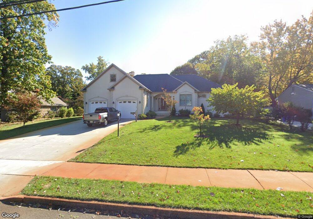
68 Pancoast Blvd Delran, NJ 08075
Estimated Value: $434,000 - $649,000
--
Bed
--
Bath
2,483
Sq Ft
$227/Sq Ft
Est. Value
About This Home
This home is located at 68 Pancoast Blvd, Delran, NJ 08075 and is currently estimated at $564,090, approximately $227 per square foot. 68 Pancoast Blvd is a home located in Burlington County with nearby schools including Millbridge Elementary School, Delran Intermediate School, and Delran Middle School.
Ownership History
Date
Name
Owned For
Owner Type
Purchase Details
Closed on
Oct 18, 2006
Sold by
Kelly Kelvin N and Kelly Tomika L
Bought by
Rodrigues Joseph and Rodrigues Lisete
Current Estimated Value
Purchase Details
Closed on
Jun 4, 2004
Sold by
Greenlee David A and Greenlee Sandra J
Bought by
Kelly Kelvin N and Kelly Tomika L
Home Financials for this Owner
Home Financials are based on the most recent Mortgage that was taken out on this home.
Original Mortgage
$221,031
Interest Rate
5.99%
Mortgage Type
FHA
Purchase Details
Closed on
Jul 30, 1999
Sold by
Fuss Karl A and Markman Mardyne R
Bought by
Greenlee David A and Greenlee Sandra J
Home Financials for this Owner
Home Financials are based on the most recent Mortgage that was taken out on this home.
Original Mortgage
$131,000
Interest Rate
7.53%
Create a Home Valuation Report for This Property
The Home Valuation Report is an in-depth analysis detailing your home's value as well as a comparison with similar homes in the area
Home Values in the Area
Average Home Value in this Area
Purchase History
| Date | Buyer | Sale Price | Title Company |
|---|---|---|---|
| Rodrigues Joseph | $280,000 | Weichert Title Agency | |
| Kelly Kelvin N | $224,900 | Congress Title Corp | |
| Greenlee David A | $138,000 | -- |
Source: Public Records
Mortgage History
| Date | Status | Borrower | Loan Amount |
|---|---|---|---|
| Previous Owner | Kelly Kelvin N | $221,031 | |
| Previous Owner | Greenlee David A | $131,000 |
Source: Public Records
Tax History Compared to Growth
Tax History
| Year | Tax Paid | Tax Assessment Tax Assessment Total Assessment is a certain percentage of the fair market value that is determined by local assessors to be the total taxable value of land and additions on the property. | Land | Improvement |
|---|---|---|---|---|
| 2025 | $13,300 | $334,500 | $52,900 | $281,600 |
| 2024 | $13,179 | $334,500 | $52,900 | $281,600 |
| 2023 | $13,179 | $334,500 | $52,900 | $281,600 |
| 2022 | $13,009 | $334,500 | $52,900 | $281,600 |
| 2021 | $13,015 | $334,500 | $52,900 | $281,600 |
| 2020 | $12,989 | $334,500 | $52,900 | $281,600 |
| 2019 | $12,868 | $334,500 | $52,900 | $281,600 |
| 2018 | $12,654 | $334,500 | $52,900 | $281,600 |
| 2017 | $12,453 | $334,500 | $52,900 | $281,600 |
| 2016 | $1,940 | $52,900 | $52,900 | $0 |
| 2015 | $7,185 | $199,200 | $52,900 | $146,300 |
| 2014 | $6,872 | $199,200 | $52,900 | $146,300 |
Source: Public Records
Map
Nearby Homes
- 1122 S Fairview St
- 7016 Route 130
- 1062 S Fairview St
- 14 Montclair Dr
- 9000 Route 130
- 9002 Route 130
- 910 S Fairview St
- 224 Progress St
- 404 Greenwood Ave
- 327 Whittaker St
- 705 Arndt Ave
- 649 Bridgeboro St
- 702 Delaware Ave
- 14 Grant St
- 53 Hartford Rd
- 528 S Fairview St
- 514 Bridgeboro St
- 506 Bridgeboro St
- 0 Delaware Ave Unit NJBL2090486
- 820 S Chester Ave
- 64 Pancoast Blvd
- 76 Pancoast Blvd
- 60 Pancoast Blvd
- 75 Pancoast Blvd
- 78 Pancoast Blvd
- 71 Pancoast Blvd
- 910 Hubbs St
- 65 Pancoast Blvd
- 82 Pancoast Blvd
- 61 Pancoast Blvd
- 77 Pancoast Blvd
- 56 Pancoast Blvd
- 912 Hubbs St
- 45 Pancoast Blvd
- 907 Hubbs St
- 79 Pancoast Blvd
- 909 Hubbs St
- 50 Pancoast Blvd
- 19 Harper Blvd
- 21 Harper Blvd